File:The Yucatan Peninsula (MODIS 2021-05-05).jpg

Original file (3,406 × 2,699 pixels, file size: 800 KB, MIME type: image/jpeg)
Captions
Captions
Summary
[edit].jpg&action=edit§ion=1)
| Description |
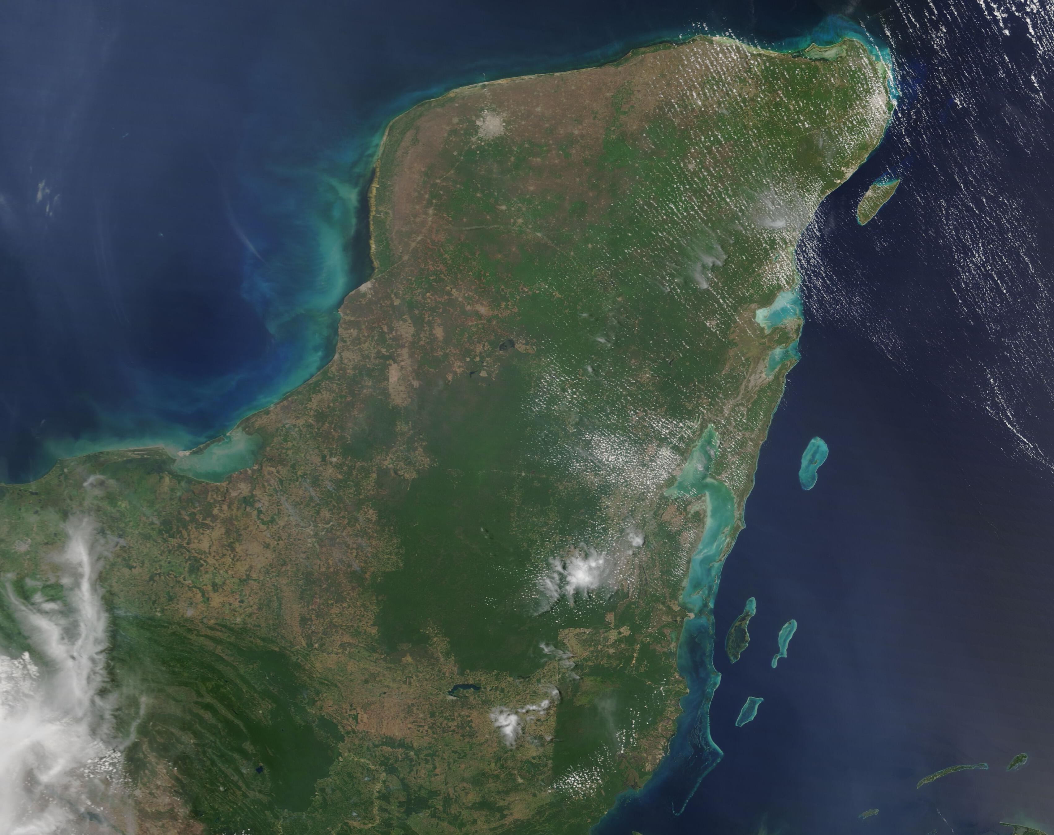
English: The gorgeous greens and sun-warmed beaches of the Yucatan Peninsula are clearly evident in the true-color image acquired by the Moderate Resolution Imaging Spectroradiometer (MODIS) on board NASA’s Terra satellite on May 3, 2021.
The Peninsula is comprised of several Mexican states, including Yucatan in the north, Quintana Roo to east, and Campeche to the west. Mexico shares the Peninsula with Belize, which sits along the southeastern coast, and Guatemala, which is found south and east of Campeche. The weather in the Yucatan tends to be hot year-round and is divided into two main seasons: the wet season and the dry season. Running from November to May, the dry season appeals to sun-loving tourists, but it is the wet season, with high humidity and frequent downpours, that feeds the rainforests and spurs vegetative growth across the Peninsula. Acquired after months of hot, dry days, this image shows substantial tan across the Peninsula. The tan color indicates open land with little vegetation. Cement-colored pixels mark human structures, such as cities and roads. The largest area of cement-gray, seen in the northwest, is the city of Merida. Many small gray dots near Merida mark smaller cities, all strung together by roadways. Agricultural lands, marked by tell-tale right-angled, neat patches of light green or tan, stretch along much of the Yucatan Peninsula, especially in the south. Many such patches can be seen at the edges of green forest. When viewing this image, it becomes strikingly obvious that the hands of humans has encroached deeply into the rainforest, both by adding structures and through deforestation for agricultural purposes. |
||
| Date | Taken on 3 May 2021 | ||
| Source |
The Yucatan Peninsula (direct link)
|
||
| Author | MODIS Land Rapid Response Team, NASA GSFC |
| This media is a product of the Terra mission Credit and attribution belongs to the mission team, if not already specified in the "author" row |
Licensing
[edit].jpg&action=edit§ion=2)
| This file is in the public domain in the United States because it was solely created by NASA. NASA copyright policy states that "NASA material is not protected by copyright unless noted". (See Template:PD-USGov, NASA copyright policy page or JPL Image Use Policy.) | ||
 |
Warnings:
|
File history
Click on a date/time to view the file as it appeared at that time.
| Date/Time | Thumbnail | Dimensions | User | Comment | |
|---|---|---|---|---|---|
| current | 17:49, 30 January 2024 | | 3,406 × 2,699 (800 KB) | OptimusPrimeBot (talk | contribs) | #Spacemedia - Upload of http://modis.gsfc.nasa.gov/gallery/images/image05052021_250m.jpg via Commons:Spacemedia |
You cannot overwrite this file.
File usage on Commons
There are no pages that use this file.
.jpg&oldid=909385131)