File:The World's End, Almer - geograph.org.uk - 294665.jpg
Jump to navigation
Jump to search
No higher resolution available.
The_World's_End,_Almer_-_geograph.org.uk_-_294665.jpg (600 × 399 pixels, file size: 55 KB, MIME type: image/jpeg)
Captions
Captions
Add a one-line explanation of what this file represents
Summary
[edit]
| Description |
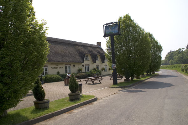
English: The Worlds End, Almer Belonging to the Drax Estate, the World's End was at one time believed to be the oldest pub in Dorset; sadly it was recently destroyed by fire and was razed to the ground but like the Phoenix rose from the ashes. The present pub is a tribute to the builders who not only restored the pub completely but improved on the original design. The slip-road goes on to join the A31 to Bere Regis. |
| Date | |
| Source | From geograph.org.uk |
| Author | John Lamper |
| Object location | | View this and other nearby images on: OpenStreetMap |
|---|
_heading:225.00&language=en)
Licensing
[edit]

|
This image was taken from the Geograph project collection. See this photograph's page on the Geograph website for the photographer's contact details. The copyright on this image is owned by John Lamper and is licensed for reuse under the Creative Commons Attribution-ShareAlike 2.0 license.
|
This file is licensed under the Creative Commons Attribution-Share Alike 2.0 Generic license.
Attribution: John Lamper
- You are free:
- to share – to copy, distribute and transmit the work
- to remix – to adapt the work
- Under the following conditions:
- attribution – You must give appropriate credit, provide a link to the license, and indicate if changes were made. You may do so in any reasonable manner, but not in any way that suggests the licensor endorses you or your use.
- share alike – If you remix, transform, or build upon the material, you must distribute your contributions under the same or compatible license as the original.
- Remove redundant categories and try to put this image in the most specific category/categories
- Remove this template
- The location categories are based on information from this geonames tool and this OpenStreetMap tool combined with a database. You can also have a look at this tool from mysociety.
- The topic category from Geograph was Inn (find similar images at Geograph)
File history
Click on a date/time to view the file as it appeared at that time.
| Date/Time | Thumbnail | Dimensions | User | Comment | |
|---|---|---|---|---|---|
| current | 22:07, 14 December 2010 | | 600 × 399 (55 KB) | GeographBot (talk | contribs) | == {{int:filedesc}} == {{Information |description={{en|1=The Worlds End, Almer Belonging to the Drax Estate, the World's End was at one time believed to be the oldest pub in Dorset; sadly it was recently destroyed by fire and was razed to the ground but |
You cannot overwrite this file.
File usage on Commons
The following page uses this file:
- File:The Worlds End, Almer - geograph.org.uk - 294665.jpg (file redirect)