File:The Ward of Portsoken - geograph.org.uk - 1036184.jpg
Jump to navigation
Jump to search
No higher resolution available.
The_Ward_of_Portsoken_-_geograph.org.uk_-_1036184.jpg (640 × 480 pixels, file size: 76 KB, MIME type: image/jpeg)
Captions
Captions
Add a one-line explanation of what this file represents
Summary
[edit]
| Description |
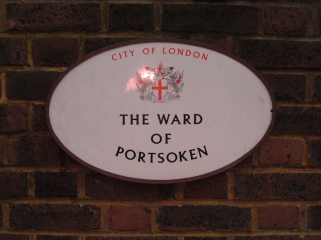
English: The Ward of Portsoken This marker sign is located at the eastern end of Portsoken Street at its junction with Mansell Street. Portsoken is one of 25 wards in the City of London, and is unusual in that it has a relatively high residential population, comprising about 15% of the City's total, and is in some ways more characteristic of neighbouring Tower Hamlets than the City itself. The ward is centred around Aldgate Underground station, on the City's eastern edge. |
| Date | |
| Source | From geograph.org.uk |
| Author | Stephen McKay |
| Attribution (required by the license) | Stephen McKay / The Ward of Portsoken / |
| Camera location | | View this and other nearby images on: OpenStreetMap |
|---|
_heading:337.00&language=en)
| Object location | | View this and other nearby images on: OpenStreetMap |
|---|
_heading:337.00&language=en)
Licensing
[edit]

|
This image was taken from the Geograph project collection. See this photograph's page on the Geograph website for the photographer's contact details. The copyright on this image is owned by Stephen McKay and is licensed for reuse under the Creative Commons Attribution-ShareAlike 2.0 license.
|
This file is licensed under the Creative Commons Attribution-Share Alike 2.0 Generic license.
Attribution: Stephen McKay
- You are free:
- to share – to copy, distribute and transmit the work
- to remix – to adapt the work
- Under the following conditions:
- attribution – You must give appropriate credit, provide a link to the license, and indicate if changes were made. You may do so in any reasonable manner, but not in any way that suggests the licensor endorses you or your use.
- share alike – If you remix, transform, or build upon the material, you must distribute your contributions under the same or compatible license as the original.
File history
Click on a date/time to view the file as it appeared at that time.
| Date/Time | Thumbnail | Dimensions | User | Comment | |
|---|---|---|---|---|---|
| current | 19:19, 23 February 2011 | | 640 × 480 (76 KB) | GeographBot (talk | contribs) | == {{int:filedesc}} == {{Information |description={{en|1=The Ward of Portsoken This marker sign is located at the eastern end of Portsoken Street at its junction with Mansell Street. Portsoken is one of 25 wards in the City of London, and is unusual in th |
You cannot overwrite this file.
File usage on Commons
There are no pages that use this file.
File usage on other wikis
The following other wikis use this file:
- Usage on en.wikipedia.org