File:The Visiter wreck plaque New Road Robin Hoods Bay Whitby North Yorkshire.jpg
Jump to navigation
Jump to search

Size of this preview: 800 × 600 pixels. Other resolutions: 320 × 240 pixels | 640 × 480 pixels | 1,024 × 768 pixels | 1,280 × 960 pixels | 2,560 × 1,920 pixels | 4,896 × 3,672 pixels.
Original file (4,896 × 3,672 pixels, file size: 4.93 MB, MIME type: image/jpeg)
Captions
Captions
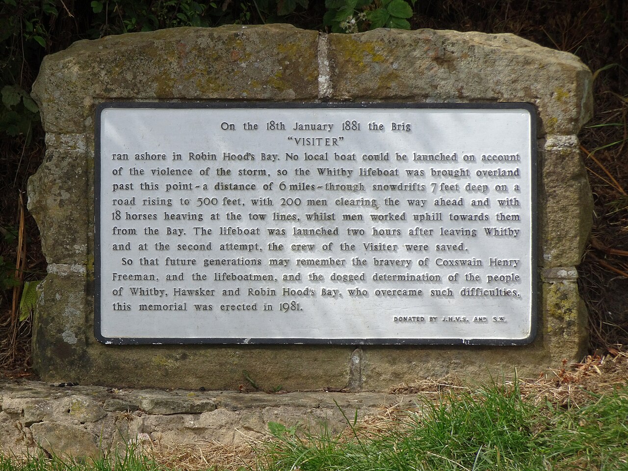
The "Visiter" wreck plaque, New Road, Robin Hood's Bay, Whitby, North Yorkshire
Summary
[edit]
| Description |
English: The "Visiter" wreck plaque, New Road, Robin Hood's Bay, Whitby, North Yorkshire "On the 18th November 1881 the Brig "Visiter" ran ashore at Robin Hood's Bay. No local boat could be launched on account of the violence of the storm, so the Whitby lifeboat was brought overland past this point - a distance of 6 miles - through snowdrifts 7 feet deep on a road rising to 500 feet, with 200 men clearing the way ahead and with 18 horses heaving at the tow lines, whilst men worked uphill towards them from the Bay. The lifeboat was launched two hours after leaving Whitby and at the second attempt the crew of the Visitor were saved. So that future generations may remember the bravery of Coxswait Henry Freeman, and the lifeboatmen, and the dogged determination of the people of Whitby, Hawsker and Robin Hood's Bay, who overcame such difficulties, this memorial was erected in 1981." |
| Date | |
| Source | Own work |
| Author | Spudgun67 |
| Camera location | | View this and other nearby images on: OpenStreetMap |
|---|
Licensing
[edit]
I, the copyright holder of this work, hereby publish it under the following license:
This file is licensed under the Creative Commons Attribution-Share Alike 4.0 International license.
- You are free:
- to share – to copy, distribute and transmit the work
- to remix – to adapt the work
- Under the following conditions:
- attribution – You must give appropriate credit, provide a link to the license, and indicate if changes were made. You may do so in any reasonable manner, but not in any way that suggests the licensor endorses you or your use.
- share alike – If you remix, transform, or build upon the material, you must distribute your contributions under the same or compatible license as the original.
File history
Click on a date/time to view the file as it appeared at that time.
| Date/Time | Thumbnail | Dimensions | User | Comment | |
|---|---|---|---|---|---|
| current | 21:09, 20 July 2022 | | 4,896 × 3,672 (4.93 MB) | Spudgun67 (talk | contribs) | Uploaded own work with UploadWizard |
You cannot overwrite this file.
File usage on Commons
The following page uses this file: