File:The Valley Of Dospat River - North.jpg
Jump to navigation
Jump to search

Size of this preview: 800 × 400 pixels. Other resolutions: 320 × 160 pixels | 640 × 320 pixels | 1,024 × 512 pixels | 1,280 × 640 pixels | 2,048 × 1,024 pixels.
Original file (2,048 × 1,024 pixels, file size: 274 KB, MIME type: image/jpeg)
Captions
Captions
Add a one-line explanation of what this file represents
Summary
[edit]
| Description |
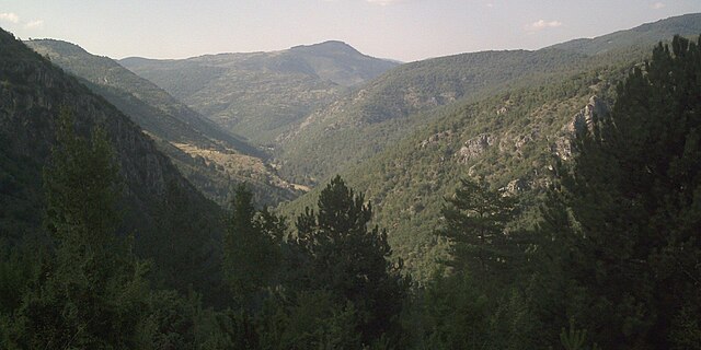
English: A look from the village of Tuhovishta towards the valley of the Dospat River in northern direction. The peak in the middle is Tumba - 1142 meters.
Български: Поглед от село Туховища към долината на река Доспат в северна посока. В средата връх Тумба - 1142 метра. |
| Date | Дата на получаване: 25 август 2008. (Date received: 25 August 2008.) |
| Source | Получена по електронна поща от Ерол Исметов. (Received by e-mail from Erol Ismetov.) |
| Author | Качена от Chech Explorer от името на Ерол Исметов. (Uploaded by Chech Explorer on behalf of Erol Ismetov.) |
Licensing
[edit]
This file is licensed under the Creative Commons Attribution-Share Alike 3.0 Unported license.
Attribution: Erol Ismetov
- You are free:
- to share – to copy, distribute and transmit the work
- to remix – to adapt the work
- Under the following conditions:
- attribution – You must give appropriate credit, provide a link to the license, and indicate if changes were made. You may do so in any reasonable manner, but not in any way that suggests the licensor endorses you or your use.
- share alike – If you remix, transform, or build upon the material, you must distribute your contributions under the same or compatible license as the original.
File history
Click on a date/time to view the file as it appeared at that time.
| Date/Time | Thumbnail | Dimensions | User | Comment | |
|---|---|---|---|---|---|
| current | 12:39, 29 August 2008 | | 2,048 × 1,024 (274 KB) | Chech Explorer (talk | contribs) | {{Information |Description={{en|1=A look from the village of Tuhovishta towards the valley of the Dospat River in northern direction. The peak in the middle is Tumba - 1142 meters.}} {{bg|1=Поглед от село Туховища към долинат |
You cannot overwrite this file.
File usage on Commons
There are no pages that use this file.
File usage on other wikis
The following other wikis use this file:
- Usage on el.wikipedia.org
- Usage on hy.wikipedia.org
- Usage on ka.wikipedia.org
- Usage on ru.wikipedia.org