File:The Upper Cock Inn, Croesyceiliog - geograph.org.uk - 1526053.jpg
Jump to navigation
Jump to search
No higher resolution available.
The_Upper_Cock_Inn,_Croesyceiliog_-_geograph.org.uk_-_1526053.jpg (640 × 371 pixels, file size: 66 KB, MIME type: image/jpeg)
Captions
Captions
Add a one-line explanation of what this file represents
Summary
[edit]
| Description |
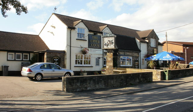
English: The Upper Cock Inn, Croesyceiliog Located on The Highway, adjacent to the junction with the Garw. The weather vane,on the left edge of the main roof, has an appropriate shape.
The name Croesyceiliog, the Cock's Cross, may derive from a large sculptured crowing cock that used to be on a mound in a field near the Inn. It was possibly a medieval reference to St Peter's denial of Jesus. The sculpture is thought to have been destroyed by Cromwell's troops in the mid 17th century during their pillaging of the countryside. |
| Date | |
| Source | From geograph.org.uk |
| Author | John Grayson |
| Camera location | | View this and other nearby images on: OpenStreetMap |
|---|
_heading:292.00&language=en)
| Object location | | View this and other nearby images on: OpenStreetMap |
|---|
_heading:292.00&language=en)
Licensing
[edit]

|
This image was taken from the Geograph project collection. See this photograph's page on the Geograph website for the photographer's contact details. The copyright on this image is owned by John Grayson and is licensed for reuse under the Creative Commons Attribution-ShareAlike 2.0 license.
|
This file is licensed under the Creative Commons Attribution-Share Alike 2.0 Generic license.
Attribution: John Grayson
- You are free:
- to share – to copy, distribute and transmit the work
- to remix – to adapt the work
- Under the following conditions:
- attribution – You must give appropriate credit, provide a link to the license, and indicate if changes were made. You may do so in any reasonable manner, but not in any way that suggests the licensor endorses you or your use.
- share alike – If you remix, transform, or build upon the material, you must distribute your contributions under the same or compatible license as the original.
File history
Click on a date/time to view the file as it appeared at that time.
| Date/Time | Thumbnail | Dimensions | User | Comment | |
|---|---|---|---|---|---|
| current | 04:34, 3 March 2011 | | 640 × 371 (66 KB) | GeographBot (talk | contribs) | == {{int:filedesc}} == {{Information |description={{en|1=The Upper Cock Inn, Croesyceiliog Located on The Highway, adjacent to the junction with the Garw. The weather vane,on the left edge of the main roof, has an appropriate shape. The name Croesyceil |
You cannot overwrite this file.
File usage on Commons
There are no pages that use this file.