File:The USGS Seismic Monitoring Facility at Guantanamo -b.JPG
Jump to navigation
Jump to search

Size of this preview: 800 × 600 pixels. Other resolutions: 320 × 240 pixels | 640 × 480 pixels | 1,024 × 768 pixels | 1,280 × 960 pixels | 1,984 × 1,488 pixels.
Original file (1,984 × 1,488 pixels, file size: 435 KB, MIME type: image/jpeg)
Captions
Captions
Add a one-line explanation of what this file represents
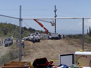
| Description | The USGS Seismic Monitoring Facility at Guantanamo. | |||
| Date | Unknown date | |||
| Source | https://earthquake.usgs.gov/monitoring/operations/station.php?network=CU&station=GTBY#site | |||
| Author | Unknown author | |||
| Permission (Reusing this file) |
|
File history
Click on a date/time to view the file as it appeared at that time.
| Date/Time | Thumbnail | Dimensions | User | Comment | |
|---|---|---|---|---|---|
| current | 05:45, 14 March 2015 | | 1,984 × 1,488 (435 KB) | Geo Swan (talk | contribs) | {{Information |Description=The USGS Seismic Monitoring Facility at Guantanamo. |Source=http://earthquake.usgs.gov/monitoring/operations/station.php?network=CU&station=GTBY#site |Date=unknown |Author=unknown |Permission={{PD-USGov-USGS}} |other_versions... |
You cannot overwrite this file.
File usage on Commons
There are no pages that use this file.