File:The Tombstone of the Battleford Eight.jpg
Jump to navigation
Jump to search
Size of this preview: 800 × 600 pixels. Other resolutions: 320 × 240 pixels | 640 × 480 pixels | 1,024 × 768 pixels | 1,280 × 960 pixels | 2,560 × 1,920 pixels | 4,896 × 3,672 pixels.
Original file (4,896 × 3,672 pixels, file size: 6.73 MB, MIME type: image/jpeg)
Captions
Captions
Add a one-line explanation of what this file represents
Summary
[edit]
| Description |
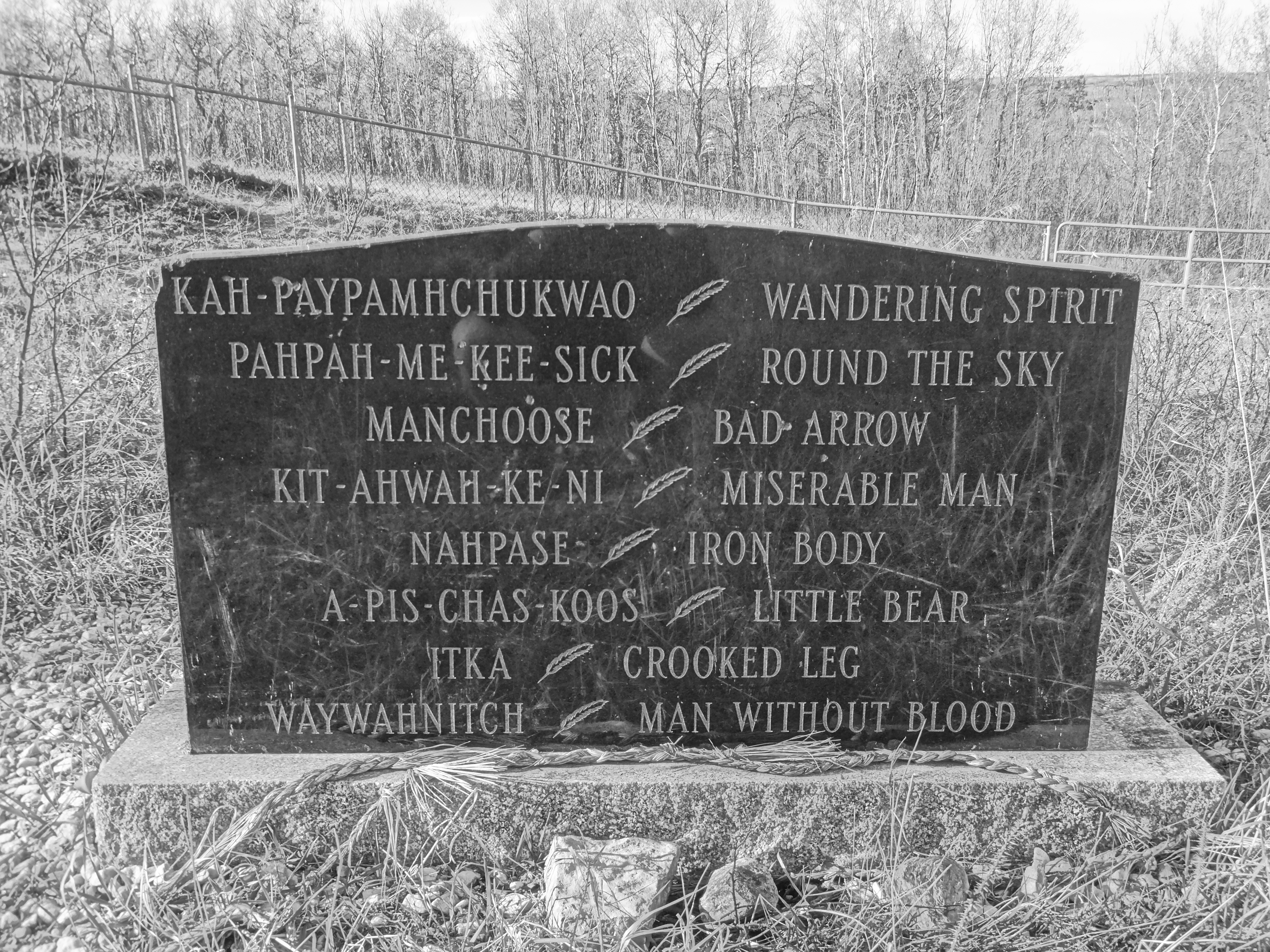
English: The gravesite of the Battleford Eight in Battleford, Saskatchewan, Canada. This is the gravesite of the largest mass hanging in the history of Canada which occurred on November 27th, 1885 in the wake of the Riel Resistance.
Documents at the time show that the Judge who condemned the Battleford eight to hang at Fort Battleford was accused of severe bias, the Saskatchewan Herald reported on December 14th, 1885 that a telegram was making the rounds of the press stating that Judge Charles Rouleau "is reported to have threatened that every Indian and Half-breed and rebel brought before him after the insurrection was suppressed, would be sent to the gallows if possible. In view of all the circumstances, and particularly as Judge Rouleau was a heavy loser pecuniarily by the Indian outbreak at Battleford, it is contended that he should not have been allowed to preside at the trial of the prisoners. A memorial has been received by the Department of Justice asking that the matter be investigated." |
| Date | |
| Source | Own work |
| Author | Saskg |
| Camera location | | View this and other nearby images on: OpenStreetMap |
|---|
The site of the graves is public.
Licensing
[edit]
I, the copyright holder of this work, hereby publish it under the following license:
This file is licensed under the Creative Commons Attribution-Share Alike 4.0 International license.
- You are free:
- to share – to copy, distribute and transmit the work
- to remix – to adapt the work
- Under the following conditions:
- attribution – You must give appropriate credit, provide a link to the license, and indicate if changes were made. You may do so in any reasonable manner, but not in any way that suggests the licensor endorses you or your use.
- share alike – If you remix, transform, or build upon the material, you must distribute your contributions under the same or compatible license as the original.
File history
Click on a date/time to view the file as it appeared at that time.
| Date/Time | Thumbnail | Dimensions | User | Comment | |
|---|---|---|---|---|---|
| current | 02:34, 7 May 2017 | | 4,896 × 3,672 (6.73 MB) | Embedded Data Bot (talk | contribs) | This file contains embedded data: After 6.7MiB (7059968 bytes, via Ending): Identified type: image/jpeg (JPEG image data, Exif standard: [TIFF image data, little-endian, direntries=4, xresolution=62, yresolution=70, resolutionunit=2], ba... |
| 02:34, 7 May 2017 |  | 4,896 × 3,672 (7.53 MB) | Saskg (talk | contribs) | User created page with UploadWizard |
You cannot overwrite this file.
File usage on Commons
There are no pages that use this file.
File usage on other wikis
The following other wikis use this file:
- Usage on en.wikipedia.org
- Usage on fr.wikipedia.org
- Usage on www.wikidata.org