File:The Southern Alps.jpg
Jump to navigation
Jump to search
Size of this preview: 800 × 402 pixels. Other resolutions: 320 × 161 pixels | 640 × 322 pixels | 1,024 × 514 pixels | 1,280 × 643 pixels | 2,560 × 1,286 pixels | 5,046 × 2,535 pixels.
Original file (5,046 × 2,535 pixels, file size: 11.74 MB, MIME type: image/jpeg)
Captions
Captions
Add a one-line explanation of what this file represents
Summary
[edit]
| Description |
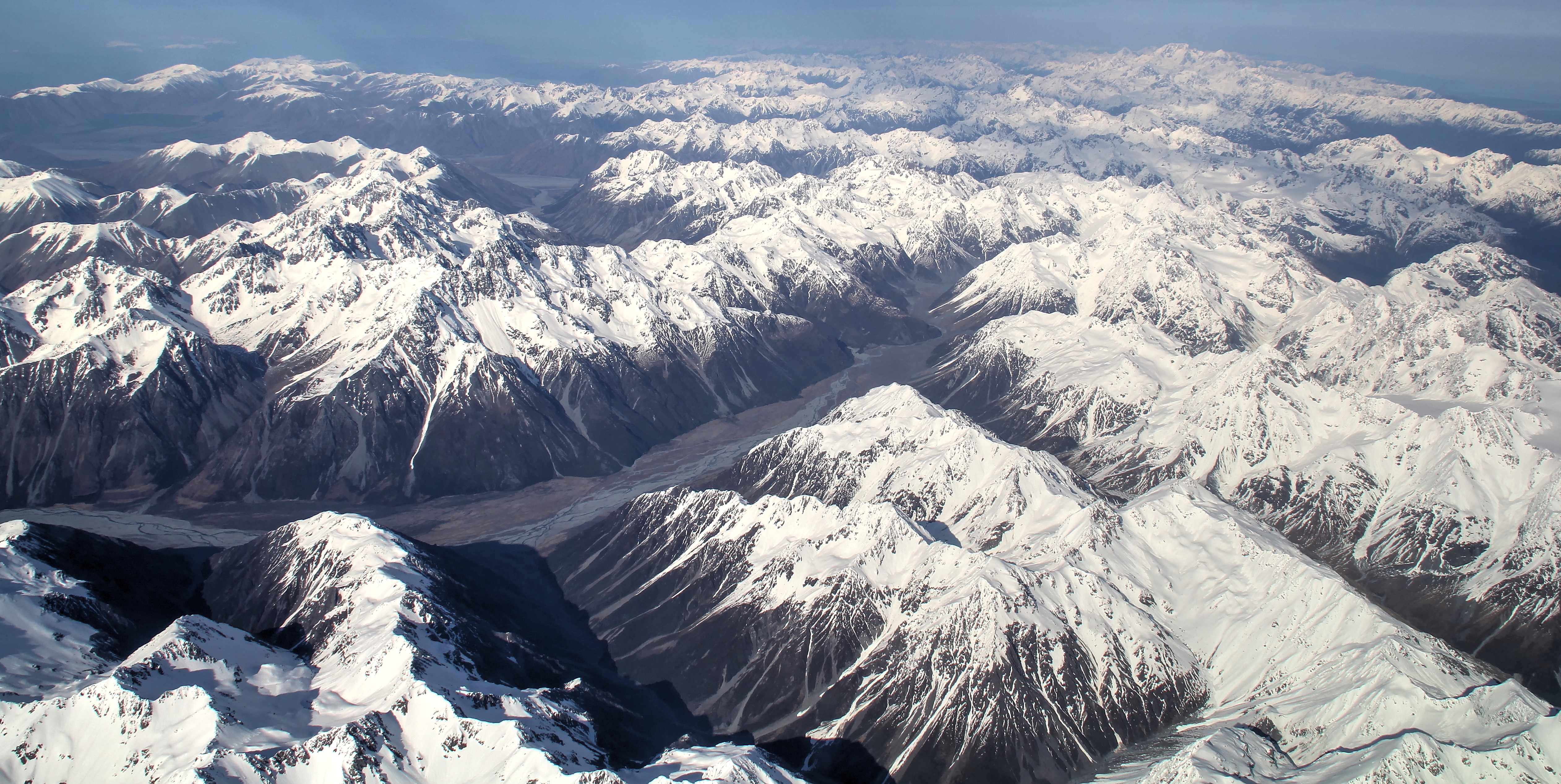
English: The Southern Alps are the nearly 500 km-long mountainous backbone of New Zealand's South Island. They exisit due to the active convergent boundary between the Pacific and Australian tectonics plates. This boundary is expressed by the Alpine Fault and associated fault systems, and lies on the western side of the alps. This view is looking south along the mountains, on approach into Christchurch Airport, and encomapsses a large part of Te Wahipounamu World Heritage Area.
The prominent river valley is that of the Rakaia River. The Jollie Range lies behind the river. The Butler Range, and numerous glaciers, lies in the centre-right of the image. The country's highest mountain, Aoraki-Mount Cook (3724 m; the name "Aoraki" is Maori for cloud-piercer), is visible in the right background. Mount Tasman, the country's second-highest mountain (3497 M), lies slightly to the right of Mount Cook. |
| Date | |
| Source | https://www.flickr.com/photos/121262944@N04/16514736728/ |
| Author | Kyle Bland |
| Camera location | | View this and other nearby images on: OpenStreetMap |
|---|
Licensing
[edit]
This file is licensed under the Creative Commons Attribution-Share Alike 2.0 Generic license.
- You are free:
- to share – to copy, distribute and transmit the work
- to remix – to adapt the work
- Under the following conditions:
- attribution – You must give appropriate credit, provide a link to the license, and indicate if changes were made. You may do so in any reasonable manner, but not in any way that suggests the licensor endorses you or your use.
- share alike – If you remix, transform, or build upon the material, you must distribute your contributions under the same or compatible license as the original.
| This image was originally posted to Flickr by b.landscape at https://flickr.com/photos/121262944@N04/16514736728. It was reviewed on 5 March 2021 by FlickreviewR 2 and was confirmed to be licensed under the terms of the cc-by-sa-2.0. |
File history
Click on a date/time to view the file as it appeared at that time.
| Date/Time | Thumbnail | Dimensions | User | Comment | |
|---|---|---|---|---|---|
| current | 01:42, 5 March 2021 | | 5,046 × 2,535 (11.74 MB) | Schwede66 (talk | contribs) | Uploaded a work by Kyle Bland from https://www.flickr.com/photos/121262944@N04/16514736728/ with UploadWizard |
You cannot overwrite this file.
File usage on Commons
There are no pages that use this file.