File:The River Trent - geograph.org.uk - 1395637.jpg
Jump to navigation
Jump to search
No higher resolution available.
The_River_Trent_-_geograph.org.uk_-_1395637.jpg (640 × 427 pixels, file size: 96 KB, MIME type: image/jpeg)
Captions
Captions
Add a one-line explanation of what this file represents
Summary
[edit]
| Description |
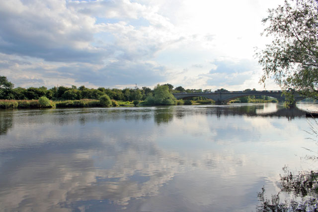
English: The River Trent. Looking towards Gunthorpe Bridge from the river bank by the Unicorn Hotel.
Gunthorpe Bridge is the only bridge over the River Trent between Newark and Nottingham. Old Gunthorpe toll bridge, http://images.google.co.uk/imgres?imgurl=http://homepages.which.net/~shardlow.heritage/gunth.jpg&imgrefurl=http://homepages.which.net/~shardlow.heritage/shwppcards.htm&usg=__o0CWy9UhqL9o7Ju1jsVRWYTz0QM=&h=339&w=535&sz=38&hl=en&start=7&um=1&tbnid=lDpKlYKFY8o-4M:&tbnh=84&tbnw=132&prev=/images%3Fq%3Dgunthorpe%2Bbridge%26hl%3Den%26safe%3Doff%26sa%3DN%26um%3D1 , was built on the site of a ford and ferry that had existed since Roman times. Built in 1875 by the Gunthorpe Bridge Company who raised £7,500 through a share issue, it was a largely iron structure crossing the Trent: see 956029 and 955984. The tolls were horse and carriage 1/-, horse and wagon 6d, horse alone 3d, people and passengers 1d, motorcycles 3d, cars 1/- and lorries 2/6. In 1925 the Gunthorpe Bridge Act empowered the council to buy the owners out, demolish the bridge and replace it with the present one, seen here, a couple of hundred yards up stream. This believed to be the first toll bridge in the country to be replaced by a free one. |
| Date | |
| Source | From geograph.org.uk |
| Author | Kate Jewell |
| Attribution (required by the license) | Kate Jewell / The River Trent / |
| Camera location | | View this and other nearby images on: OpenStreetMap |
|---|
_heading:247.00&language=en)
| Object location | | View this and other nearby images on: OpenStreetMap |
|---|
_heading:247.00&language=en)
Licensing
[edit]

|
This image was taken from the Geograph project collection. See this photograph's page on the Geograph website for the photographer's contact details. The copyright on this image is owned by Kate Jewell and is licensed for reuse under the Creative Commons Attribution-ShareAlike 2.0 license.
|
This file is licensed under the Creative Commons Attribution-Share Alike 2.0 Generic license.
Attribution: Kate Jewell
- You are free:
- to share – to copy, distribute and transmit the work
- to remix – to adapt the work
- Under the following conditions:
- attribution – You must give appropriate credit, provide a link to the license, and indicate if changes were made. You may do so in any reasonable manner, but not in any way that suggests the licensor endorses you or your use.
- share alike – If you remix, transform, or build upon the material, you must distribute your contributions under the same or compatible license as the original.
File history
Click on a date/time to view the file as it appeared at that time.
| Date/Time | Thumbnail | Dimensions | User | Comment | |
|---|---|---|---|---|---|
| current | 23:26, 28 February 2011 | | 640 × 427 (96 KB) | GeographBot (talk | contribs) | == {{int:filedesc}} == {{Information |description={{en|1=The River Trent Looking towards Gunthorpe Bridge from the river bank by the Unicorn Hotel. Gunthorpe Bridge is the only bridge over the River Trent between Newark and Nottingham. Old Gunthorpe to |
You cannot overwrite this file.
File usage on Commons
There are no pages that use this file.