File:The Rigolets (Louisiana) - 2016 NOAA nautical chart.png
Jump to navigation
Jump to search

Size of this preview: 800 × 417 pixels. Other resolutions: 320 × 167 pixels | 640 × 333 pixels | 1,024 × 533 pixels | 1,280 × 667 pixels | 2,560 × 1,334 pixels | 7,020 × 3,657 pixels.
Original file (7,020 × 3,657 pixels, file size: 1.21 MB, MIME type: image/png)
Captions
Captions
Add a one-line explanation of what this file represents
Summary
[edit]_-_2016_NOAA_nautical_chart.png&action=edit§ion=1)
| Description |
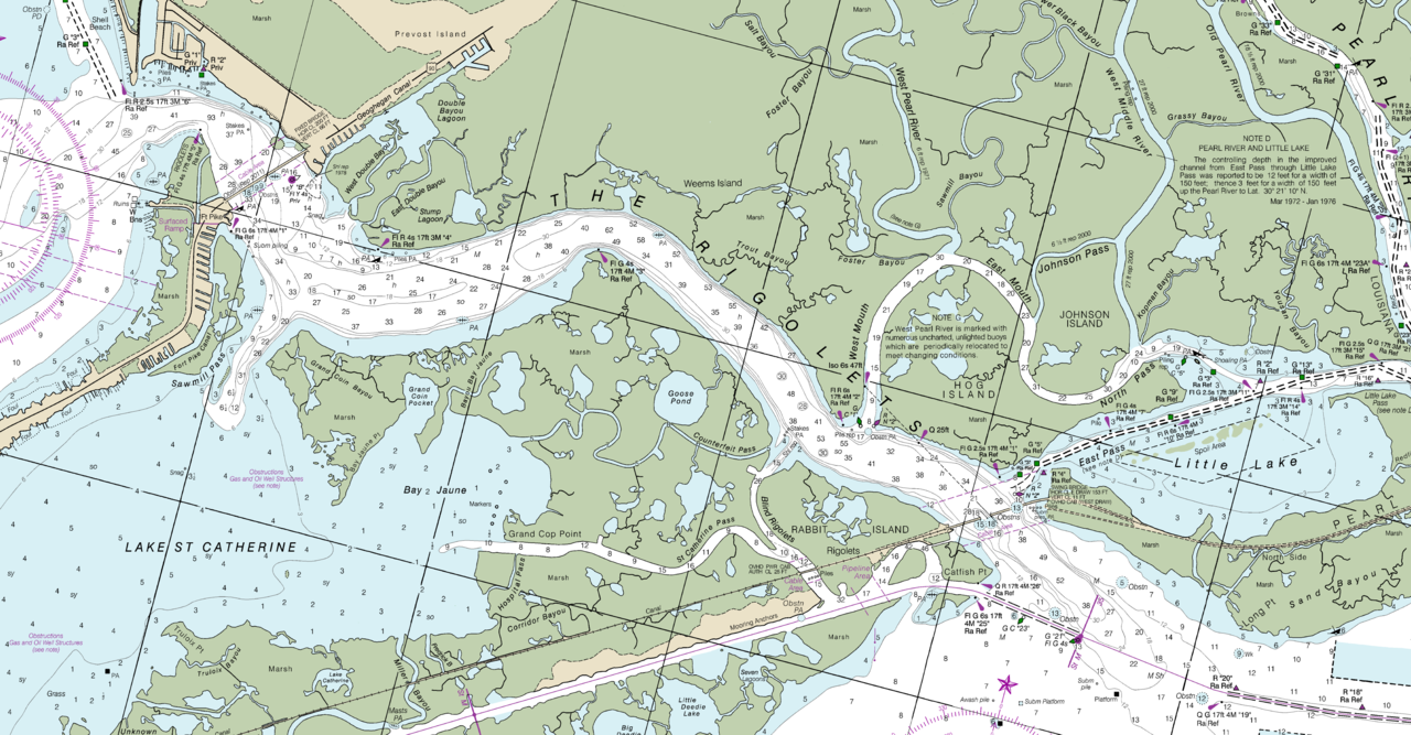
English: NOAA nautical chart of the The Rigolets in Louisiana, which is strait connecting Lake Pontchartrain and Lake St. Catherine to Lake Borgne and the Gulf of Mexico. |
| Date | |
| Source | Charts at NOAA Office of Coast Survey (direct link) |
| Author | NOAA Office of Coast Survey |
Licensing
[edit]_-_2016_NOAA_nautical_chart.png&action=edit§ion=2)
This image is in the public domain because it contains materials that originally came from the U.S. National Oceanic and Atmospheric Administration, taken or made as part of an employee's official duties.
|
File history
Click on a date/time to view the file as it appeared at that time.
| Date/Time | Thumbnail | Dimensions | User | Comment | |
|---|---|---|---|---|---|
| current | 19:38, 22 April 2017 | | 7,020 × 3,657 (1.21 MB) | WClarke (talk | contribs) | User created page with UploadWizard |
You cannot overwrite this file.
File usage on Commons
There are no pages that use this file.
File usage on other wikis
The following other wikis use this file:
- Usage on en.wikipedia.org
_-_2016_NOAA_nautical_chart.png&oldid=815803888)