File:The Pump House - geograph.org.uk - 684599.jpg
Jump to navigation
Jump to search

Size of this preview: 449 × 600 pixels. Other resolutions: 179 × 240 pixels | 479 × 640 pixels.
Original file (479 × 640 pixels, file size: 100 KB, MIME type: image/jpeg)
Captions
Captions
Add a one-line explanation of what this file represents
Summary
[edit]
| Description |
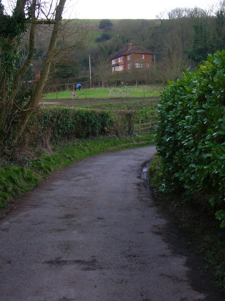
English: The Pump House Viewed from Spring Lane. As the names suggest the foot of the Downs has long provided springs for water and a nearby covered reservoir suggest an older use though it now appears to be a residential house. The donkey in the field in the foreground had also just let off the most strange sounding braying noise that had me wondering what on earth the noise was before he/she came in view. |
| Date | |
| Source | From geograph.org.uk |
| Author | Simon Carey |
| Attribution (required by the license) | Simon Carey / The Pump House / |
| Camera location | | View this and other nearby images on: OpenStreetMap |
|---|
_heading:202.00&language=en)
| Object location | | View this and other nearby images on: OpenStreetMap |
|---|
_heading:202.00&language=en)
Licensing
[edit]

|
This image was taken from the Geograph project collection. See this photograph's page on the Geograph website for the photographer's contact details. The copyright on this image is owned by Simon Carey and is licensed for reuse under the Creative Commons Attribution-ShareAlike 2.0 license.
|
This file is licensed under the Creative Commons Attribution-Share Alike 2.0 Generic license.
Attribution: Simon Carey
- You are free:
- to share – to copy, distribute and transmit the work
- to remix – to adapt the work
- Under the following conditions:
- attribution – You must give appropriate credit, provide a link to the license, and indicate if changes were made. You may do so in any reasonable manner, but not in any way that suggests the licensor endorses you or your use.
- share alike – If you remix, transform, or build upon the material, you must distribute your contributions under the same or compatible license as the original.
- Remove redundant categories and try to put this image in the most specific category/categories
- Remove this template
- The location categories are based on information from this geonames tool and this OpenStreetMap tool combined with a database. You can also have a look at this tool from mysociety.
- The topic category from Geograph was House (find similar images at Geograph)
File history
Click on a date/time to view the file as it appeared at that time.
| Date/Time | Thumbnail | Dimensions | User | Comment | |
|---|---|---|---|---|---|
| current | 03:00, 8 February 2011 | | 479 × 640 (100 KB) | GeographBot (talk | contribs) | == {{int:filedesc}} == {{Information |description={{en|1=The Pump House Viewed from Spring Lane. As the names suggest the foot of the Downs has long provided springs for water and a nearby covered reservoir suggest an older use though it now appears to be |
You cannot overwrite this file.
File usage on Commons
There are no pages that use this file.