File:The Old Harbour - geograph.org.uk - 1728736.jpg

Original file (4,327 × 2,434 pixels, file size: 2.72 MB, MIME type: image/jpeg)
Captions
Captions
Summary
[edit]
| Description |
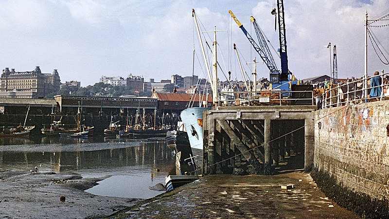
English: The Old Harbour
The photograph of the Old Harbour (also known as the Inner Harbour) shows the eastern end of the goods quay, which is being used to unload wood imported from the continent. Beyond is the fishing pier and beyond that on the left can be seen the 1715435. For another photograph of the Old Harbour, click here: https://www.geograph.org.uk/photo/1727915 . For a more easterly view (from behind the viewpoint), click here: https://www.geograph.org.uk/photo/1729337 . For a photograph showing timber being unloaded, click here: https://www.geograph.org.uk/photo/1730035 . To see a photograph taken from more or less the same viewpoint but facing the opposite direction away from the goods quay, click here: https://www.geograph.org.uk/photo/1731762 . - - - In the late 60's I dabbled with a number of different makes of slide film before settling on Kodachrome. This one was a Boots own brand that you had to mount into your own frames, hence no actual processing date. The date given for the year taken is, by my recollection, the latest possible processing date. However, it could have been at any time during 1965 to 1969. - - - See also this photograph (2009) by Mark Pitts : 1489104. |
| Date | |
| Source | From geograph.org.uk |
| Author | Alan Walker |
| Attribution (required by the license) | Alan Walker / The Old Harbour / |
| Camera location | | View this and other nearby images on: OpenStreetMap |
|---|
_heading:270.00&language=en)
| Object location | | View this and other nearby images on: OpenStreetMap |
|---|
_heading:270.00&language=en)
Licensing
[edit]

|
This image was taken from the Geograph project collection. See this photograph's page on the Geograph website for the photographer's contact details. The copyright on this image is owned by Alan Walker and is licensed for reuse under the Creative Commons Attribution-ShareAlike 2.0 license.
|
- You are free:
- to share – to copy, distribute and transmit the work
- to remix – to adapt the work
- Under the following conditions:
- attribution – You must give appropriate credit, provide a link to the license, and indicate if changes were made. You may do so in any reasonable manner, but not in any way that suggests the licensor endorses you or your use.
- share alike – If you remix, transform, or build upon the material, you must distribute your contributions under the same or compatible license as the original.
File history
Click on a date/time to view the file as it appeared at that time.
| Date/Time | Thumbnail | Dimensions | User | Comment | |
|---|---|---|---|---|---|
| current | 13:11, 5 March 2011 | | 4,327 × 2,434 (2.72 MB) | GeographBot (talk | contribs) | == {{int:filedesc}} == {{Information |description={{en|1=The Old Harbour The photograph of the Old Harbour (also known as the Inner Harbour) shows the eastern end of the goods quay, which is being used to unload wood imported from the continent. Beyo |
You cannot overwrite this file.
File usage on Commons
There are no pages that use this file.