File:The Mackinac Strait (MODIS 2021-05-19).jpg

Original file (1,790 × 1,407 pixels, file size: 1.29 MB, MIME type: image/jpeg)
Captions
Captions
Summary
[edit].jpg&action=edit§ion=1)
| Description |
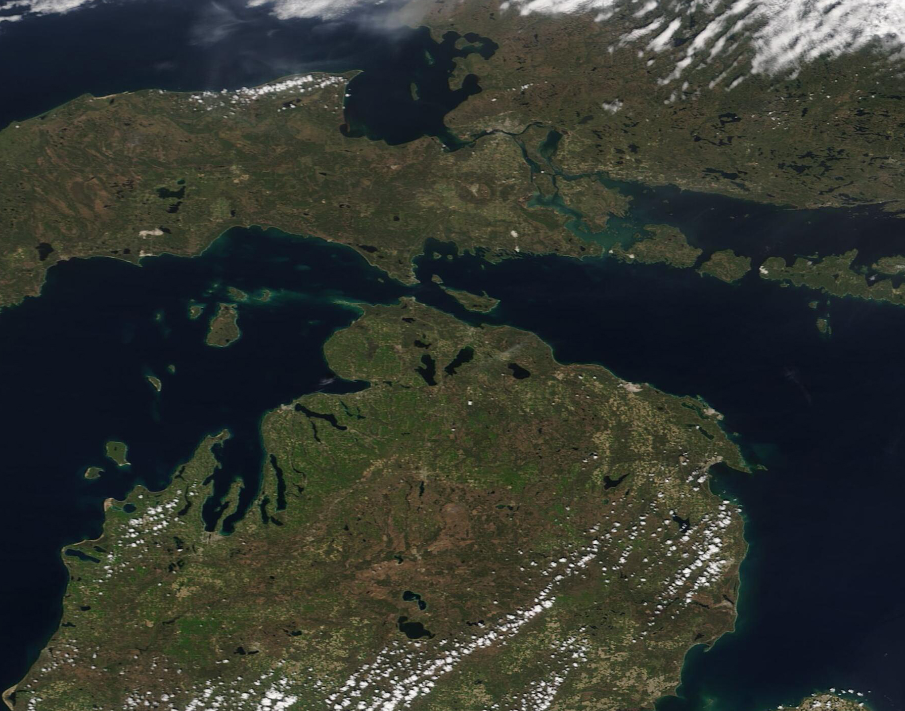
English: Thousands of years ago, during the Wisconsin Ice Age, much of North America found itself buried under a vast sheet of ice which was as much as two miles (3.2 km) thick in some areas. While the continents were roughly the same size and shape as they were now, the landscape was being ground and shaped into valleys and mountains under the weight of the shifting ice.
Eventually, the melting glaciers stopped grinding forward and began to retreat, slowly melting and filling basins with water. As the Laurentide ice sheet retreated northward, a massive lake formed over lands belonging to modern-day Canada and United States. Over time – lots of time – the slow lifting of the bedrock as it was freed from the weight of the ice sheet began to change the shorelines and Lake Superior, Lake Michigan, and Lake Huron emerged. About 3,000 years ago these lakes attained their present shape. Because of their positively glacial start, the North American Great Lakes are unique among the world’s large lakes in that their basins are linked together and form one continuous drainage basin. Together, they constitute the greatest freshwater system on Earth, covering an area larger than Texas and about half the size of Alaska. Starting in Lake Superior, the water flows out the lake’s southeastern tip down the St. Marys River into Lakes Michigan and Huron. On May 17, 2021, the Moderate Resolution Imaging Spectroradiometer (MODIS) on board NASA’s Aqua satellite acquired a true-color image nearly-centered on the Straits of Mackinac, a stretch of water five miles wide that separates Michigan’s lower and upper peninsulas. The strait connects Lakes Michigan (left) and Huron (right). Lake Superior, which connects to Lake Huron through the St. Mary’s River can be seen in the northwest (upper left). The gray smudges seen along the St. Mary’s River marks the twin cities of Sault Sainte Marie, Ontario, Canada (north) and Sault Sainte Marie, Michigan, USA (south). The boundary between Canada and the United States divides Lake Superior, St. Mary’s River, and Lake Huron. |
||
| Date | Taken on 17 May 2021 | ||
| Source |
The Mackinac Strait (direct link)
|
||
| Author | MODIS Land Rapid Response Team, NASA GSFC |
| This media is a product of the Aqua mission Credit and attribution belongs to the mission team, if not already specified in the "author" row |
Licensing
[edit].jpg&action=edit§ion=2)
| This file is in the public domain in the United States because it was solely created by NASA. NASA copyright policy states that "NASA material is not protected by copyright unless noted". (See Template:PD-USGov, NASA copyright policy page or JPL Image Use Policy.) | ||
 |
Warnings:
|
File history
Click on a date/time to view the file as it appeared at that time.
| Date/Time | Thumbnail | Dimensions | User | Comment | |
|---|---|---|---|---|---|
| current | 17:47, 30 January 2024 | | 1,790 × 1,407 (1.29 MB) | OptimusPrimeBot (talk | contribs) | #Spacemedia - Upload of http://modis.gsfc.nasa.gov/gallery/images/image05192021_250m.jpg via Commons:Spacemedia |
You cannot overwrite this file.
File usage on Commons
There are no pages that use this file.
.jpg&oldid=909384551)