File:The Hague 4.30001E 52.08334N.jpg
Jump to navigation
Jump to search

Size of this preview: 800 × 599 pixels. Other resolutions: 320 × 240 pixels | 640 × 479 pixels | 1,024 × 766 pixels | 1,280 × 958 pixels.
Original file (1,280 × 958 pixels, file size: 145 KB, MIME type: image/jpeg)
Captions
Captions
Add a one-line explanation of what this file represents
Summary
[edit]
| Description |
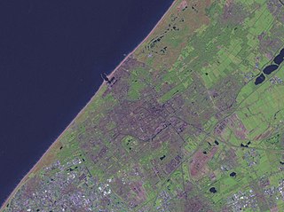
Nederlands: Satellietfoto van Den Haag, Scheveningen, Monster, 's-Gravezande, Loosduinen, Delft, Pijnacker, Nootdorp, Leidschendam, Voorburg, Voorschoten, Wassenaar. |
| Date | 14 May 2005 (original upload date) |
| Source | Satellite imagery taken from NASA World Wind software (by screenshot) |
| Author | Photograph: NASA |
| Other versions | Derivative works of this file: Den Haag 4.30001E 52.08334N.jpg |
Licensing
[edit]
| This image is in the public domain because it is a screenshot from NASA’s globe software World Wind using a public domain layer, such as Blue Marble, MODIS, Landsat, SRTM, USGS or GLOBE.
|
 |
File history
Click on a date/time to view the file as it appeared at that time.
| Date/Time | Thumbnail | Dimensions | User | Comment | |
|---|---|---|---|---|---|
| current | 15:22, 14 May 2005 | | 1,280 × 958 (145 KB) | Rex (talk | contribs) | Screenshot from NASA World Wind. {{PD}} Category:Maps Category:The Netherlands |
You cannot overwrite this file.
File usage on Commons
There are no pages that use this file.
File usage on other wikis
The following other wikis use this file:
- Usage on nl.wikipedia.org