File:The Forest tram stop (geograph 1811197).jpg
Jump to navigation
Jump to search
No higher resolution available.
The_Forest_tram_stop_(geograph_1811197).jpg (800 × 600 pixels, file size: 131 KB, MIME type: image/jpeg)
Captions
Captions
Add a one-line explanation of what this file represents
Summary
[edit].jpg&action=edit§ion=1)
| Description |
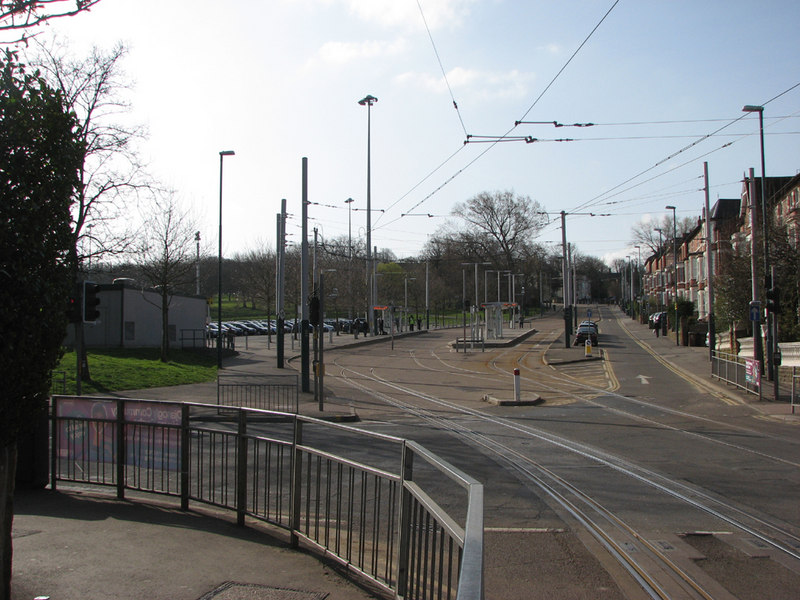
English: The Forest tram stop. The tracks in the foreground cross Gregory Boulevard, with Noel Street and the climb up Mount Hooton Road straight ahead. The edge of the park-and-ride car park is to the left of the tram stop. The nearest tram track is interlaced (or gauntleted) in a way intended to avoid placing pointwork in a heavily trafficed road lane. |
| Date | Taken on 16 April 2010 |
| Source | From geograph.org.uk |
| Author | John Sutton |
| Permission (Reusing this file) |
Creative Commons Attribution Share-alike license 2.0 |
| Attribution (required by the license) | John Sutton / The Forest tram stop / |
| Camera location | | View this and other nearby images on: OpenStreetMap |
|---|
.jpg¶ms=052.965968_N_-001.167822_E_globe:Earth_type:camera_heading:157.00&language=en)
Licensing
[edit].jpg&action=edit§ion=2)

|
This image was taken from the Geograph project collection. See this photograph's page on the Geograph website for the photographer's contact details. The copyright on this image is owned by John Sutton and is licensed for reuse under the Creative Commons Attribution-ShareAlike 2.0 license.
|
This file is licensed under the Creative Commons Attribution-Share Alike 2.0 Generic license.
Attribution: John Sutton
- You are free:
- to share – to copy, distribute and transmit the work
- to remix – to adapt the work
- Under the following conditions:
- attribution – You must give appropriate credit, provide a link to the license, and indicate if changes were made. You may do so in any reasonable manner, but not in any way that suggests the licensor endorses you or your use.
- share alike – If you remix, transform, or build upon the material, you must distribute your contributions under the same or compatible license as the original.
File history
Click on a date/time to view the file as it appeared at that time.
| Date/Time | Thumbnail | Dimensions | User | Comment | |
|---|---|---|---|---|---|
| current | 10:31, 24 August 2015 | | 800 × 600 (131 KB) | Chris j wood (talk | contribs) | Transferred from geograph.co.uk using [https://tools.wmflabs.org/geograph2commons/ grograph2commons] |
You cannot overwrite this file.
File usage on Commons
The following 2 pages use this file:
File usage on other wikis
The following other wikis use this file:
- Usage on en.wikipedia.org
- Usage on www.wikidata.org
.jpg&oldid=912580704)