File:The County of Rosscommon - By H. Moll Geographer - btv1b53056423h.jpg
Original file (2,728 × 3,424 pixels, file size: 1.33 MB, MIME type: image/jpeg)
Captions
Captions
Summary
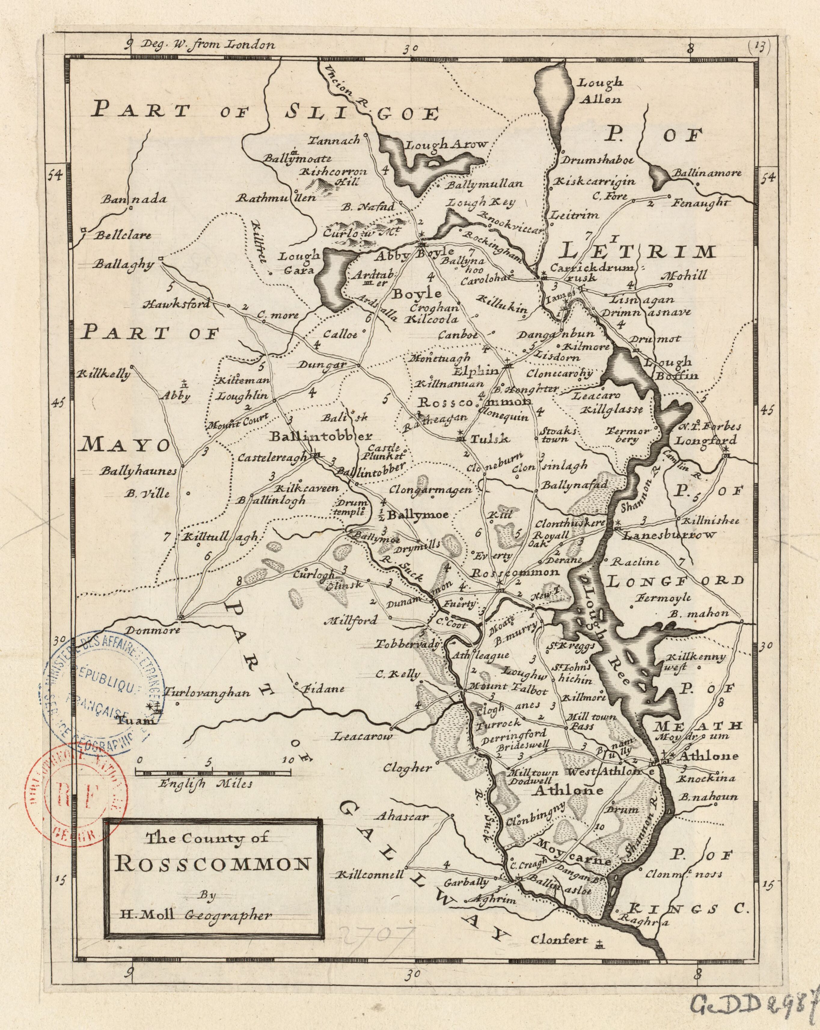
[edit]| English: The County of Rosscommon by H. Moll Geographer
( |
|||||||||||||||||||||||||||
|---|---|---|---|---|---|---|---|---|---|---|---|---|---|---|---|---|---|---|---|---|---|---|---|---|---|---|---|
| Author |
|
||||||||||||||||||||||||||
| Title |
English: The County of Rosscommon by H. Moll Geographer |
||||||||||||||||||||||||||
| Description |
English: Moll's map of County Rosscommon (Roscommon) in Connacht Province during the British occupation of Ireland. Printed separately and as map 13 (listed as "The County of Roscommon") in his 1728 Set of Twenty New and Correct Maps of Ireland...
Français : Sujet : Routes
Divisions politiques et administratives Roscommon, Comté de -- Routes Roscommon, Comté de -- Divisions politiques et administratives Échelle(s) : 10 English Miles [= 4,4 cm] Appartient à l’ensemble documentaire : AnvilEur Couverture : Irlande Langue : anglais Éditeur : [H. Moll] (London) |
||||||||||||||||||||||||||
| Date | 1728 | ||||||||||||||||||||||||||
| Dimensions | height: 21 cm (8.2 in); width: 27 cm (10.6 in) | ||||||||||||||||||||||||||
| Collection |
|
||||||||||||||||||||||||||
| References |
Français : Notice de recueil : http://catalogue.bnf.fr/ark:/12148/cb40577015h
Appartient à : Collection d'Anville ; 02707 Notice du catalogue : http://catalogue.bnf.fr/ark:/12148/cb41204002m |
||||||||||||||||||||||||||
| Source/Photographer |
Français : Bibliothèque nationale de France, département Cartes et plans, GE DD-2987 (2707)
Bibliothèque nationale de France |
||||||||||||||||||||||||||
| Permission (Reusing this file) |
|
||||||||||||||||||||||||||
| Other versions |
|
||||||||||||||||||||||||||


.jpg)

| Annotations | This image is annotated: View the annotations at Commons |
File history
Click on a date/time to view the file as it appeared at that time.
| Date/Time | Thumbnail | Dimensions | User | Comment | |
|---|---|---|---|---|---|
| current | 01:16, 12 July 2022 | | 2,728 × 3,424 (1.33 MB) | Gzen92Bot (talk | contribs) | Gallica btv1b53056423h |
You cannot overwrite this file.
File usage on Commons
The following 2 pages use this file: