File:The Atlantic LOC 2013593219.jpg
Jump to navigation
Jump to search

Size of this preview: 493 × 599 pixels. Other resolutions: 197 × 240 pixels | 395 × 480 pixels | 632 × 768 pixels | 843 × 1,024 pixels | 1,685 × 2,048 pixels | 11,151 × 13,549 pixels.
Original file (11,151 × 13,549 pixels, file size: 19.86 MB, MIME type: image/jpeg)
Captions
Captions
Add a one-line explanation of what this file represents
Summary
[edit]| Warning | The original file is very high-resolution. It might not load properly or could cause your browser to freeze when opened at full size. |
|---|
| Description |
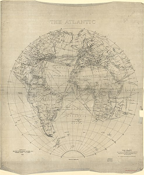
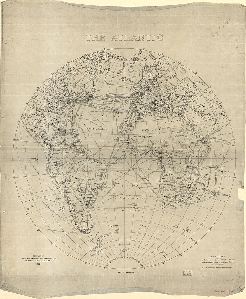
English: Shows major cities, shipping lines and submarine cables. Relief shown by contours. "M.I.D.G.S. Map No. 103 A." Drawn on tracing linen. "Note: Scale true on the equator and 20th (Central) Meridian. Geographical Data from U.S. Hydrographic Charts and other sources." Available also through the Library of Congress Web site as a raster image. LC copy imperfect: Fragile, darkened, major losses along edges and fold lines. Sectioned in 2 and mounted on cloth. |
||
| Title | The Atlantic | ||
| Shelf ID | G9101.P93 1922 .O9 | ||
| Date | |||
| Source | https://www.loc.gov/item/2013593219/ | ||
| Author | Ourand, Charles H. | ||
| Permission (Reusing this file) |
|
||
| Other versions |
|
||
| Location | Atlantic Ocean · United States | ||
| Part of | American Memory · Catalog · Transportation And Communication · Geography And Map Division | ||
| Subject | Atlantic Ocean · Telecommunication · Telecommunication Systems · Cables, Submarine · Shipping · United States · Maps · Transatlantic Cables |


Licensing
[edit]
|
This is a faithful photographic reproduction of a two-dimensional, public domain work of art. The work of art itself is in the public domain for the following reason:
The official position taken by the Wikimedia Foundation is that "faithful reproductions of two-dimensional public domain works of art are public domain".
This photographic reproduction is therefore also considered to be in the public domain in the United States. In other jurisdictions, re-use of this content may be restricted; see Reuse of PD-Art photographs for details. | ||||
File history
Click on a date/time to view the file as it appeared at that time.
| Date/Time | Thumbnail | Dimensions | User | Comment | |
|---|---|---|---|---|---|
| current | 02:59, 15 May 2018 | | 11,151 × 13,549 (19.86 MB) | Fæ (talk | contribs) | LOC Maps https://www.loc.gov/item/2013593219/ #249 |
You cannot overwrite this file.
File usage on Commons
The following page uses this file: