File:Territorio Federal Amazonas (1856 - 1881).PNG
Jump to navigation
Jump to search
Size of this preview: 600 × 600 pixels. Other resolutions: 240 × 240 pixels | 480 × 480 pixels | 768 × 768 pixels | 1,024 × 1,024 pixels | 1,800 × 1,800 pixels.
Original file (1,800 × 1,800 pixels, file size: 42 KB, MIME type: image/png)
Captions
Captions
Add a one-line explanation of what this file represents
Summary
[edit].PNG&action=edit§ion=1)
| Description |
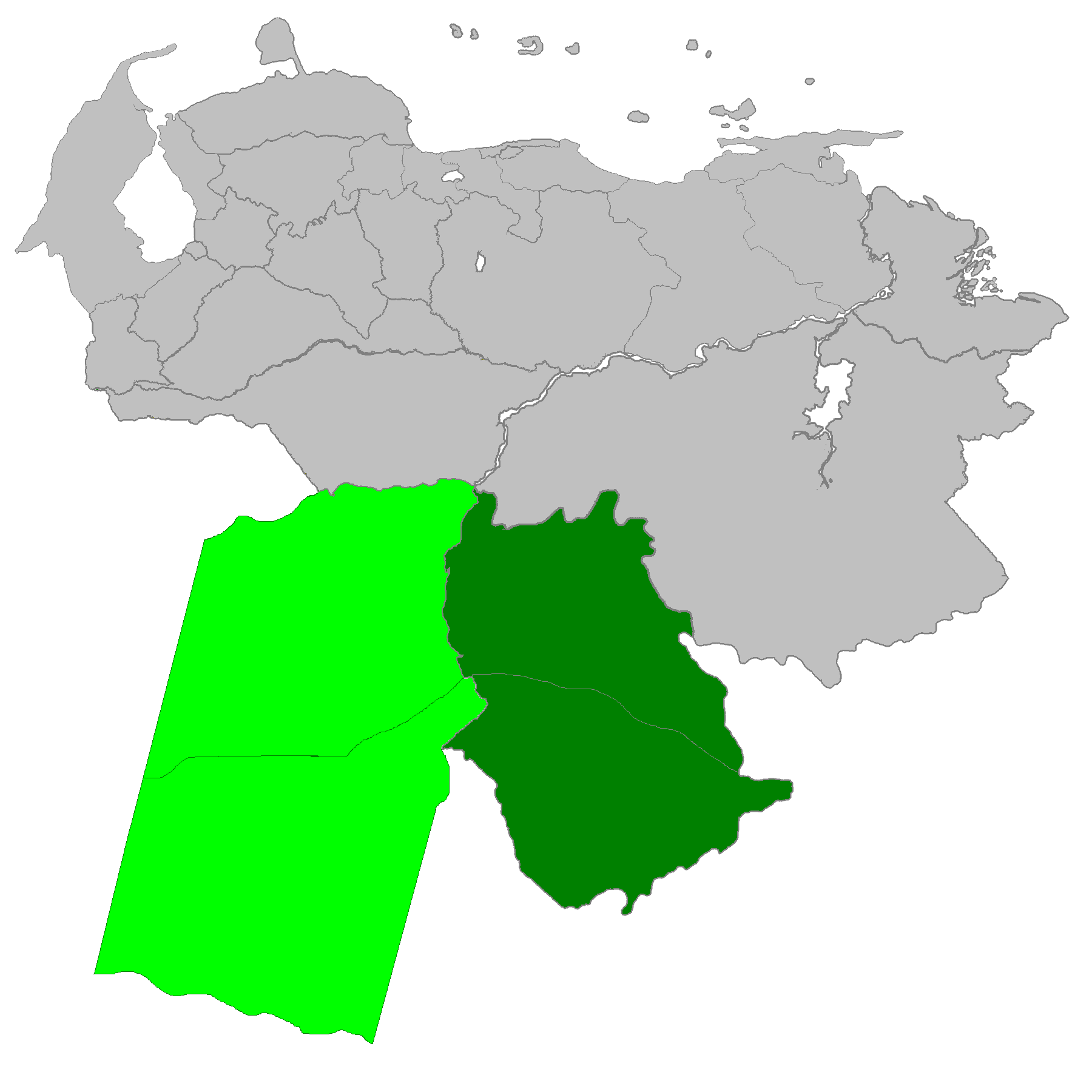
Español: Ubicación del Territorio Federal Amazonas. El área clara es la que se superpone en los mapas Colombianos de la época y corresponde a los departamentos de Vichada y Guainía. El imperio español dejó un legado de fronteras imprecisas, trazadas con descuido debido a que todo era de la corona. Los límites terrestres entre Venezuela y Colombia ya fueron establecidos a satisfacción de ambas partes el último tratado en 1941. |
| Date | |
| Source | Own work |
| Author | Andrés González |
Licensing
[edit].PNG&action=edit§ion=2)
I, the copyright holder of this work, hereby publish it under the following license:
This file is licensed under the Creative Commons Attribution-Share Alike 3.0 Unported license.
- You are free:
- to share – to copy, distribute and transmit the work
- to remix – to adapt the work
- Under the following conditions:
- attribution – You must give appropriate credit, provide a link to the license, and indicate if changes were made. You may do so in any reasonable manner, but not in any way that suggests the licensor endorses you or your use.
- share alike – If you remix, transform, or build upon the material, you must distribute your contributions under the same or compatible license as the original.
File history
Click on a date/time to view the file as it appeared at that time.
| Date/Time | Thumbnail | Dimensions | User | Comment | |
|---|---|---|---|---|---|
| current | 02:49, 6 February 2013 | | 1,800 × 1,800 (42 KB) | Andrés González (talk | contribs) | User created page with UploadWizard |
You cannot overwrite this file.
File usage on Commons
There are no pages that use this file.
File usage on other wikis
The following other wikis use this file:
- Usage on zh.wikipedia.org
.PNG&oldid=585599881)