File:Terpersie Castle - geograph.org.uk - 494943.jpg
Jump to navigation
Jump to search
No higher resolution available.
Terpersie_Castle_-_geograph.org.uk_-_494943.jpg (640 × 480 pixels, file size: 119 KB, MIME type: image/jpeg)
Captions
Captions
Add a one-line explanation of what this file represents
Summary
[edit]
| Description |
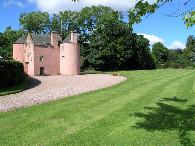
English: Terpersie Castle Terpersie is a very attractive small Z-plan castle, hidden away behind a farm in a side glen on the south side of the Correen Hills. It was restored from an almost complete ruin within the last 20 years or so. The last Gordon of Terpersie was "out" during the rebellion of 1745, and he hid in the Correen Hills above his house after the defeat at Culloden until eventually he was caught by the searching government troops. They did not at first realise who they had caught, thinking him just a vagrant, until he was brought down to Terpersie where his children on seeing him ran towards him with cries of "Daddy Daddy"!! He was taken to Carlisle and hung! |
| Date | |
| Source | From geograph.org.uk |
| Author | Richard Paxman |
| Attribution (required by the license) | Richard Paxman / Terpersie Castle / |
| Camera location | | View this and other nearby images on: OpenStreetMap |
|---|
_heading:270.00&language=en)
| Object location | | View this and other nearby images on: OpenStreetMap |
|---|
_heading:270.00&language=en)
Licensing
[edit]

|
This image was taken from the Geograph project collection. See this photograph's page on the Geograph website for the photographer's contact details. The copyright on this image is owned by Richard Paxman and is licensed for reuse under the Creative Commons Attribution-ShareAlike 2.0 license.
|
This file is licensed under the Creative Commons Attribution-Share Alike 2.0 Generic license.
Attribution: Richard Paxman
- You are free:
- to share – to copy, distribute and transmit the work
- to remix – to adapt the work
- Under the following conditions:
- attribution – You must give appropriate credit, provide a link to the license, and indicate if changes were made. You may do so in any reasonable manner, but not in any way that suggests the licensor endorses you or your use.
- share alike – If you remix, transform, or build upon the material, you must distribute your contributions under the same or compatible license as the original.
File history
Click on a date/time to view the file as it appeared at that time.
| Date/Time | Thumbnail | Dimensions | User | Comment | |
|---|---|---|---|---|---|
| current | 06:13, 5 February 2011 | | 640 × 480 (119 KB) | GeographBot (talk | contribs) | == {{int:filedesc}} == {{Information |description={{en|1=Terpersie Castle Terpersie is a very attractive small Z-plan castle, hidden away behind a farm in a side glen on the south side of the Correen Hills. It was restored from an almost complete ruin wi |
You cannot overwrite this file.
File usage on Commons
The following page uses this file:
File usage on other wikis
The following other wikis use this file:
- Usage on de.wikipedia.org
- Usage on en.wikipedia.org
- Usage on pt.wikipedia.org
- Usage on ru.wikipedia.org
- Usage on www.wikidata.org