File:Ternopil', 2 Shpytal'na Str..jpg
Original file (3,114 × 2,000 pixels, file size: 1.14 MB, MIME type: image/jpeg)
Captions
Summary
[edit]DescriptionTernopil', 2 Shpytal'na Str..jpg |
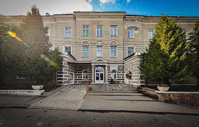
Українська: Міський шпиталь (мур.), Тернопіль, вул. Шпитальна, 2
|
||
Date | |||
Source | Own work | ||
Author | Сидорчук Ярослав |
Camera location | 49° 32′ 56.32″ N, 25° 36′ 01.42″ E | View this and other nearby images on: OpenStreetMap | 49.548978; 25.600394 |
---|
Licensing
[edit]- You are free:
- to share – to copy, distribute and transmit the work
- to remix – to adapt the work
- Under the following conditions:
- attribution – You must give appropriate credit, provide a link to the license, and indicate if changes were made. You may do so in any reasonable manner, but not in any way that suggests the licensor endorses you or your use.
- share alike – If you remix, transform, or build upon the material, you must distribute your contributions under the same or compatible license as the original.
This image was uploaded as part of Wiki Loves Monuments 2014.
Afrikaans ∙ Alemannisch ∙ العربية ∙ جازايرية ∙ azərbaycanca ∙ Bikol Central ∙ беларуская ∙ беларуская (тарашкевіца) ∙ български ∙ বাংলা ∙ brezhoneg ∙ bosanski ∙ català ∙ čeština ∙ Cymraeg ∙ dansk ∙ Deutsch ∙ Zazaki ∙ Ελληνικά ∙ English ∙ Esperanto ∙ español ∙ eesti ∙ euskara ∙ فارسی ∙ suomi ∙ français ∙ Frysk ∙ Gaeilge ∙ galego ∙ עברית ∙ हिन्दी ∙ hrvatski ∙ magyar ∙ հայերեն ∙ Bahasa Indonesia ∙ Ido ∙ italiano ∙ 日本語 ∙ ქართული ∙ 한국어 ∙ кыргызча ∙ Lëtzebuergesch ∙ latviešu ∙ Malagasy ∙ македонски ∙ മലയാളം ∙ Bahasa Melayu ∙ Malti ∙ norsk bokmål ∙ नेपाली ∙ Nederlands ∙ norsk nynorsk ∙ norsk ∙ polski ∙ português ∙ português do Brasil ∙ română ∙ русский ∙ sicilianu ∙ davvisámegiella ∙ slovenčina ∙ slovenščina ∙ shqip ∙ српски / srpski ∙ svenska ∙ ไทย ∙ Tagalog ∙ Türkçe ∙ українська ∙ اردو ∙ oʻzbekcha / ўзбекча ∙ Yorùbá ∙ 中文 ∙ 中文(中国大陆) ∙ 中文(简体) ∙ 中文(繁體) ∙ 中文(香港) ∙ 中文(臺灣) ∙ +/− |
File history
Click on a date/time to view the file as it appeared at that time.
Date/Time | Thumbnail | Dimensions | User | Comment | |
---|---|---|---|---|---|
current | 16:33, 10 September 2021 | 3,114 × 2,000 (1.14 MB) | Athosmera (talk | contribs) | Light and quality improvements | |
16:21, 27 September 2014 | 3,114 × 2,000 (3.77 MB) | Xlibes (talk | contribs) | User created page with UploadWizard |
You cannot overwrite this file.
File usage on Commons
The following page uses this file:
File usage on other wikis
The following other wikis use this file:
- Usage on uk.wikipedia.org
- Вікіпедія:Вікі любить пам'ятки/старий АТУ/Тернопільська область/Тернопіль
- Охорона здоров'я в Тернополі
- Тернопільська міська комунальна лікарня швидкої допомоги
- Вікіпедія:Wiki Loves Monuments/Тернопільська область/Тернопіль
- Вікіпедія:Вікі любить пам'ятки/Тернопільська область/Тернопільський район/Тернопільська громада
- Usage on www.wikidata.org
Metadata
This file contains additional information such as Exif metadata which may have been added by the digital camera, scanner, or software program used to create or digitize it. If the file has been modified from its original state, some details such as the timestamp may not fully reflect those of the original file. The timestamp is only as accurate as the clock in the camera, and it may be completely wrong.
Exposure time | 1/320 sec (0.003125) |
---|---|
F-number | f/9 |
ISO speed rating | 800 |
Date and time of data generation | 15:33, 27 September 2014 |
Lens focal length | 10.175501 mm |
Horizontal resolution | 240 dpi |
Vertical resolution | 240 dpi |
Software used | Adobe Photoshop Lightroom Classic 10.0 (Windows) |
File change date and time | 18:30, 10 September 2021 |
Exposure Program | Not defined |
Exif version | 2.31 |
Date and time of digitizing | 15:33, 27 September 2014 |
APEX shutter speed | 8.321928 |
APEX aperture | 6.33985 |
APEX brightness | 0 |
APEX exposure bias | 0 |
Maximum land aperture | 0 APEX (f/1) |
Subject distance | 0 meters |
Metering mode | Unknown |
Light source | Unknown |
Flash | Flash did not fire |
Color space | sRGB |
Focal plane X resolution | 0 |
Focal plane Y resolution | 0 |
Focal plane resolution unit | 0 |
Exposure index | 0 |
Sensing method | 0 |
File source | 0 |
Scene type | 0 |
Date metadata was last modified | 20:30, 10 September 2021 |
Unique ID of original document | C059BD1BB67A45F6C7038282FE2387B4 |
IIM version | 4 |
Structured data
Items portrayed in this file
depicts
49°32'56.321"N, 25°36'1.418"E
27 September 2014
0.003125 second
10.175501 millimetre
800
image/jpeg
- Cultural heritage monuments in Ukraine with known IDs
- Cultural heritage monuments in Ukraine missing SDC location of creation
- Files with coordinates missing SDC location of creation
- CC-BY-SA-4.0
- Self-published work
- Images from Wiki Loves Monuments 2014
- Images from Wiki Loves Monuments 2014 in Ukraine
- Images from Wiki Loves Monuments missing SDC location of creation
- Uploaded via Campaign:wlm-ua
- WLM 2014 in Ukraine Round Zero
- Ukraine photographs taken on 2014-09-27