File:Telephone Building in Denver.jpg
Jump to navigation
Jump to search

Size of this preview: 450 × 600 pixels. Other resolutions: 180 × 240 pixels | 360 × 480 pixels | 576 × 768 pixels | 768 × 1,024 pixels | 2,112 × 2,816 pixels.
Original file (2,112 × 2,816 pixels, file size: 1.94 MB, MIME type: image/jpeg)
Captions
Captions
Add a one-line explanation of what this file represents
|
This is an image of a place or building that is listed on the National Register of Historic Places in the United States of America. Its reference number is 4001555. |
| Camera location | | View this and other nearby images on: OpenStreetMap |
|---|
| Description |
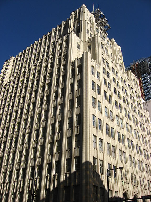
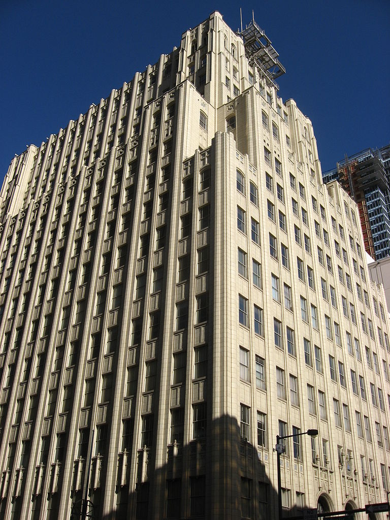
English: Three-quarters view of the Telephone Building, located at the eastern corner of the intersection of Curtis and Fourteenth Streets in Denver, Colorado, United States. Built in 1929, it was the headquarters of Mountain States Telephone and Telegraph Company (now Qwest) until 1984. The building is listed on the National Register of Historic Places. |
||
| Date | Taken on 16 March 2009 | ||
| Source | Own work | ||
| Author | Nyttend | ||
| Permission (Reusing this file) |
|
||
| Other versions |
 Entrance onto Fourteenth Street Entrance onto Fourteenth Street |
File history
Click on a date/time to view the file as it appeared at that time.
| Date/Time | Thumbnail | Dimensions | User | Comment | |
|---|---|---|---|---|---|
| current | 17:23, 21 March 2009 | | 2,112 × 2,816 (1.94 MB) | Nyttend (talk | contribs) | {{Location|39|44|43|N|104|59|49|W}} {{Information |Description=Three-quarters view of the {{w|Telephone Building}}, located at the eastern corner of the intersection of Curtis and Fourteenth Streets in {{w|Denver}}, {{w|Colorado}}, {{w|United States}}. B |
You cannot overwrite this file.
File usage on Commons
The following 2 pages use this file:
File usage on other wikis
The following other wikis use this file:
- Usage on en.wikipedia.org
- Usage on www.wikidata.org