File:Teia de aranha.png
Original file (4,272 × 2,848 pixels, file size: 13.22 MB, MIME type: image/png)
Captions
Summary
[edit]DescriptionTeia de aranha.png |
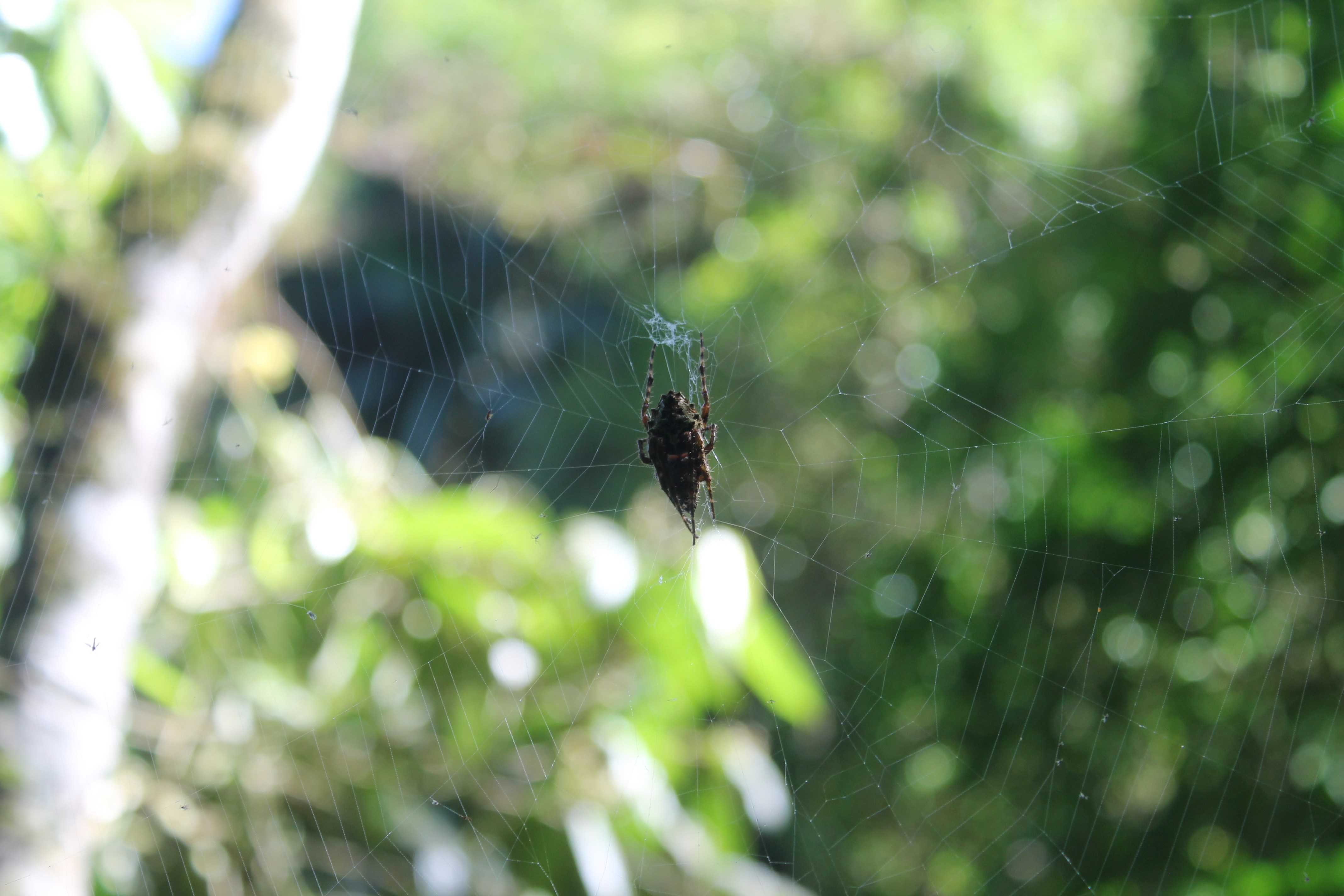
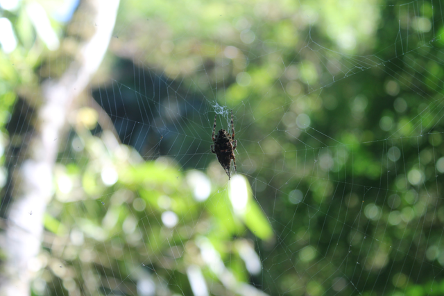
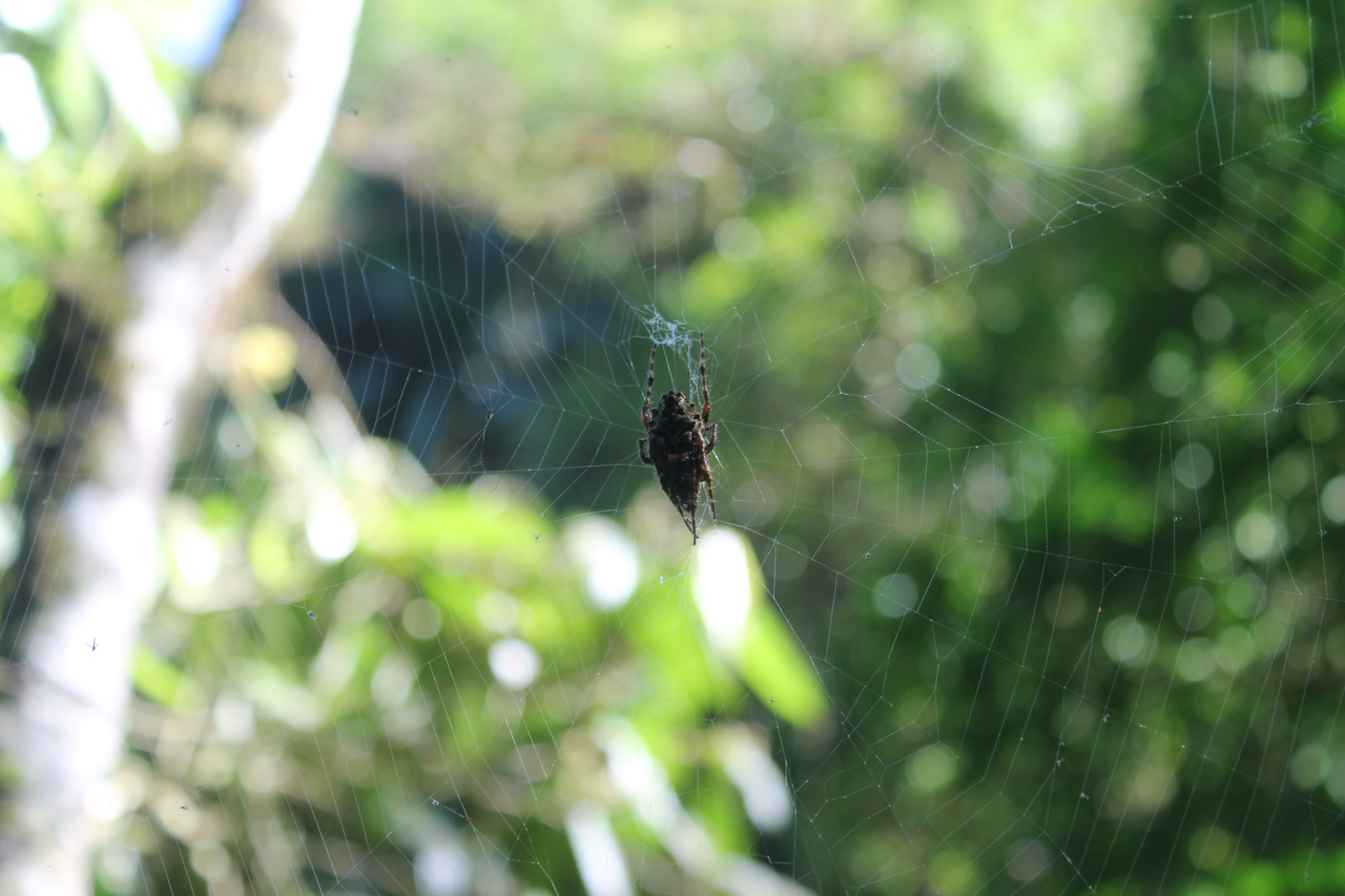
Português: Aranha em meio à sua teia, com a Mata Atlântica de fundo, ao longo da trilha que permeia o rio Betary, no PETAR. |
Date | |
Source | Own work |
Author | Irineo Albiero Filho |
Camera location | 2° 23′ 41″ S, 60° 55′ 14″ W | View this and other nearby images on: OpenStreetMap | -2.394722; -60.920556 |
---|
Licensing
[edit]- You are free:
- to share – to copy, distribute and transmit the work
- to remix – to adapt the work
- Under the following conditions:
- attribution – You must give appropriate credit, provide a link to the license, and indicate if changes were made. You may do so in any reasonable manner, but not in any way that suggests the licensor endorses you or your use.
- share alike – If you remix, transform, or build upon the material, you must distribute your contributions under the same or compatible license as the original.
This image was uploaded as part of Wiki Loves Earth 2017.
aragonés | العربية | asturianu | azərbaycanca | беларуская (тарашкевіца) | български | বাংলা | brezhoneg | català | čeština | Cymraeg | Deutsch | Ελληνικά | English | español | eesti | euskara | فارسی | français | galego | עברית | hrvatski | հայերեն | Bahasa Indonesia | italiano | 日本語 | ქართული | 한국어 | latviešu | македонски | മലയാളം | मराठी | Bahasa Melayu | norsk bokmål | नेपाली | Nederlands | norsk | polski | português | português do Brasil | русский | sicilianu | shqip | slovenščina | српски / srpski | svenska | ไทย | Türkçe | українська | اردو | 中文 | 中文(台灣) | +/− |
File history
Click on a date/time to view the file as it appeared at that time.
Date/Time | Thumbnail | Dimensions | User | Comment | |
---|---|---|---|---|---|
current | 23:16, 8 May 2017 | 4,272 × 2,848 (13.22 MB) | Irineoaf (talk | contribs) | User created page with UploadWizard |
You cannot overwrite this file.
File usage on Commons
There are no pages that use this file.
Metadata
This file contains additional information such as Exif metadata which may have been added by the digital camera, scanner, or software program used to create or digitize it. If the file has been modified from its original state, some details such as the timestamp may not fully reflect those of the original file. The timestamp is only as accurate as the clock in the camera, and it may be completely wrong.
Lens focal length | 49 mm |
---|---|
Exposure time | 1/60 sec (0.016666666666667) |
F-number | f/5.6 |
ISO speed rating | 200 |
Camera manufacturer | Canon |
Camera model | Canon EOS REBEL T3 |
Date and time of data generation | 15:59, 15 April 2017 |
Color space | sRGB |
Image width | 4,272 px |
Focal plane Y resolution | 4,786.5546218487 |
Exposure Program | Not defined |
White balance | Auto white balance |
Exif version | 2.3 |
Meaning of each component |
|
Exposure mode | Auto exposure |
Flash | Flash did not fire, compulsory flash suppression |
APEX aperture | 5 |
Focal plane X resolution | 4,720.4418604651 |
Focal plane resolution unit | inches |
Image height | 2,848 px |
Maximum land aperture | 5.417022232203 APEX (f/6.54) |
Custom image processing | Normal process |
Metering mode | Pattern |
Scene capture type | Standard |
Lens used | Canon EF-S 18-55mm f/3.5-5.6 IS II |
Software used | Photos 2.0 |
Date and time of digitizing | 15:59, 15 April 2017 |
File change date and time | 15:59, 15 April 2017 |
Rating (out of 5) | 0 |
Horizontal resolution | 28.35 dpi |
Vertical resolution | 28.35 dpi |
Structured data
Items portrayed in this file
depicts
some value
2°23'40.999"S, 60°55'14.002"W
15 April 2017
- Files with coordinates missing SDC location of creation
- CC-BY-SA-4.0
- Self-published work
- Images from Wiki Loves Earth 2017
- Images from Wiki Loves Earth 2017 in Brazil
- Images from Wiki Loves Earth missing SDC depicts
- Images from Wiki Loves Earth missing SDC location of creation
- Uploaded via Campaign:wle-br
- Brazil photographs taken on 2017-04-15