File:Tegeltableau Woonstichting de Key.jpg
![File:Tegeltableau Woonstichting de Key.jpg](https://upload.wikimedia.org/wikipedia/commons/thumb/0/04/Tegeltableau_Woonstichting_de_Key.jpg/717px-Tegeltableau_Woonstichting_de_Key.jpg?20170819201856)
Original file (2,783 × 2,326 pixels, file size: 4.59 MB, MIME type: image/jpeg)
Captions
Captions
Summary
[edit]DescriptionTegeltableau Woonstichting de Key.jpg |
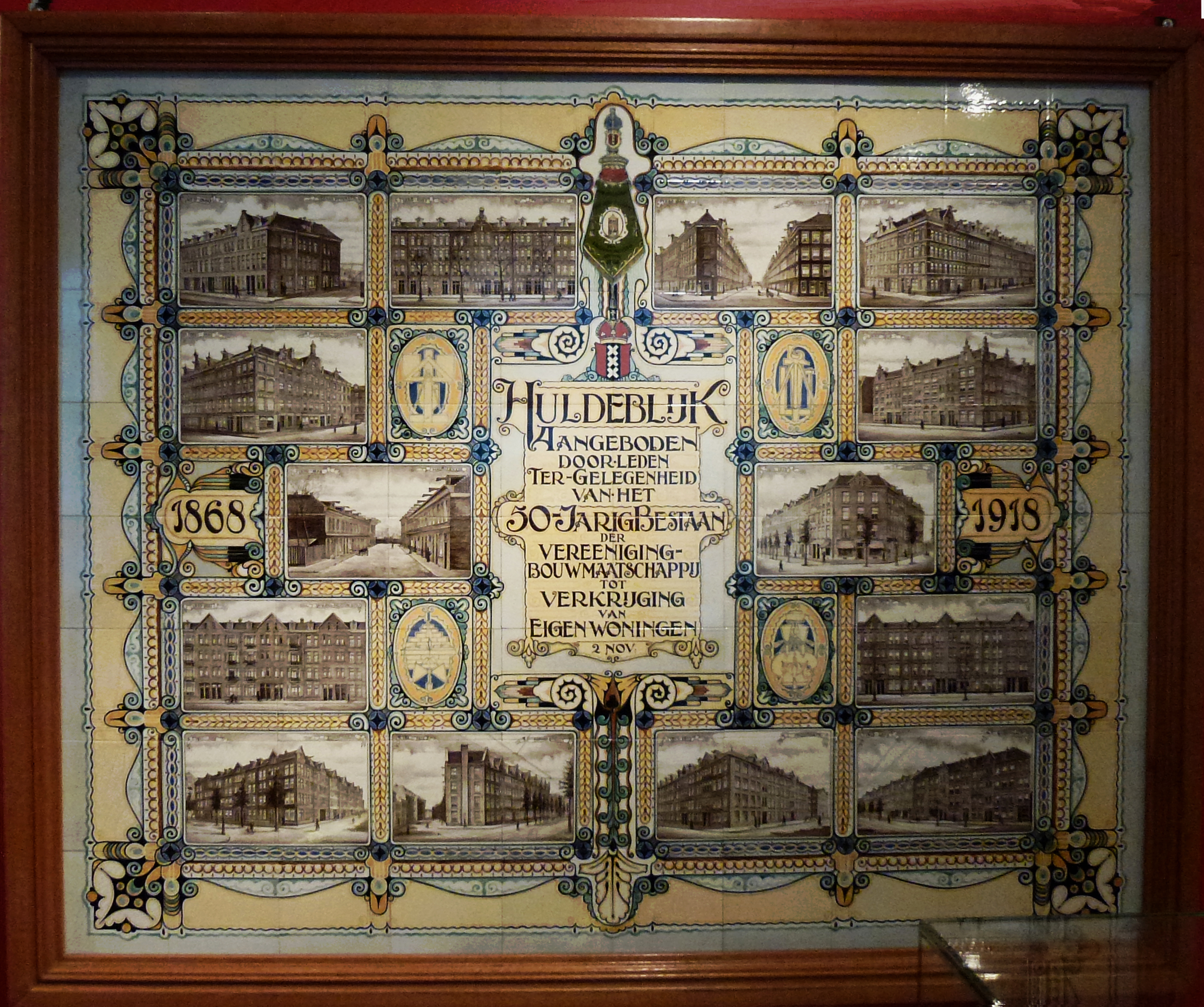
Nederlands: Tegeltableau Woonstichting de Key uit 1918 vervaardig door Plateelbakkerij Delft N.V. ter gelegenheid van het vijftigjarig bestaan van Vereeniging Bouw maatschappij tot Verkrijging van Eigen Woningen. Tot 1903 realiseerde deze maatschappij 780 woningen. In 1983 werd het opgenomen in Woningbouw vereniging Onze Woning en in 1997 in Woonstichting De Key. Rechts onder aan het tableau staat: PB Delft, Hilversum |
Date | |
Source | Self-photographed, Locatie: Amsterdam Museum |
Author | Firma Plateelbakkerij Delft N.V |
Camera location | 52° 22′ 12.55″ N, 4° 53′ 25.12″ E ![]() | View this and other nearby images on: OpenStreetMap | ![]() |
---|
Licensing
[edit]
This is a faithful photographic reproduction of a two-dimensional, public domain work of art. The work of art itself is in the public domain for the following reason:
The official position taken by the Wikimedia Foundation is that "faithful reproductions of two-dimensional public domain works of art are public domain".
This photographic reproduction is therefore also considered to be in the public domain in the United States. In other jurisdictions, re-use of this content may be restricted; see Reuse of PD-Art photographs for details. |
File history
Click on a date/time to view the file as it appeared at that time.
Date/Time | Thumbnail | Dimensions | User | Comment | |
---|---|---|---|---|---|
current | 20:18, 19 August 2017 | ![]() | 2,783 × 2,326 (4.59 MB) | Agaath (talk | contribs) | User created page with UploadWizard |
You cannot overwrite this file.
File usage on Commons
There are no pages that use this file.
File usage on other wikis
The following other wikis use this file:
- Usage on nl.wikipedia.org
Metadata
This file contains additional information such as Exif metadata which may have been added by the digital camera, scanner, or software program used to create or digitize it. If the file has been modified from its original state, some details such as the timestamp may not fully reflect those of the original file. The timestamp is only as accurate as the clock in the camera, and it may be completely wrong.
Camera manufacturer | Panasonic |
---|---|
Camera model | DMC-TZ20 |
Exposure time | 1/10 sec (0.1) |
F-number | f/3.3 |
ISO speed rating | 400 |
Date and time of data generation | 12:34, 24 June 2017 |
Lens focal length | 4.3 mm |
Latitude | 52° 22′ 12.56″ N |
Longitude | 4° 53′ 25.12″ E |
Width | 4,320 px |
Height | 2,432 px |
Bits per component |
|
Pixel composition | RGB |
Orientation | Normal |
Number of components | 3 |
Horizontal resolution | 180 dpi |
Vertical resolution | 180 dpi |
Software used | Adobe Photoshop Elements 12.0 Windows |
File change date and time | 21:53, 19 August 2017 |
Y and C positioning | Co-sited |
Exposure Program | Normal program |
Exif version | 2.3 |
Date and time of digitizing | 12:34, 24 June 2017 |
Meaning of each component |
|
Image compression mode | 4 |
APEX shutter speed | 3.321928 |
APEX aperture | 3.444932 |
APEX exposure bias | 0 |
Maximum land aperture | 3.4453125 APEX (f/3.3) |
Metering mode | Pattern |
Light source | Unknown |
Flash | Flash did not fire, compulsory flash suppression |
Supported Flashpix version | 1 |
Color space | sRGB |
Sensing method | One-chip color area sensor |
File source | Digital still camera |
Scene type | A directly photographed image |
Custom image processing | Normal process |
Exposure mode | Auto exposure |
White balance | Auto white balance |
Digital zoom ratio | 0 |
Focal length in 35 mm film | 27 mm |
Scene capture type | Standard |
Scene control | High gain up |
Contrast | Normal |
Saturation | Normal |
Sharpness | Normal |
GPS time (atomic clock) | 13:06 |
Satellites used for measurement | 4 |
Receiver status | Measurement in progress |
Measurement mode | 2-dimensional measurement |
Measurement precision | Moderate (0.8) |
Geodetic survey data used | WGS-84 |
Name of GPS area | GOUDSE SCHOUWBURG |
GPS date | 18 June 2017 |
GPS tag version | 0.0.2.2 |
Date metadata was last modified | 23:53, 19 August 2017 |
Unique ID of original document | 2EA51B25E5992F438188398B16F4997C |