File:Te rarawa iwi location map.png
Jump to navigation
Jump to search

Size of this preview: 525 × 600 pixels. Other resolutions: 210 × 240 pixels | 420 × 480 pixels | 695 × 794 pixels.
Original file (695 × 794 pixels, file size: 11 KB, MIME type: image/png)
Captions
Captions
Add a one-line explanation of what this file represents
Summary
[edit]
| Description |
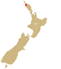
English: Iwi location map |
| Source | Derived from Image:IwiMap.png |
| Author | Me |
Licensing
[edit]
| I, the copyright holder of this work, release this work into the public domain. This applies worldwide. In some countries this may not be legally possible; if so: I grant anyone the right to use this work for any purpose, without any conditions, unless such conditions are required by law. |
File history
Click on a date/time to view the file as it appeared at that time.
| Date/Time | Thumbnail | Dimensions | User | Comment | |
|---|---|---|---|---|---|
| current | 08:48, 19 June 2008 | | 695 × 794 (11 KB) | Lanma726 (talk | contribs) | {{Information |Description={{en|1=Iwi location map}} |Source=Derived from Image:IwiMap.png |Author=Me |Date= |Permission= |other_versions= }} {{ImageUpload|full}} |
You cannot overwrite this file.
File usage on Commons
There are no pages that use this file.
File usage on other wikis
The following other wikis use this file:
- Usage on en.wikipedia.org
- Usage on mi.wikipedia.org
- Te Rarawa
- Te Waiariki (Te Rarawa)
- Te Uri-o-Tai
- Te Uri-o-Hina
- Te Taomauī
- Te Pōkeka
- Te Patupīnaki
- Te Parewhero
- Te Kaimata
- Te Ihutai
- Te Ākau
- Ngāti Waiora (Te Rarawa)
- Ngāti Tūpoto (Te Rarawa)
- Ngāti Te Ao (Te Rarawa)
- Ngāti Rua (Te Rarawa)
- Ngāti Moroki
- Ngāti Moetonga
- Ngāti Marara
- Ngāti Manawa (Te Rarawa)
- Ngāti Kurī (Te Rarawa)
- Ngāti Kohu
- Ngāti Kaitūtae
- Ngāti Hine (Te Rarawa)
- Usage on nn.wikipedia.org