File:Tarter-ferry-rd-bridge fulton-county-illinois.jpg
Jump to navigation
Jump to search

Size of this preview: 800 × 303 pixels. Other resolutions: 320 × 121 pixels | 640 × 243 pixels | 1,024 × 388 pixels | 1,280 × 485 pixels | 4,090 × 1,550 pixels.
Original file (4,090 × 1,550 pixels, file size: 2.05 MB, MIME type: image/jpeg)
Captions
Captions
Add a one-line explanation of what this file represents
Summary
[edit]
| Description |
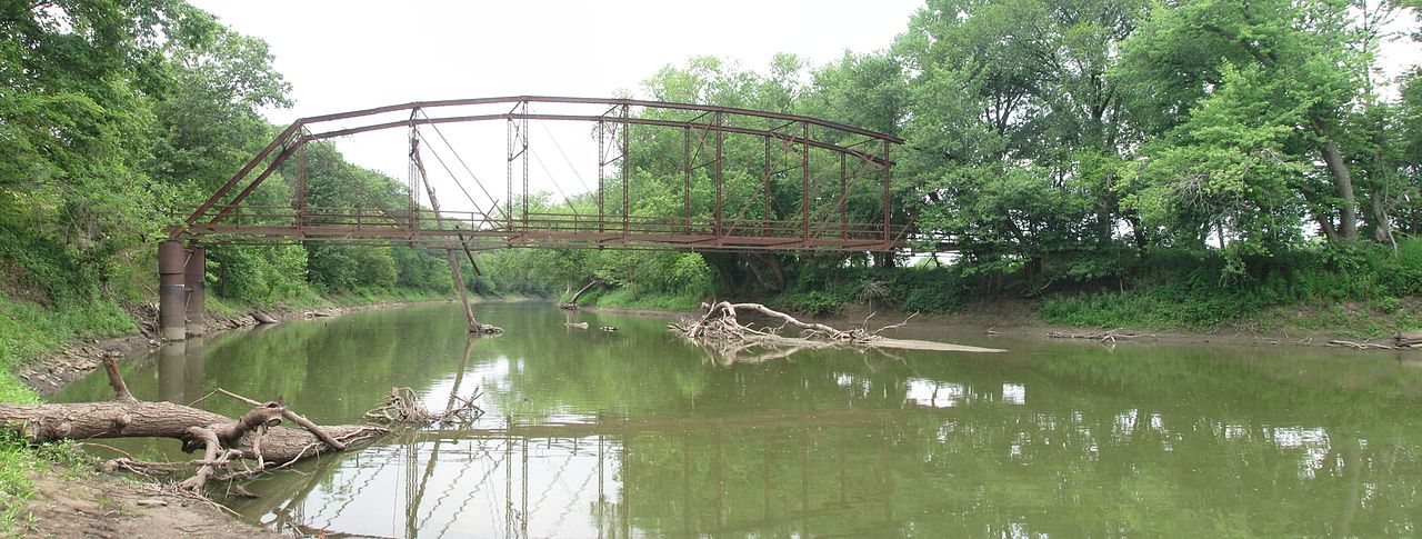
English: Facing west, a panorama view of the Parker through truss bridge that once carried Tarter Ferry Road over the Spoon River.
|
||
| Date | |||
| Source | Own work | ||
| Author | Fmiser |
| Camera location | | View this and other nearby images on: OpenStreetMap |
|---|
Licensing
[edit]
I, the copyright holder of this work, hereby publish it under the following licenses:
This file is licensed under the Creative Commons Attribution-Share Alike 3.0 Unported, 2.5 Generic, 2.0 Generic and 1.0 Generic license.
- You are free:
- to share – to copy, distribute and transmit the work
- to remix – to adapt the work
- Under the following conditions:
- attribution – You must give appropriate credit, provide a link to the license, and indicate if changes were made. You may do so in any reasonable manner, but not in any way that suggests the licensor endorses you or your use.
- share alike – If you remix, transform, or build upon the material, you must distribute your contributions under the same or compatible license as the original.

|
Permission is granted to copy, distribute and/or modify this document under the terms of the GNU Free Documentation License, Version 1.2 or any later version published by the Free Software Foundation; with no Invariant Sections, no Front-Cover Texts, and no Back-Cover Texts. A copy of the license is included in the section entitled GNU Free Documentation License. |
You may select the license of your choice.
File history
Click on a date/time to view the file as it appeared at that time.
| Date/Time | Thumbnail | Dimensions | User | Comment | |
|---|---|---|---|---|---|
| current | 04:01, 30 July 2013 | 4,090 × 1,550 (2.05 MB) | Fmiser (talk | contribs) | {{Information |Description ={{en|1=Facing west, a panorama view of the Parker through truss bridge that once carried Tarter Ferry Road over the Spoon River.}} |Source ={{own}} |Author =Fmiser |Date =2012-07-... |
You cannot overwrite this file.
File usage on Commons
There are no pages that use this file.
File usage on other wikis
The following other wikis use this file:
- Usage on en.wikipedia.org
- Usage on www.wikidata.org
Metadata
Categories:
- National Register of Historic Places in Fulton County, Illinois
- Road bridges in Fulton County, Illinois
- Bridges on the National Register of Historic Places in Illinois
- Bridges over rivers in Illinois
- Road bridges in Illinois
- Through truss bridges in Illinois
- 2012 in Illinois
- Built in Illinois in 1880
- 1880s bridges in Illinois
- Bridges in the United States completed in 1880
- Abandoned road bridges in the United States
- Steel bridges in the United States
- Bridges in the United States less than 0.1 kilometers
- Destroyed bridges
- Spoon River