File:Tantallon Castle - Flickr - S. Rae.jpg
Jump to navigation
Jump to search

Size of this preview: 800 × 393 pixels. Other resolutions: 320 × 157 pixels | 640 × 315 pixels | 1,024 × 504 pixels | 1,280 × 630 pixels | 3,416 × 1,680 pixels.
Original file (3,416 × 1,680 pixels, file size: 1.94 MB, MIME type: image/jpeg)
Captions
Captions
Add a one-line explanation of what this file represents
Summary
[edit]
| Description |
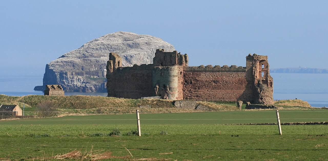
With the Bass Rock in the background to the left, and the Isle of May behind to the right. A mid 14th century fortification the site itself is much older. The name Dentaloune recorded circa 1300 suggests a pre 7th century Anglian conquest Brittonic name in Din- (fort) as in Dunbar (Dynbaer 680AD), Edinburgh (Din Eidyn), and Bamburgh (Din Guardi). These names belong to a period in history when a largely forgotten British tribe called the Votadini (Gododdin) controlled what is now south east Scotland and north east England. |
| Date | |
| Source | Tantallon Castle |
| Author | S. Rae from Scotland, UK |
| Camera location | | View this and other nearby images on: OpenStreetMap |
|---|
Licensing
[edit]
This file is licensed under the Creative Commons Attribution 2.0 Generic license.
- You are free:
- to share – to copy, distribute and transmit the work
- to remix – to adapt the work
- Under the following conditions:
- attribution – You must give appropriate credit, provide a link to the license, and indicate if changes were made. You may do so in any reasonable manner, but not in any way that suggests the licensor endorses you or your use.
| This image was originally posted to Flickr by S. Rae at https://flickr.com/photos/35142635@N05/7005954705. It was reviewed on 22 October 2016 by FlickreviewR and was confirmed to be licensed under the terms of the cc-by-2.0. |
File history
Click on a date/time to view the file as it appeared at that time.
| Date/Time | Thumbnail | Dimensions | User | Comment | |
|---|---|---|---|---|---|
| current | 04:54, 22 October 2016 | | 3,416 × 1,680 (1.94 MB) | Josve05a (talk | contribs) | == {{int:filedesc}} == {{Information |Description=With the Bass Rock in the background to the left, and the Isle of May behind to the right. A mid 14th century fortification the site itself is much older. The name Dentaloune recorded circa 1300 sugges... |
You cannot overwrite this file.
File usage on Commons
There are no pages that use this file.
File usage on other wikis
The following other wikis use this file:
- Usage on de.wikipedia.org
- Usage on en.wikipedia.org