File:Tailcup lupine, Lupinus argenteus var. heteranthus (33318925978).jpg
Jump to navigation
Jump to search
Size of this preview: 800 × 600 pixels. Other resolutions: 320 × 240 pixels | 640 × 480 pixels | 1,024 × 768 pixels | 1,280 × 960 pixels | 2,560 × 1,920 pixels | 3,648 × 2,736 pixels.
Original file (3,648 × 2,736 pixels, file size: 7.63 MB, MIME type: image/jpeg)
Captions
Captions
Add a one-line explanation of what this file represents
Summary
[edit].jpg&action=edit§ion=1)
| Description |
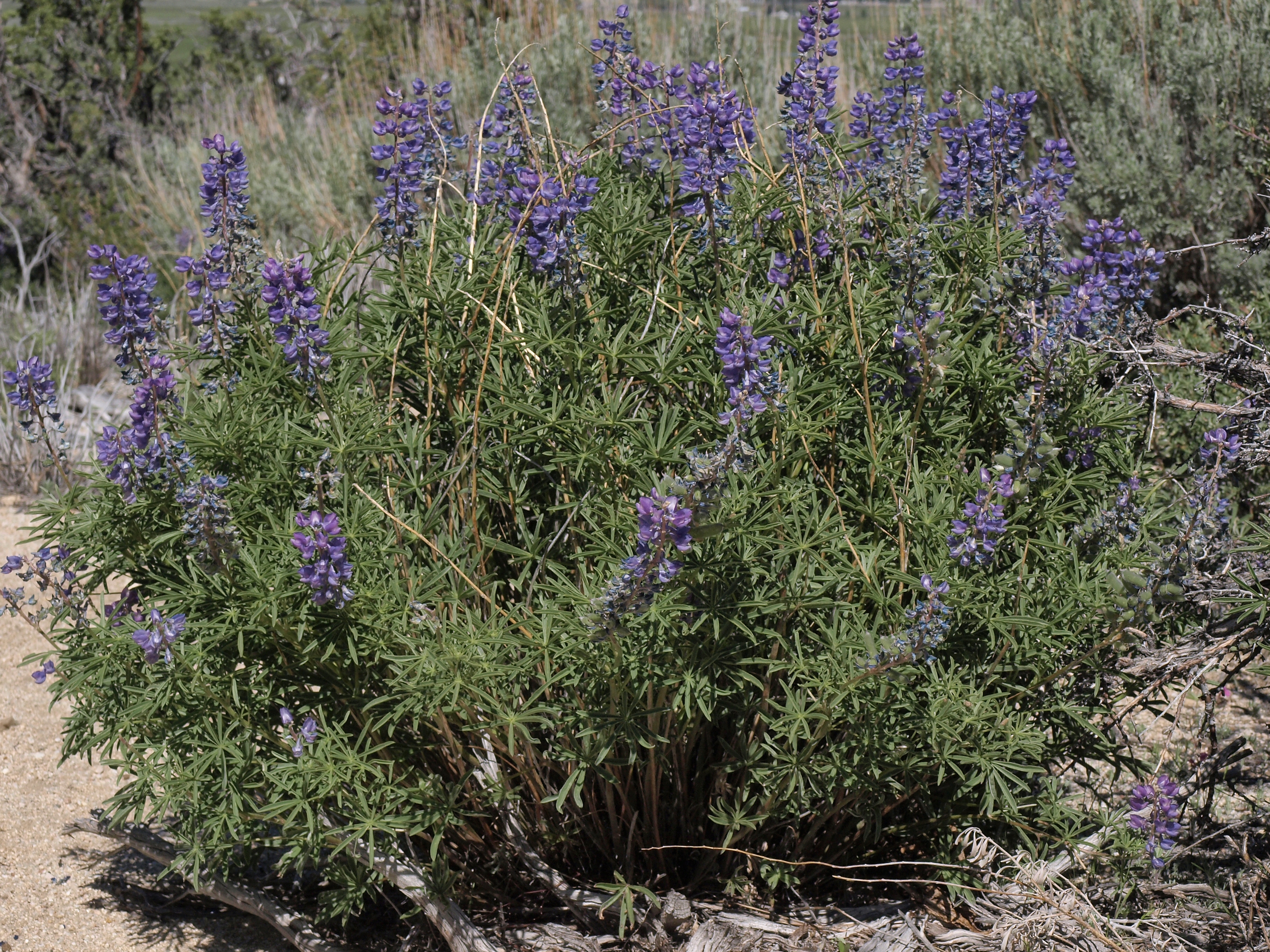
tailcup lupine, Lupinus argenteus var. heteranthus, Nevada, Jobs Peak Ranch Trail, Carson Range, Sierra Nevada, Sheridan, Carson Valley drainage, elevation 1498 m (4915 ft). This is one of the most frequently encountered perennial lupines in the western Great Basin and adjacent eastern Sierra Nevada of southeast Oregon, western Nevada, and eastern California. It is found mainly in the sagebrush zone at about 1400-2700 meters (4600-8900 feet) elevation. Plants in this area sometimes resemble Lupinus arbustus in their greener foliage, bushier habit, and long calyx spurs. But the defining character for L. arbustus, wing petals densely hairy outside near banner, does not appear to be present. And the type location for L. argenteus var. heteranthus is only a few miles north of here. The two species are questionably distinct anyway, and if merged this variety would still be the valid name under L. argenteus for plants of L. arbustus. |
| Date | |
| Source | tailcup lupine, Lupinus argenteus var. heteranthus |
| Author | Jim Morefield from Nevada, USA |
| Camera location | | View this and other nearby images on: OpenStreetMap |
|---|
.jpg¶ms=038.892119_N_-119.823489_E_globe:Earth_type:camera_source:Flickr_&language=en)
Licensing
[edit].jpg&action=edit§ion=2)
This file is licensed under the Creative Commons Attribution-Share Alike 2.0 Generic license.
- You are free:
- to share – to copy, distribute and transmit the work
- to remix – to adapt the work
- Under the following conditions:
- attribution – You must give appropriate credit, provide a link to the license, and indicate if changes were made. You may do so in any reasonable manner, but not in any way that suggests the licensor endorses you or your use.
- share alike – If you remix, transform, or build upon the material, you must distribute your contributions under the same or compatible license as the original.
| This image was originally posted to Flickr by Jim Morefield at https://flickr.com/photos/127605180@N04/33318925978 (archive). It was reviewed on 29 December 2019 by FlickreviewR 2 and was confirmed to be licensed under the terms of the cc-by-sa-2.0. |
File history
Click on a date/time to view the file as it appeared at that time.
| Date/Time | Thumbnail | Dimensions | User | Comment | |
|---|---|---|---|---|---|
| current | 03:10, 29 December 2019 | | 3,648 × 2,736 (7.63 MB) | Ser Amantio di Nicolao (talk | contribs) | Transferred from Flickr via #flickr2commons |
You cannot overwrite this file.
File usage on Commons
The following page uses this file:
- File:Tailcup lupine, Lupinus argenteus var. heteranthus.jpg (file redirect)
File usage on other wikis
The following other wikis use this file:
- Usage on en.wikipedia.org
.jpg&oldid=902482676)