File:TV-009-0544 (16107097722).jpg

Original file (1,600 × 1,200 pixels, file size: 185 KB, MIME type: image/jpeg)
Captions
Captions
Summary
[edit].jpg&action=edit§ion=1)
| Description |
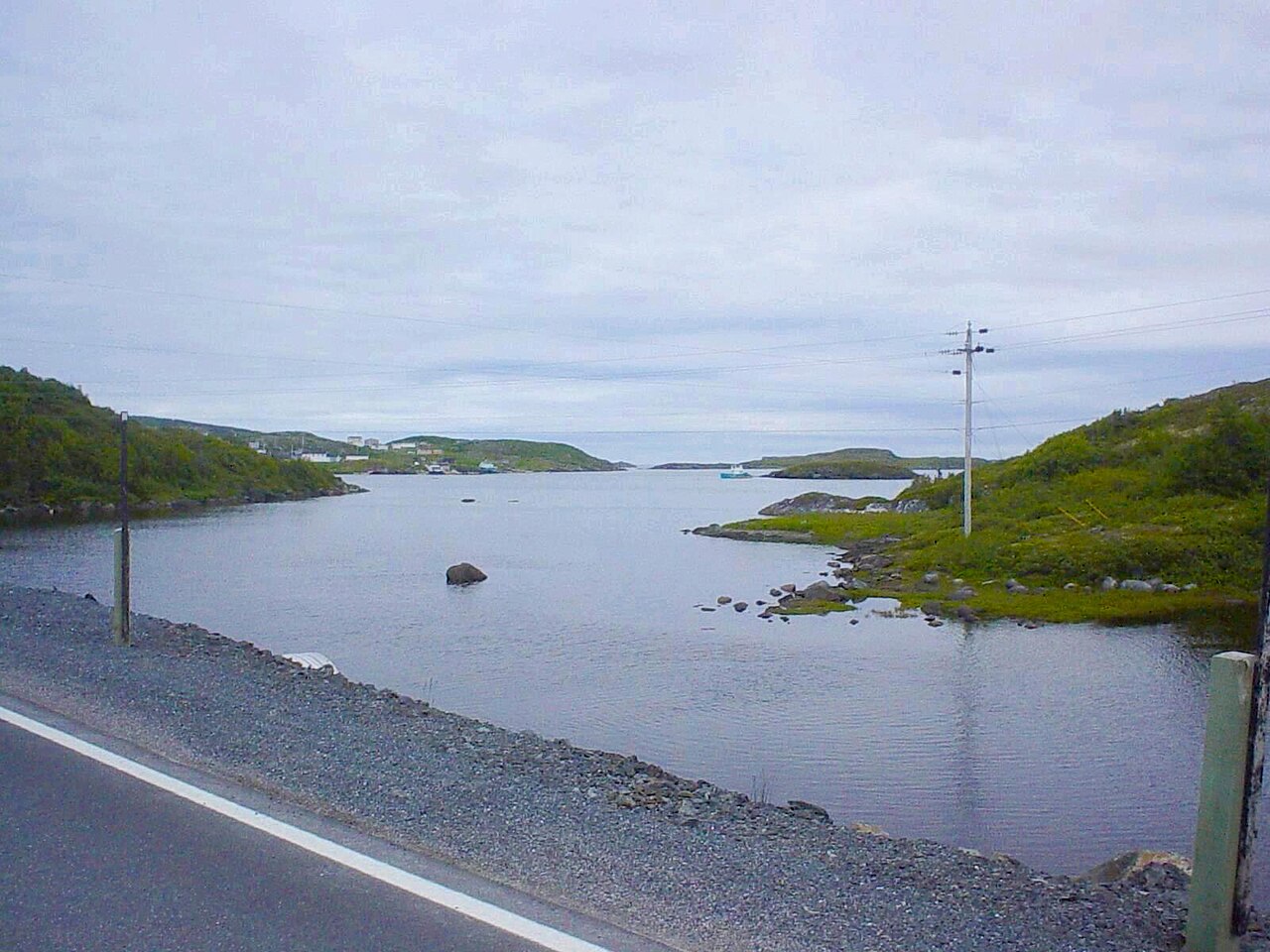
St. Lunaire-Griquet, Newfoundland. Looking southeast toward the open waters of the North Atlantic, St. Lunaire Bay was one of the first fishing regions in the New World to be exploited by Europeans - it was well established as a favourite stomping ground of French and Basque cod fishermen from around 1500, even before Jacques Cartier came on the scene to explore the surrounding lands. In 1713, St. Lunaire Bay, like the rest of the west coast of Newfoundland, came under the umbrella of the French Shore, an area of exclusive fishing rights granted to France as part of the Treaty of Utrecht - and seventy years later, on the heels of the disintegration of France's colonial holdings in North America, King Louis XVI sent Navy Admiral Guillaume Liberge de Granchain to map the bay as a strategic manoeuver to fend off British designs on these fertile waters. One of the islands far in the distance, where he set up his own fishing premises, today bears Admiral Granchain's name - and his efforts at defending France's claims were successful, as their unchallenged access to the west coast of Newfoundland was not revoked until the Entente Cordiale in 1904, by which time the matter was an economic irrelevancy. Saint-Lunaire-Griquet, Terre-Neuve. Le baie Saint-Lunaire (la vue ici est au sud-est vers les eaux libres de l'Atlantique Nord) était l'une des premières régions de pêche dans le Nouveau Monde à être exploitée par les Européens - elle était bien établie comme un point de rencontre préféré des pêcheurs de morue français et basques depuis environ 1500, même avant ce que Jacques Cartier est venu sur la scène pour explorer les terres environnantes. En 1713, la baie Saint-Lunaire, même que le reste de la côte occidentale de Terre-Neuve, est venu sous l'égide de la Côte française, une zone de droits de pêche exclusifs accordée à la France dans le cadre du Traité d'Utrecht - et soixante-dix années plus tard, par la suite de la désintégration des possessions coloniales de la France en Amérique du Nord, le roi Louis XVI a envoyé l'amiral Guillaume Liberge de Granchain pour cartographier la baie comme une manoeuvre stratégique pour repousser des vues britanniques sur ces eaux fertiles. L'une des îles loin au fond, où il a établi sa propre installation de pêche, porte aujourd'hui le nom de l'amiral Granchain - et ses efforts à défendre les revendications de la France ont réussi, car leur accès incontesté de la côte ouest de Terre-Neuve n'a pas été révoqué jusqu'à l'Entente cordiale de 1904, date à laquelle l'affaire était sans pertinence économique. Saint Lunaire-Griquet, Terranova. La Bahía de San Lunario (la vista aquía es en dirección sureste hacia las aguas abiertas del Atlántico del Norte) era una de las primeras regiones de pesca en el Nuevo Mundo en explotarse por los europeos - era bien establecido como un refugio preferido de los pescadores de bacalao franceses y vascos desde más o menos el año 1500, incluso antes que Jacques Cartier entró en escena para explorar las tierras circundantes. En 1713, la Bahía de San Lunario, al igual que el resto de la costa occidental de Terranova, quedó bajo la égida de la Costa Francesa, una zona derechos de pesca exclusivos que se concedió a Francia como parte del Tratado de Utrecht - y setenta años después, tras la desintegración de las posesiones coloniales de Francia en América del Norte, el rey Luis XVI envió el almirante Guillaume Liberge de Granchain para mapear la bahía como una maniobra estratégica para defenderla de los deseos británicos para estas aguas fértiles. Una de las islas que se sitúa lejos al fondo en esta foto, donde él instalóó su propio establecimiento pesquero, hoy lleva el nombre del almirante Granchain - y sus esfuerzos en la defensa de las reivindicaciones de Francia tuvieron éxito, ya que su acceso indiscutido a la costa oeste de Terranova no se revocó hasta la Entente Cordiale de 1904, momento en que el asunto era una irrelevancia económica. |
| Date | |
| Source | TV-009-0544 |
| Author | André Carrotflower |
Licensing
[edit].jpg&action=edit§ion=2)
- You are free:
- to share – to copy, distribute and transmit the work
- to remix – to adapt the work
- Under the following conditions:
- attribution – You must give appropriate credit, provide a link to the license, and indicate if changes were made. You may do so in any reasonable manner, but not in any way that suggests the licensor endorses you or your use.
- share alike – If you remix, transform, or build upon the material, you must distribute your contributions under the same or compatible license as the original.
| This image was originally posted to Flickr by Carrotflower Productions International at https://flickr.com/photos/59639129@N08/16107097722. It was reviewed on 17 June 2020 by FlickreviewR 2 and was confirmed to be licensed under the terms of the cc-by-sa-2.0. |
File history
Click on a date/time to view the file as it appeared at that time.
| Date/Time | Thumbnail | Dimensions | User | Comment | |
|---|---|---|---|---|---|
| current | 16:19, 17 June 2020 | | 1,600 × 1,200 (185 KB) | Mindmatrix (talk | contribs) | Transferred from Flickr via #flickr2commons |
You cannot overwrite this file.
File usage on Commons
There are no pages that use this file.
.jpg&oldid=894810080)