File:TRD destinations map.svg
Jump to navigation
Jump to search

Size of this PNG preview of this SVG file: 560 × 599 pixels. Other resolutions: 224 × 240 pixels | 449 × 480 pixels | 718 × 768 pixels | 957 × 1,024 pixels | 1,914 × 2,048 pixels | 645 × 690 pixels.
Original file (SVG file, nominally 645 × 690 pixels, file size: 490 KB)
Captions
Captions
Add a one-line explanation of what this file represents
Summary
[edit]
| Description |
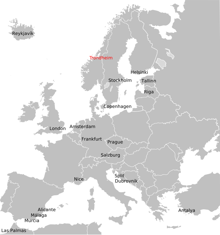
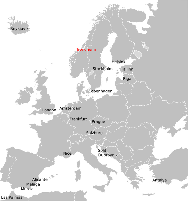
English: International destinations from Trondheim Airport, Værnes |
| Date | |
| Source | Own work |
| Author | Alasdair McLellan |
Licensing
[edit]
| I, the copyright holder of this work, release this work into the public domain. This applies worldwide. In some countries this may not be legally possible; if so: I grant anyone the right to use this work for any purpose, without any conditions, unless such conditions are required by law. |
File history
Click on a date/time to view the file as it appeared at that time.
| Date/Time | Thumbnail | Dimensions | User | Comment | |
|---|---|---|---|---|---|
| current | 20:53, 30 October 2011 | | 645 × 690 (490 KB) | Arsenikk (talk | contribs) | Updated destinations (Helsinki, Tallinn, Antalya, Frankfurt), remove Åre/Östersund |
| 22:13, 13 February 2010 |  | 645 × 690 (483 KB) | Arsenikk (talk | contribs) | +Split | |
| 22:08, 13 February 2010 |  | 645 × 690 (479 KB) | Arsenikk (talk | contribs) | Try again | |
| 22:03, 13 February 2010 |  | 645 × 690 (383 KB) | Arsenikk (talk | contribs) | {{Information |Description={{en|1=International destinations from Trondheim Airport, Værnes}} |Source={{own}} |Author=Alasdair McLellan |Date=2010-02-13 |Permission= |other_versions= }} [[Category:Maps of cities served by flights from |
You cannot overwrite this file.
File usage on Commons
There are no pages that use this file.
File usage on other wikis
The following other wikis use this file:
- Usage on en.wikipedia.org