File:TC Dina 23 jan 2002 0640Z.jpg
Jump to navigation
Jump to search

Size of this preview: 452 × 600 pixels. Other resolutions: 181 × 240 pixels | 362 × 480 pixels | 579 × 768 pixels | 772 × 1,024 pixels | 1,544 × 2,048 pixels | 6,000 × 7,960 pixels.
Original file (6,000 × 7,960 pixels, file size: 7.01 MB, MIME type: image/jpeg)
Captions
Captions
Add a one-line explanation of what this file represents
Summary
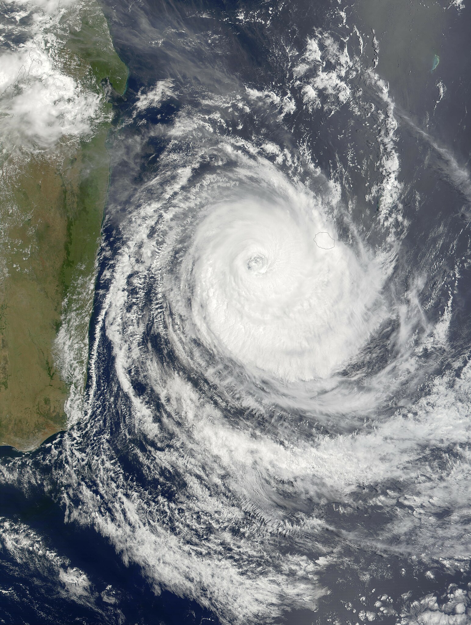
[edit]| Description | Maximum sustained winds in Cyclone Dina had dropped to about 130 miles per hour as of Wednesday morning, January 23, 2002, and were predicted to continue dropping as the storm pursued a west-southwestward track that will likely shift more toward the south, keeping the center of the storm away from the island of Madagascar. In this true-color MODIS image made from data acquired on the morning of January 23, the storm had cleared Mauritius (eastern-most island) but was still covering Riunion. The outer bands of clouds were skirting the southeast coast of Madagascar. | |||||
| Date | ||||||
| Source | http://visibleearth.nasa.gov/view_rec.php?id=2402 | |||||
| Author | Jacques Descloitres, MODIS Land Rapid Response Team, NASA/GSFC | |||||
| Permission (Reusing this file) |
|

File history
Click on a date/time to view the file as it appeared at that time.
| Date/Time | Thumbnail | Dimensions | User | Comment | |
|---|---|---|---|---|---|
| current | 20:18, 3 December 2006 | | 6,000 × 7,960 (7.01 MB) | Good kitty (talk | contribs) | == Summary == {{Information |Description=Maximum sustained winds in Cyclone Dina had dropped to about 130 miles per hour as of Wednesday morning, January 23, 2002, and were predicted to continue dropping as the storm pursued a west-southwestward track tha |
You cannot overwrite this file.
File usage on Commons
There are no pages that use this file.
File usage on other wikis
The following other wikis use this file:
- Usage on en.wikipedia.org
- Usage on zh.wikipedia.org