File:Szczutowo (gmina) location map.png
Jump to navigation
Jump to search
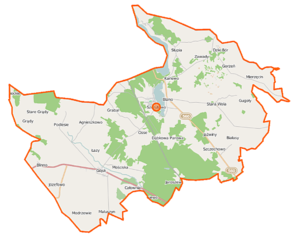
Size of this preview: 739 × 600 pixels. Other resolutions: 296 × 240 pixels | 592 × 480 pixels | 966 × 784 pixels.
Original file (966 × 784 pixels, file size: 101 KB, MIME type: image/png)
Captions
Captions
Add a one-line explanation of what this file represents
| Description |
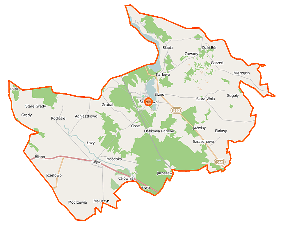
Polski: Mapa gminy Szczutowo, Polska
English: Map of Gmina Szczutowo, Poland |
|||||||||
| Date | ||||||||||
| Source | You may find a page on the OpenStreetMap wiki page for Szczutowo (gmina) | |||||||||
| Creator |
OpenStreetMap contributors OpenStreetMap contributors |
|||||||||
| Permission (Reusing this file) |
OpenStreetMap data is available under the Open Database License (details). Map tiles are licensed under the Creative Commons Attribution-ShareAlike 2.0 license (CC-BY-SA 2.0).
This file is licensed under the Creative Commons Attribution-Share Alike 2.0 Generic license.
|
|||||||||
| Geotemporal data | ||||||||||
| Bounding box |
|
|||||||||
| Georeferencing | If inappropriate please set warp_status = skip to hide. | |||||||||
File history
Click on a date/time to view the file as it appeared at that time.
| Date/Time | Thumbnail | Dimensions | User | Comment | |
|---|---|---|---|---|---|
| current | 10:41, 7 October 2014 | | 966 × 784 (101 KB) | VanWiel (talk | contribs) | {{OpenStreetMap | name = Szczutowo (gmina) | location = Szczutowo (gmina) | description = {{pl|Mapa gminy Szczutowo, Polska}} {{en|Map of Gmina Szczutowo, Poland}} | top = 52.9931 | left = 19.4365... |
You cannot overwrite this file.
File usage on Commons
There are no pages that use this file.
File usage on other wikis
The following other wikis use this file:
- Usage on fr.wikipedia.org
- Usage on pl.wikipedia.org
- Szczutowo (gmina)
- Białasy
- Blinno
- Całownia
- Cisse
- Dąbkowa Parowa
- Dziki Bór
- Gójsk
- Grabal
- Gugoły
- Karlewo
- Szczechowo
- Stara Wola
- Agnieszkowo (województwo mazowieckie)
- Blizno (województwo mazowieckie)
- Gorzeń (województwo mazowieckie)
- Maluszyn (województwo mazowieckie)
- Modrzewie (województwo mazowieckie)
- Szczutowo (województwo mazowieckie)
- Grądy (powiat sierpecki)
- Jaźwiny (powiat sierpecki)
- Józefowo (powiat sierpecki)
- Łazy (powiat sierpecki)
- Mierzęcin (powiat sierpecki)
- Mościska (powiat sierpecki)
- Podlesie (powiat sierpecki)
- Słupia (gmina Szczutowo)
- Jezioro Urszulewskie
- Szczutowo (przystanek kolejowy)
- Jaroszewo (województwo mazowieckie)
- Majewo (województwo mazowieckie)
- Stare Grądy (województwo mazowieckie)
- Zawady (powiat sierpecki)
- Urszulewka
- Parafia św. Marii Magdaleny w Szczutowie
- Moduł:Mapa/dane/Szczutowo (gmina)
- Jeleniec (Grabal)
- Kościół św. Marii Magdaleny w Szczutowie
- Parafia św. Mikołaja w Gójsku
- Kościół św. Wawrzyńca w Karlewie
- Jezioro Szczutowskie
- Helenowo (Maluszyn)
- Czartownia
- Nowe Agnieszkowo
- Usage on pl.wikibooks.org
_location_map.png&oldid=506901265)