File:Syria M5 Highway.svg
Jump to navigation
Jump to search

Size of this PNG preview of this SVG file: 800 × 565 pixels. Other resolutions: 320 × 226 pixels | 640 × 452 pixels | 1,024 × 724 pixels | 1,280 × 905 pixels | 2,560 × 1,809 pixels | 1,040 × 735 pixels.
Original file (SVG file, nominally 1,040 × 735 pixels, file size: 462 KB)
Captions
Captions
Add a one-line explanation of what this file represents

Summary
[edit]
| Description |
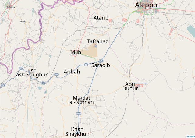
English: Map of the M5 Highway — in the Aleppo Governorate, northern Syria. |
| Date | |
| Source | OpenSteetMap |
| Author | Futuretrillionaire |
Licensing
[edit]
| This work contains information from OpenStreetMap, which is made available under the Open Database License (ODbL).
The ODbL does not require any particular license for maps produced from ODbL data. Prior to 1 August 2020, map tiles produced by the OpenStreetMap Foundation were licensed under the CC-BY-SA-2.0 license. Maps produced by other people may be subject to other licences. |
Futuretrillionaire, the copyright holder of this work, hereby publishes it under the following licenses:

|
Permission is granted to copy, distribute and/or modify this document under the terms of the GNU Free Documentation License, Version 1.2 or any later version published by the Free Software Foundation; with no Invariant Sections, no Front-Cover Texts, and no Back-Cover Texts. A copy of the license is included in the section entitled GNU Free Documentation License. |
This file is licensed under the Creative Commons Attribution-Share Alike 3.0 Unported license.
Attribution: Futuretrillionaire
- You are free:
- to share – to copy, distribute and transmit the work
- to remix – to adapt the work
- Under the following conditions:
- attribution – You must give appropriate credit, provide a link to the license, and indicate if changes were made. You may do so in any reasonable manner, but not in any way that suggests the licensor endorses you or your use.
- share alike – If you remix, transform, or build upon the material, you must distribute your contributions under the same or compatible license as the original.
You may select the license of your choice.
File history
Click on a date/time to view the file as it appeared at that time.
| Date/Time | Thumbnail | Dimensions | User | Comment | |
|---|---|---|---|---|---|
| current | 15:33, 3 January 2013 | | 1,040 × 735 (462 KB) | FutureTrillionaire (talk | contribs) | added Taftanaz |
| 17:50, 26 December 2012 |  | 1,040 × 735 (461 KB) | FutureTrillionaire (talk | contribs) | A more detailed map from OpenStreetMap | |
| 14:09, 23 October 2012 |  | 350 × 440 (170 KB) | FutureTrillionaire (talk | contribs) | Added 2nd Highway | |
| 13:39, 23 October 2012 |  | 350 × 440 (168 KB) | FutureTrillionaire (talk | contribs) | Jisr ash-Shugur under govt control | |
| 16:52, 15 October 2012 |  | 350 × 440 (168 KB) | FutureTrillionaire (talk | contribs) | Azmarin captured [http://www.globalpost.com/dispatch/news/regions/middle-east/syria/121014/syria-rebel-fighters-capture-historical-town-azmarin] | |
| 14:28, 14 October 2012 |  | 350 × 440 (168 KB) | EllsworthSK (talk | contribs) | Saraqib to blue per http://www.nowlebanon.com/NewsArticleDetails.aspx?ID=446293 | |
| 15:14, 13 October 2012 |  | 350 × 440 (168 KB) | FutureTrillionaire (talk | contribs) | As requested by Sopher99, Saraqib is changed to blue. | |
| 22:38, 12 October 2012 |  | 350 × 440 (168 KB) | FutureTrillionaire (talk | contribs) | Added Azmarin | |
| 21:56, 12 October 2012 |  | 350 × 440 (167 KB) | FutureTrillionaire (talk | contribs) | Smaller text | |
| 21:50, 12 October 2012 |  | 350 × 440 (166 KB) | FutureTrillionaire (talk | contribs) | Bigger |
You cannot overwrite this file.
File usage on Commons
The following page uses this file:
File usage on other wikis
The following other wikis use this file:
- Usage on ar.wikipedia.org
- Usage on en.wikipedia.org
- Usage on es.wikipedia.org
- Usage on nl.wikipedia.org
- Usage on pl.wikipedia.org
- Usage on tr.wikipedia.org
- Usage on www.wikidata.org
- Usage on zh.wikipedia.org