File:Swietokrzyskie mapa fizyczna.png
Jump to navigation
Jump to search

Size of this preview: 711 × 600 pixels. Other resolutions: 285 × 240 pixels | 569 × 480 pixels | 911 × 768 pixels | 1,214 × 1,024 pixels | 1,794 × 1,513 pixels.
Original file (1,794 × 1,513 pixels, file size: 372 KB, MIME type: image/png)
Captions
Captions
Add a one-line explanation of what this file represents
Summary
[edit]
| Description |
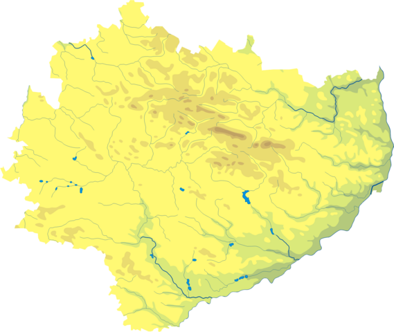
Polski: Mapa wód i ukształtowania powierzchni województwa świętokrzyskiego. Autor: Aotearoa Współrzędne graniczne mapy:
Legenda  |
| Date | 29 August 2006 (original upload date) |
| Source | Transferred from pl.wikipedia; transferred to Commons by User:Pjahr using CommonsHelper. |
| Author | Original uploader was Aotearoa at pl.wikipedia |
| Permission (Reusing this file) |
Released under the GNU Free Documentation License. |
Licensing
[edit]
Aotearoa at pl.wikipedia, the copyright holder of this work, hereby publishes it under the following license:

|
Permission is granted to copy, distribute and/or modify this document under the terms of the GNU Free Documentation License, Version 1.2 or any later version published by the Free Software Foundation; with no Invariant Sections, no Front-Cover Texts, and no Back-Cover Texts. A copy of the license is included in the section entitled GNU Free Documentation License. |
| This file is licensed under the Creative Commons Attribution-Share Alike 3.0 Unported license. | ||
| Attribution: Aotearoa at pl.wikipedia | ||
| ||
| This licensing tag was added to this file as part of the GFDL licensing update. |
Original upload log
[edit]
The original description page was here. All following user names refer to pl.wikipedia.
- 2006-08-29 18:33 Aotearoa 373×314× (49964 bytes) Mapa wód i ukształtowania powierzchni województwa świętokrzyskiego. Autor: [[Wikipedysta:Aotearoa|Aotearoa]]
File history
Click on a date/time to view the file as it appeared at that time.
| Date/Time | Thumbnail | Dimensions | User | Comment | |
|---|---|---|---|---|---|
| current | 11:02, 29 October 2012 | | 1,794 × 1,513 (372 KB) | Aotearoa (talk | contribs) | drobne techniczne |
| 21:39, 6 December 2009 |  | 373 × 314 (49 KB) | File Upload Bot (Magnus Manske) (talk | contribs) | {{BotMoveToCommons|pl.wikipedia|year={{subst:CURRENTYEAR}}|month={{subst:CURRENTMONTHNAME}}|day={{subst:CURRENTDAY}}}} {{Information |Description={{pl|Mapa wód i ukształtowania powierzchni województwa świętokrzyskiego. Autor: [[:pl:Wikipedysta:Aotea |
You cannot overwrite this file.
File usage on Commons
The following page uses this file:
- File:Województwo świętokrzyskie - mapa fizyczna.png (file redirect)
File usage on other wikis
The following other wikis use this file:
- Usage on be.wikipedia.org
- Usage on bg.wikipedia.org
- Usage on ce.wikipedia.org
- Usage on de.wikipedia.org
- Usage on hu.wikipedia.org
- Usage on lv.wikipedia.org
- Usage on pl.wikipedia.org
- Usage on pt.wikipedia.org
- Usage on uk.wikipedia.org
- Usage on www.wikidata.org