File:Sweeping Saharan Dust Storm (MODIS 2021-02-18).jpg

Original file (5,152 × 4,269 pixels, file size: 2.49 MB, MIME type: image/jpeg)
Captions
Captions
Summary
[edit].jpg&action=edit§ion=1)
| Description |
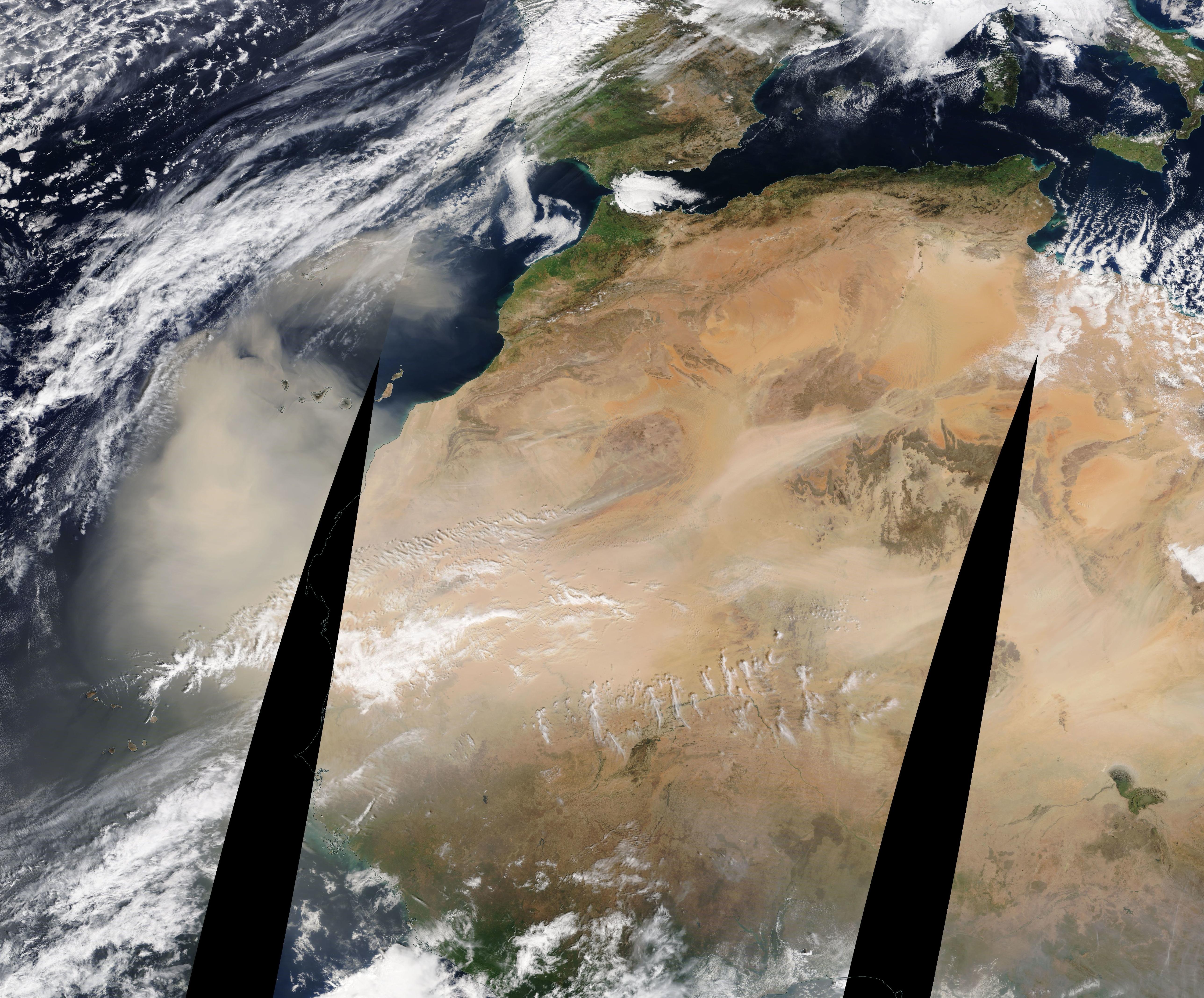
English: Strong winds blowing across northern Africa created a sweeping storm of sand and dust in mid-February 2021. The Moderate Resolution Imaging Spectroradiometer (MODIS) on board NASA’s Terra satellite acquired a true-color image of a massive mobilization of Saharan dust on February 16. The image is a mosaic, with data from three different passes of the satellite over Africa stitched together to give a broad view of the region. The dark areas are created by lack of data collection at the edge of the satellite swaths and due to projection of a curved Earth surface onto a flat image.
Plumes of camel-color dust rise as far inland as Libya and Chad and blow westward, joining more rising dust until the shifting sand completely blankets the skies over Mauritania, southern Morocco, and northern Senegal. The leading edge of the massive dust cloud extends about 500 miles (805 km) off the African coast to completely obscure part of the North Atlantic Ocean from view. Thick swirls of dust also hang over the Canary Islands. The total length of shifting sand, measured from the first major plumes of inland to the leading edge of dust over the Atlantic, comes in at about 2,600 miles (4,180 km). For comparison, the approximate maximum width of the African Continent, from east to west, is 4,600 miles (7,400 km) and the distance from the coast of Senegal (Africa) to the coast of Brazil (South America) is only about 1,600 miles (2,575 km). By February 15, the leading edge of the dust appeared to be extending further across the Atlantic Ocean, moving toward South America. Every year, about 800 million tons of dust is picked up by the wind from deserts in North Africa and blown across the Atlantic Ocean, traveling to the Amazon River Basin in South America, beaches in the Caribbean and, in part, into the air in North and South America. |
||
| Date | Taken on 16 December 2021 | ||
| Source |
Sweeping Saharan Dust Storm (direct link)
|
||
| Author | MODIS Land Rapid Response Team, NASA GSFC |
| This media is a product of the Terra mission Credit and attribution belongs to the mission team, if not already specified in the "author" row |
Licensing
[edit].jpg&action=edit§ion=2)
| This file is in the public domain in the United States because it was solely created by NASA. NASA copyright policy states that "NASA material is not protected by copyright unless noted". (See Template:PD-USGov, NASA copyright policy page or JPL Image Use Policy.) | ||
 |
Warnings:
|
File history
Click on a date/time to view the file as it appeared at that time.
| Date/Time | Thumbnail | Dimensions | User | Comment | |
|---|---|---|---|---|---|
| current | 18:01, 30 January 2024 | | 5,152 × 4,269 (2.49 MB) | OptimusPrimeBot (talk | contribs) | #Spacemedia - Upload of http://modis.gsfc.nasa.gov/gallery/images/image02182021_1km.jpg via Commons:Spacemedia |
You cannot overwrite this file.
File usage on Commons
There are no pages that use this file.
.jpg&oldid=847280998)