File:Suzuka junior & senior high school, CKK20115-C9-22.jpg
Jump to navigation
Jump to search
No higher resolution available.
Suzuka_junior_&_senior_high_school,_CKK20115-C9-22.jpg (663 × 469 pixels, file size: 106 KB, MIME type: image/jpeg)
Captions
Captions
Add a one-line explanation of what this file represents
Summary
[edit]| Description |
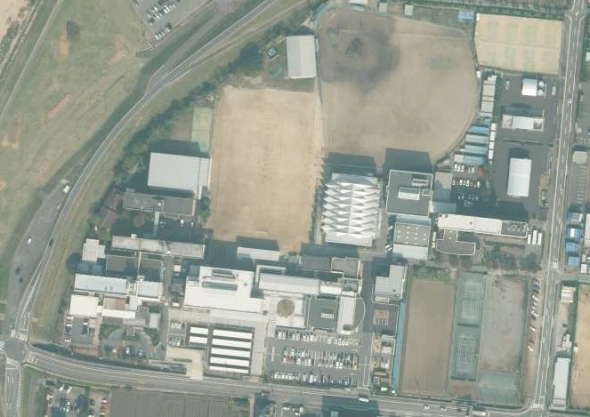
日本語:三重県鈴鹿市庄野町にある、鈴鹿中学校・高等学校の全景。
English: This is a panorama of Suzuka junior & senior high school in Suzuka, Mie, Japan. |
| Date | |
| Source |
日本語:国土画像情報(カラー空中写真)(整理番号:CKK20115、コース番号:C9、写真番号:22、撮影年月日:2011年11月4日、撮影地域:鈴鹿、撮影高度:2349m、撮影縮尺:1/10000、カメラ名称:UCXp-WA、焦点距離:70.500mm、カラー種別:カラー、写真種別:デジタル、撮影計画機関:国土地理院、市区町村名:鈴鹿市) http://mapps.gsi.go.jp/contentsImageDisplay.do?specificationId=1254222&isDetail=false
English: National Land Image Information (Color Aerial Photographs) (Reference number: CKK20115; Course Number: C9; Photo Number: 22; Date: November 4, 2011; Area: Suzuka; Height: 2349 metre; Scale: 1/10000; Camera Name: UCXp-WA; Focal Distance: 70.500 millimetre; Color Type: Color; Photo Type: Digital; Agency: Geographical Survey Institute of Japan; Municipality: Suzuka City) http://mapps.gsi.go.jp/contentsImageDisplay.do?specificationId=1254222&isDetail=false |
| Author |
English: Geographical Survey Institute of Japan 日本語:国土地理院 |
Licensing
[edit]
|
The copyright holder of this file, Ministry of Land, Infrastructure, Transport and Tourism, allows anyone to use it for any purpose, provided that the copyright holder is properly attributed. Redistribution, derivative work, commercial use, and all other use is permitted. |
Attribution:
National Land Image Information (Color Aerial Photographs), created by Ministry of Land, Infrastructure, Transport and Tourism, distributed by Geospatial Information Authority of Japan
|

File history
Click on a date/time to view the file as it appeared at that time.
| Date/Time | Thumbnail | Dimensions | User | Comment | |
|---|---|---|---|---|---|
| current | 16:52, 10 March 2017 | | 663 × 469 (106 KB) | Miyuki Meinaka (talk | contribs) | User created page with UploadWizard |
You cannot overwrite this file.
File usage on Commons
The following page uses this file:
File usage on other wikis
The following other wikis use this file:
- Usage on ja.wikipedia.org
- Usage on www.wikidata.org