File:Susz (gmina) location map.png

Original file (2,009 × 1,962 pixels, file size: 833 KB, MIME type: image/png)
Captions
Captions
Summary
[edit]_location_map.png&action=edit§ion=1)
| Description |
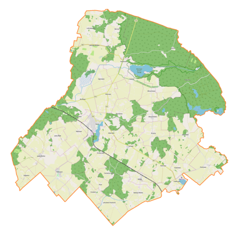
English: Location map |
| Date | |
| Source | Own work |
| Author | Smat |
| Description |
Polski: Mapa gminy Susz, Polska
English: Map of Susz (gmina), Poland |
|||||||||
| Date | ||||||||||
| Source | You may find a page on the OpenStreetMap wiki page for Susz (gmina) | |||||||||
| Creator |
OpenStreetMap contributors OpenStreetMap contributors |
|||||||||
| Permission (Reusing this file) |
OpenStreetMap data is available under the Open Database License (details). Map tiles are licensed under the Creative Commons Attribution-ShareAlike 2.0 license (CC-BY-SA 2.0).
This file is licensed under the Creative Commons Attribution-Share Alike 2.0 Generic license.
|
|||||||||
| Geotemporal data | ||||||||||
| Bounding box |
|
|||||||||
| Georeferencing | If inappropriate please set warp_status = skip to hide. | |||||||||
Licensing
[edit]_location_map.png&action=edit§ion=2)
| This work contains information from OpenStreetMap, which is made available under the Open Database License (ODbL).
The ODbL does not require any particular license for maps produced from ODbL data. Prior to 1 August 2020, map tiles produced by the OpenStreetMap Foundation were licensed under the CC-BY-SA-2.0 license. Maps produced by other people may be subject to other licences. |
File history
Click on a date/time to view the file as it appeared at that time.
| Date/Time | Thumbnail | Dimensions | User | Comment | |
|---|---|---|---|---|---|
| current | 16:07, 22 April 2019 | | 2,009 × 1,962 (833 KB) | Smat (talk | contribs) | User created page with UploadWizard |
You cannot overwrite this file.
File usage on Commons
There are no pages that use this file.
File usage on other wikis
The following other wikis use this file:
- Usage on de.wikipedia.org
- Usage on pl.wikipedia.org
- Rezerwat przyrody Jezioro Gaudy
- Rezerwat przyrody Czerwica
- Susz
- Merynos
- Babięty Wielkie (województwo warmińsko-mazurskie)
- Bałoszyce
- Bornice
- Brusiny
- Chełmżyca
- Falknowo
- Jakubowo Kisielickie
- Jawty Małe
- Jawty Wielkie
- Lubnowy Małe
- Lubnowy Wielkie
- Nipkowie
- Olbrachtowo
- Olbrachtówko
- Redaki
- Bronowo (województwo warmińsko-mazurskie)
- Dolina (powiat iławski)
- Emilianowo (gmina Susz)
- Huta (województwo warmińsko-mazurskie)
- Januszewo (powiat iławski)
- Kamieniec (województwo warmińsko-mazurskie)
- Michałowo (powiat iławski)
- Różanki (województwo warmińsko-mazurskie)
- Rudniki (województwo warmińsko-mazurskie)
- Wiśniówek (województwo warmińsko-mazurskie)
- Zieleń (województwo warmińsko-mazurskie)
- Żakowice (województwo warmińsko-mazurskie)
- Adamowo (powiat iławski)
- Czerwona Woda (powiat iławski)
- Dąbrówka (powiat iławski)
- Grabowiec (powiat iławski)
- Krzywiec (powiat iławski)
- Piotrkowo (powiat iławski)
- Różnowo (powiat iławski)
- Ulnowo (powiat iławski)
- Jezioro Suskie (Pojezierze Łasińskie)
- Pałac w Kamieńcu (województwo warmińsko-mazurskie)
- Synagoga w Suszu
- Karolewo (powiat iławski)
- Stawiec (województwo warmińsko-mazurskie)
- Bałoszyce Małe
- Fabianki (województwo warmińsko-mazurskie)
- Rumunki (Michałowo)
- Babięty Małe
- Emilianowo-Róża
View more global usage of this file.
_location_map.png)
_location_map.png&oldid=704004348)