File:Survey of Palestine, Beit Safafa (FL168744116 3526104).jpg
Jump to navigation
Jump to search

Size of this preview: 732 × 600 pixels. Other resolutions: 293 × 240 pixels | 586 × 480 pixels | 937 × 768 pixels | 1,250 × 1,024 pixels | 2,499 × 2,048 pixels | 17,063 × 13,984 pixels.
Original file (17,063 × 13,984 pixels, file size: 199.33 MB, MIME type: image/jpeg)
Captions
Captions
Add a one-line explanation of what this file represents
Summary
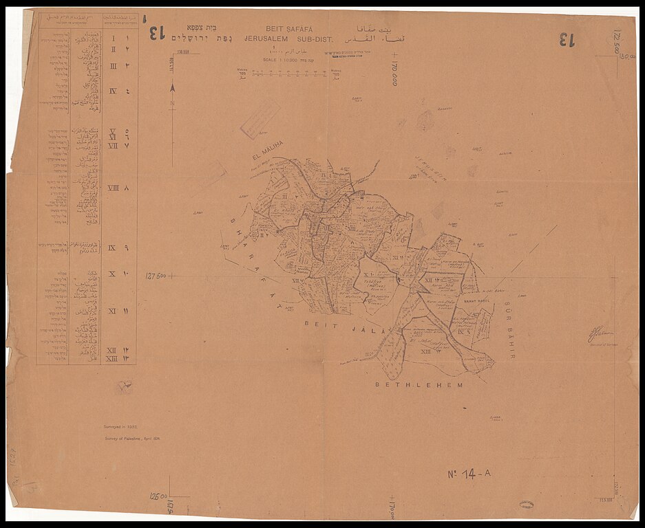
[edit]| Survey of Palestine: Beit Safafa
( |
||||||||||||||||||||||||
|---|---|---|---|---|---|---|---|---|---|---|---|---|---|---|---|---|---|---|---|---|---|---|---|---|
| Artist |
|
|||||||||||||||||||||||
| Title |
Beit Safafa |
|||||||||||||||||||||||
| Publisher |
Survey of Palestine |
|||||||||||||||||||||||
| Description |
Beit Safafa. Jerusalem sub-dist . Survey of Palestine. |
|||||||||||||||||||||||
| Language | English, Arabic, Hebrew | |||||||||||||||||||||||
| Publication date | 1934 | |||||||||||||||||||||||
| Medium | 1 sheet ; | |||||||||||||||||||||||
| Dimensions | height: 56 cm (22 in); width: 70 cm (27.5 in) | |||||||||||||||||||||||
| Collection |
|
|||||||||||||||||||||||
| Current location |
|
|||||||||||||||||||||||
| Place of publication | unknown | |||||||||||||||||||||||
| search Merhav catalog | unknown | |||||||||||||||||||||||
| Notes | על הגליון חותמת: אחוד מודדים מוסמכים בארץ ישראל.; Cadastral map.; כולל רשימת הגושים ושמותיהם בעברית וערבית.; כולל סימון שטחי מפרוז (בעלות בלעדית של אדם אחד).; בית צפאפא.; Surveyed in 1933. | |||||||||||||||||||||||
| scale | 1:10,000 cm | |||||||||||||||||||||||
| IE PID | IE168744114 | |||||||||||||||||||||||
| Rosetta filename | FL168744116 | |||||||||||||||||||||||
| NNL item ID (P3959) | 990035261040205171 | |||||||||||||||||||||||
| search Merhav catalog | English, Arabic, Hebrew, Survey of Palestine | |||||||||||||||||||||||
| search Merhav catalog | لخريطة عنوان ثان بالعربية:بيت صفافا- مجموعة ترتيب للوح القطع : قضاء القدسلخريطةבית צפפא נפת ירושליםבית צפפאLand tenureEretz IsraelMapsSurvey of Palestine | |||||||||||||||||||||||
| Source/Photographer |
|
|||||||||||||||||||||||
| Other versions | ||||||||||||||||||||||||
| Jpg / Tif version |
|
|||||||||||||||||||||||

.jpg)

.jpg&action=edit§ion=1)
Licensing
[edit].jpg&action=edit§ion=2)
This work created by the United Kingdom Government is in the public domain.
This is because it is one of the following:
HMSO has declared that the expiry of Crown Copyrights applies worldwide (ref: HMSO Email Reply)
|
 |
File history
Click on a date/time to view the file as it appeared at that time.
| Date/Time | Thumbnail | Dimensions | User | Comment | |
|---|---|---|---|---|---|
| current | 21:56, 7 August 2023 | | 17,063 × 13,984 (199.33 MB) | Geagea (talk | contribs) | pattypan 22.03 |
You cannot overwrite this file.
File usage on Commons
The following 2 pages use this file:
.jpg&oldid=803405780)