File:Sur2-KDS444.gif
Jump to navigation
Jump to search

Size of this preview: 800 × 553 pixels. Other resolutions: 320 × 221 pixels | 640 × 442 pixels | 1,024 × 708 pixels | 1,280 × 884 pixels | 2,560 × 1,769 pixels | 3,414 × 2,359 pixels.
Original file (3,414 × 2,359 pixels, file size: 1.95 MB, MIME type: image/gif)
Captions
Captions
Add a one-line explanation of what this file represents
| Description |
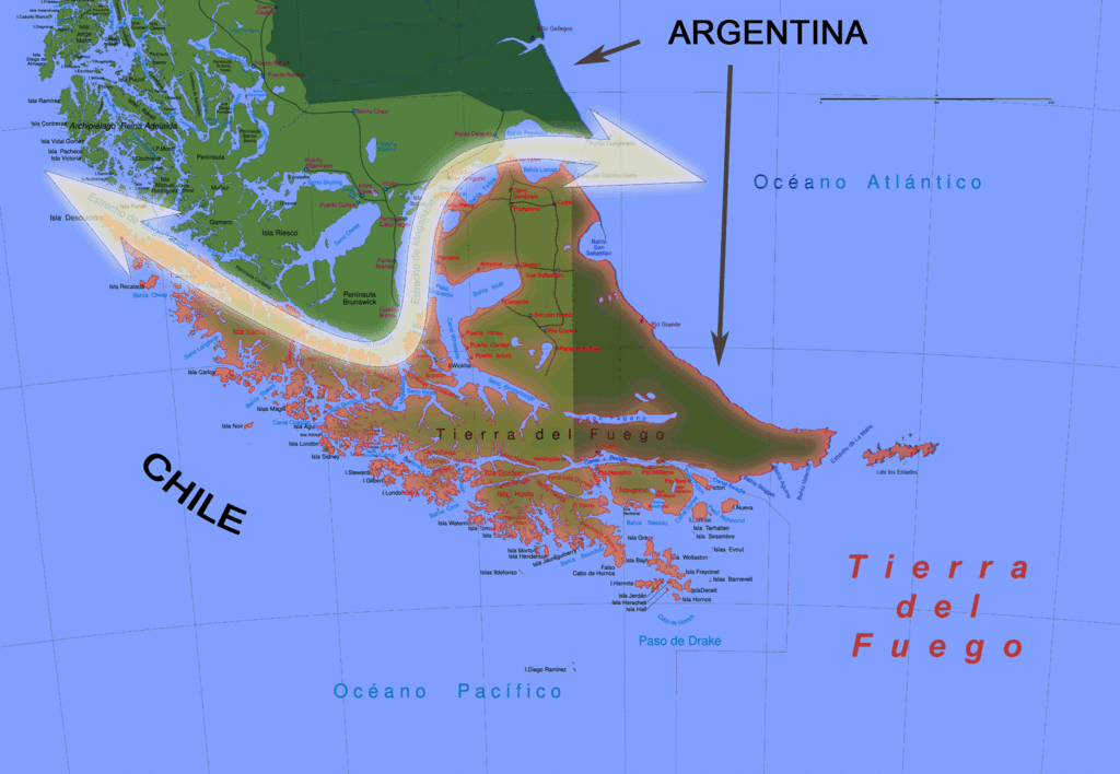
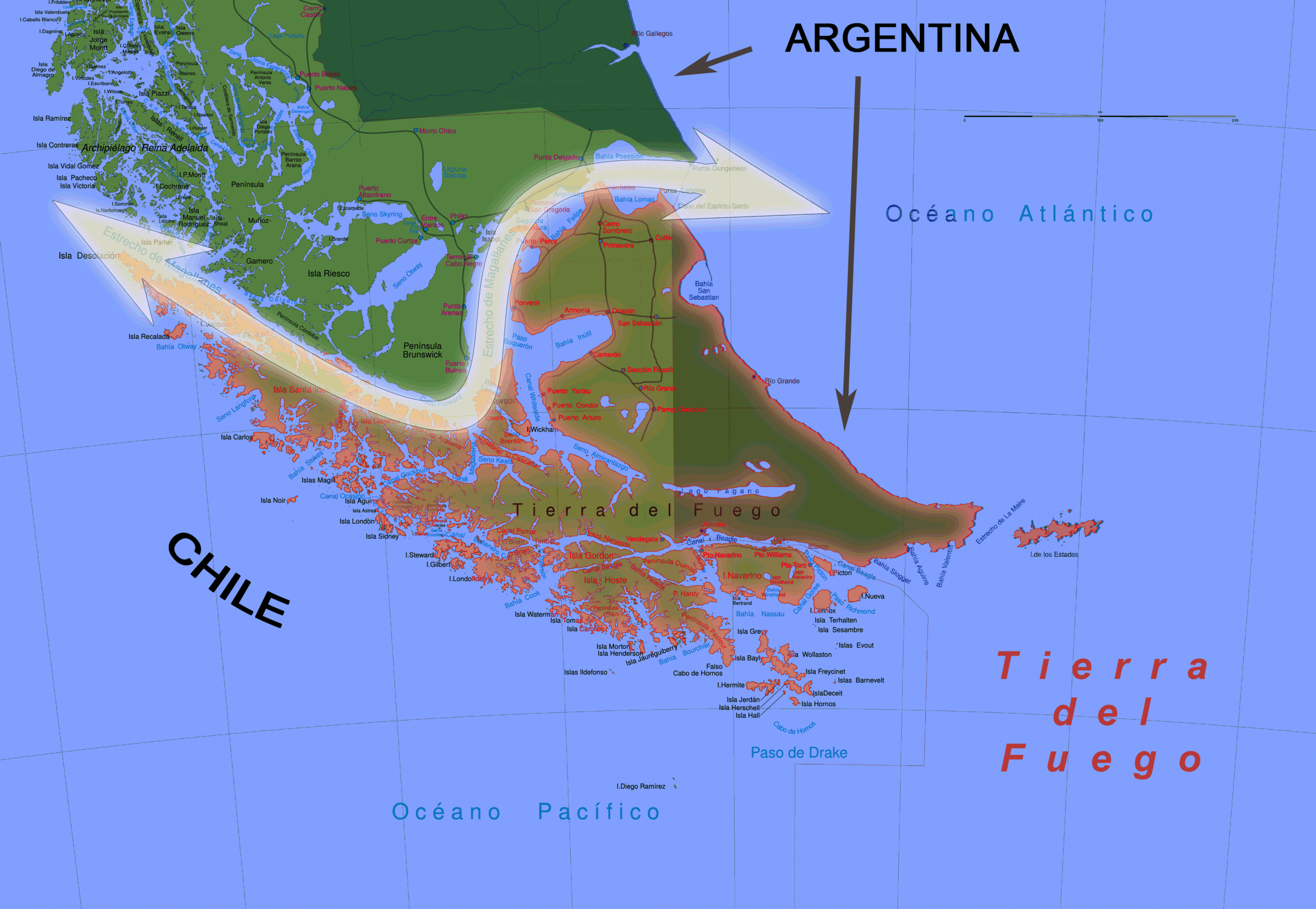
English: Big Map of southern Chile: From Straits of Magellan to Cape Horn |
| Date | (UTC) |
| Source | |
| Author |
|
| This is a retouched picture, which means that it has been digitally altered from its original version. The original can be viewed here: Sur2.gif:
|
I, the copyright holder of this work, hereby publish it under the following licenses:
| This file is licensed under the Creative Commons Attribution-Share Alike 3.0 Unported license. | ||
| ||
| This licensing tag was added to this file as part of the GFDL licensing update. |
The map has been created with the Generic Mapping Tools: https://www.generic-mapping-tools.org/ using one or more of these public-domain datasets for the relief:
|

|
Permission is granted to copy, distribute and/or modify this document under the terms of the GNU Free Documentation License, Version 1.2 or any later version published by the Free Software Foundation; with no Invariant Sections, no Front-Cover Texts, and no Back-Cover Texts. A copy of the license is included in the section entitled GNU Free Documentation License. |
You may select the license of your choice.
Original upload log
[edit]
This image is a derivative work of the following images:
- File:Sur2.gif licensed with Cc-by-sa-3.0-migrated, GFDL-GMT
- 2011-04-25T06:17:37Z KDS444 3414x2359 (2049198 Bytes) revised w tierra highlighted
- 2011-04-25T05:38:37Z KDS444 3414x2359 (1499845 Bytes) Uploaded wrong file in previous upload. Sorries.
- 2011-04-25T05:35:09Z KDS444 3894x2441 (734817 Bytes) Made clearer the international distinctions between Chile and Argentina, and darkened the oceans in order to make the Straight stand out more.
- 2011-04-25T03:06:35Z KDS444 3414x2359 (1482977 Bytes) Original author gave permission for revisions/ remixes under image's original Creative Commons Attribution-Share Alike 3.0 Unported license. Have revised image slightly making the actual Straight of Magellan identifiable on
- 2008-09-05T00:40:43Z Createaccount 3894x2441 (734817 Bytes) {{Information |Description={{en|1=Big Map of southern Chile: From Straits of Magellan to Cape Horn}} |Source=Own work by uploader |Author=[[User:Createaccount|Createaccount]] |Date=2008 |Permission={{GFDL-GMT}}} |other_versio
Uploaded with derivativeFX
File history
Click on a date/time to view the file as it appeared at that time.
| Date/Time | Thumbnail | Dimensions | User | Comment | |
|---|---|---|---|---|---|
| current | 20:21, 7 May 2011 | | 3,414 × 2,359 (1.95 MB) | Keysanger (talk | contribs) | {{Information |Description={{en|1=Big Map of southern Chile: From Straits of Magellan to Cape Horn}} |Source=*File:Sur2.gif |Date=2011-05-07 20:20 (UTC) |Author=*File:Sur2.gif: Createaccount *derivative work: ~~~ |Permis |
You cannot overwrite this file.
File usage on Commons
There are no pages that use this file.
File usage on other wikis
The following other wikis use this file:
- Usage on fa.wikipedia.org
- Usage on pl.wikipedia.org
- Usage on pl.wiktionary.org