File:Suomen suuriruhtinanmaan kartta 1201013651.jpg
Jump to navigation
Jump to search
Size of this preview: 449 × 600 pixels. Other resolutions: 180 × 240 pixels | 359 × 480 pixels | 575 × 768 pixels | 767 × 1,024 pixels | 1,533 × 2,048 pixels | 3,112 × 4,156 pixels.
Original file (3,112 × 4,156 pixels, file size: 3.87 MB, MIME type: image/jpeg)
Captions
Captions
Add a one-line explanation of what this file represents
Summary
[edit]| Description |
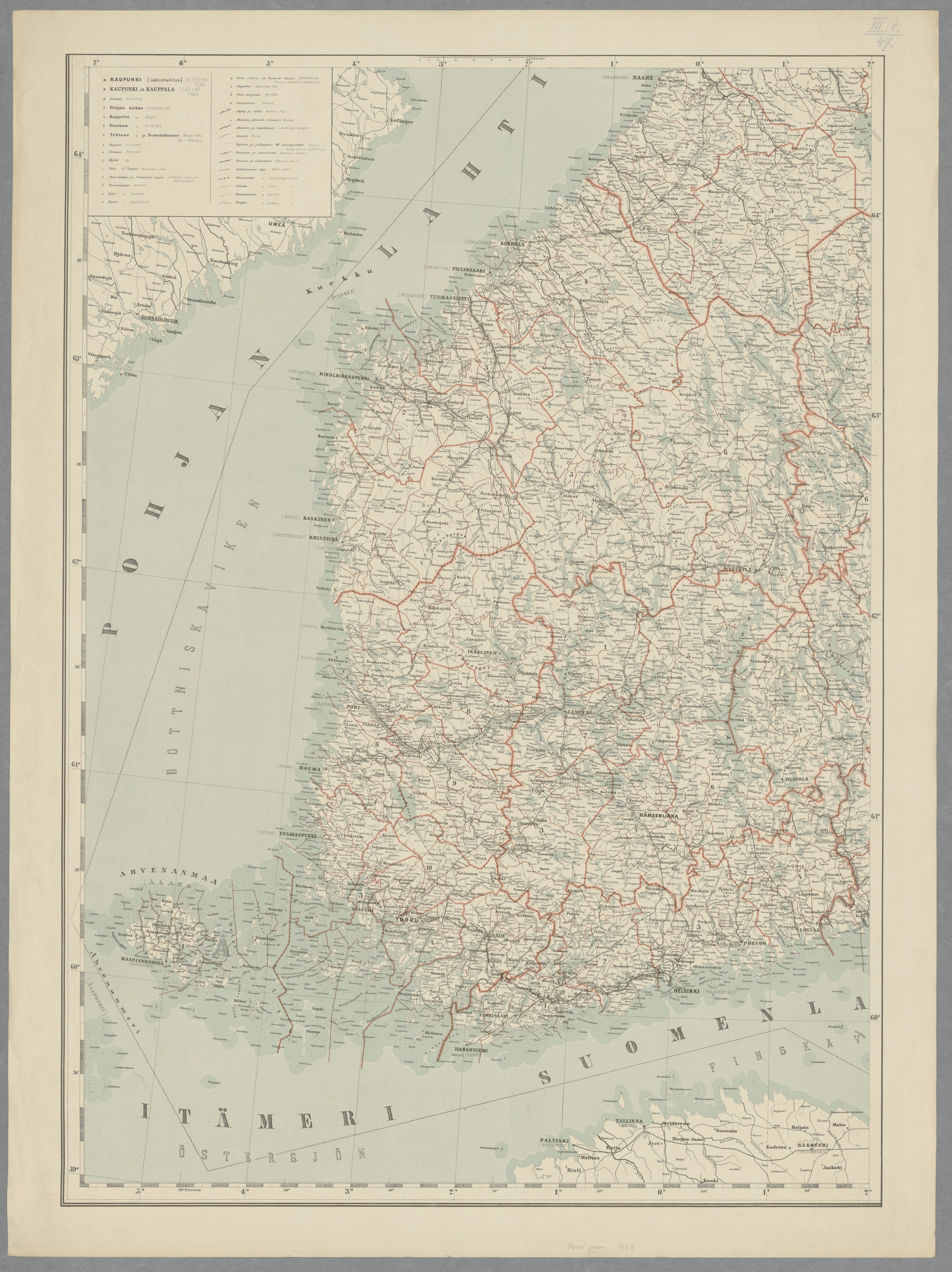
English: Map of the Grand Duchy of Finland 1908, in four parts |
|||||||||||||||||||||||
| Date | ||||||||||||||||||||||||
| Source | http://www.doria.fi/handle/10024/79240 | |||||||||||||||||||||||
| Creator | ||||||||||||||||||||||||
| Geotemporal data | ||||||||||||||||||||||||
| Scale | 1:1,000,000 | |||||||||||||||||||||||
| Georeferencing | If inappropriate please set warp_status = skip to hide. | |||||||||||||||||||||||
| Bibliographic data | ||||||||||||||||||||||||
| Part of the series | Map of the Grand Duchy of Finland 1908, in four parts | |||||||||||||||||||||||
| Language | fi,sv | |||||||||||||||||||||||
| Publisher |
K. E. Holm |
|||||||||||||||||||||||
| Printed by |
Osakeyhtiö F. Tilgmann, Helsinki |
|||||||||||||||||||||||
| Archival data | ||||||||||||||||||||||||
| Collection |
|
|||||||||||||||||||||||
| Accession number | ||||||||||||||||||||||||
| Dimensions | height: 69.2 cm (27.2 in); width: 51.3 cm (20.1 in) | |||||||||||||||||||||||

Licensing
[edit]
| This file is made available under the Creative Commons CC0 1.0 Universal Public Domain Dedication. | |
| The person who associated a work with this deed has dedicated the work to the public domain by waiving all of their rights to the work worldwide under copyright law, including all related and neighboring rights, to the extent allowed by law. You can copy, modify, distribute and perform the work, even for commercial purposes, all without asking permission.
|
File history
Click on a date/time to view the file as it appeared at that time.
| Date/Time | Thumbnail | Dimensions | User | Comment | |
|---|---|---|---|---|---|
| current | 21:55, 15 May 2015 | | 3,112 × 4,156 (3.87 MB) | Susannaanas (talk | contribs) | User created page with UploadWizard |
You cannot overwrite this file.
File usage on Commons
The following page uses this file: