File:Sucia Island Map.png
Jump to navigation
Jump to search
Size of this preview: 794 × 600 pixels. Other resolutions: 318 × 240 pixels | 636 × 480 pixels | 1,017 × 768 pixels | 1,168 × 882 pixels.
Original file (1,168 × 882 pixels, file size: 818 KB, MIME type: image/png)
Captions
Captions
Add a one-line explanation of what this file represents
Summary
[edit]
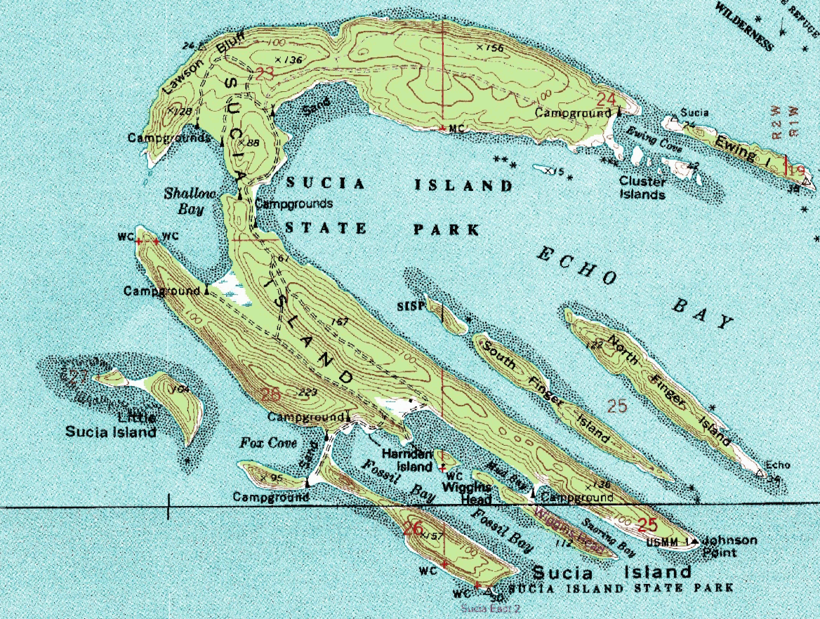
| Description | USGS topographical map of w:Sucia Island. |
| Source | Screenshot from NASA's World Wind software, using the USGS Topo layer. |
| Author | Screen capture made by Hotshot977, map by USGS. |

|
This map image could be re-created using vector graphics as an SVG file. This has several advantages; see Commons:Media for cleanup for more information. If an SVG form of this image is available, please upload it and afterwards replace this template with
{{vector version available|new image name}}.
It is recommended to name the SVG file “Sucia Island Map.svg”—then the template Vector version available (or Vva) does not need the new image name parameter. |
Licensing
[edit]
This image is in the public domain in the United States because it only contains materials that originally came from the United States Geological Survey, an agency of the United States Department of the Interior. For more information, see the official USGS copyright policy.
|
File history
Click on a date/time to view the file as it appeared at that time.
| Date/Time | Thumbnail | Dimensions | User | Comment | |
|---|---|---|---|---|---|
| current | 06:20, 4 September 2016 | | 1,168 × 882 (818 KB) | JohnnyMrNinja (talk | contribs) | increased file compression and indexed colors |
| 07:29, 6 January 2008 |  | 1,168 × 882 (2.45 MB) | Hotshot977 (talk | contribs) | {{Information |Description=USGS topographical map of Sucia Island. |Source=Screenshot from NASA's World Wind software, using the USGS Topo layer. |Date= |Author=Screen capture made by Hotshot977, map by USGS. |Permission= |other_versio |
You cannot overwrite this file.
File usage on Commons
The following 2 pages use this file:
File usage on other wikis
The following other wikis use this file:
- Usage on www.wikidata.org