File:Subcarpathia Carpatho-Ukraine german.svg
Jump to navigation
Jump to search

Size of this PNG preview of this SVG file: 662 × 500 pixels. Other resolutions: 318 × 240 pixels | 636 × 480 pixels | 1,017 × 768 pixels | 1,280 × 967 pixels | 2,560 × 1,934 pixels.
Original file (SVG file, nominally 662 × 500 pixels, file size: 365 KB)
Captions
Captions
Add a one-line explanation of what this file represents
Summary
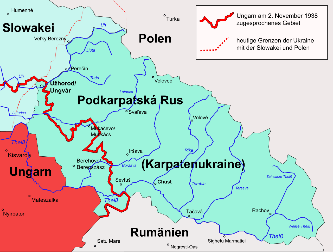
[edit]| Description | Map of Carpatoruthenia, situation from 1920 (Treaty of Trianon) to 1939 (Annexation by Hungary), with German annotations |
| Date | |
| Source | edited from Subcarpathia Carpatho-Ukraine.svg |
| Author | Martin Proehl |
| Other versions |
[]
|


.svg)


Licensing
[edit]
I, the copyright holder of this work, hereby publish it under the following license:
This file is licensed under the Creative Commons Attribution-Share Alike 2.5 Generic license.
- You are free:
- to share – to copy, distribute and transmit the work
- to remix – to adapt the work
- Under the following conditions:
- attribution – You must give appropriate credit, provide a link to the license, and indicate if changes were made. You may do so in any reasonable manner, but not in any way that suggests the licensor endorses you or your use.
- share alike – If you remix, transform, or build upon the material, you must distribute your contributions under the same or compatible license as the original.
File history
Click on a date/time to view the file as it appeared at that time.
| Date/Time | Thumbnail | Dimensions | User | Comment | |
|---|---|---|---|---|---|
| current | 21:25, 1 May 2007 | | 662 × 500 (365 KB) | Murli (talk | contribs) | Karpatoukraine -> Karpatenukraine |
| 09:10, 30 April 2007 |  | 662 × 500 (364 KB) | Murli (talk | contribs) | improved | |
| 09:06, 30 April 2007 |  | 662 × 500 (1.7 MB) | Murli (talk | contribs) | {{Information |Description= |Source= |Date= |Author= }} | |
| 08:45, 30 April 2007 |  | 662 × 500 (105 KB) | Murli (talk | contribs) | better version?! | |
| 23:05, 27 April 2007 |  | 662 × 500 (104 KB) | Murli (talk | contribs) | {{Information |Description=Map of Carpatoruthenia with german annotations |Source=edited from Subcarpathia Carpatho-Ukraine.svg |Date=28.04.2007 |Author=Martin Proehl }} |
You cannot overwrite this file.
File usage on Commons
The following 4 pages use this file:
File usage on other wikis
The following other wikis use this file:
- Usage on bs.wikipedia.org
- Usage on de.wikipedia.org
- Usage on de.wiktionary.org
- Usage on eo.wikipedia.org
- Usage on hu.wikipedia.org
- Usage on ro.wikipedia.org