File:Stromiec (gmina) location map.png
Jump to navigation
Jump to search

Size of this preview: 522 × 600 pixels. Other resolutions: 209 × 240 pixels | 418 × 480 pixels | 848 × 974 pixels.
Original file (848 × 974 pixels, file size: 247 KB, MIME type: image/png)
Captions
Captions
Add a one-line explanation of what this file represents
| Description |
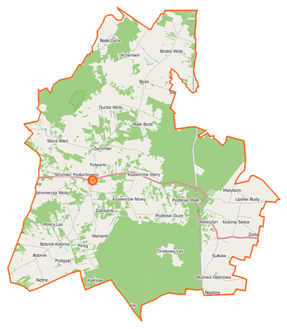
Polski: Mapa gminy Stromiec, Polska
English: Map of Gmina Stromiec, Poland |
|||||||||
| Date | ||||||||||
| Source | You may find a page on the OpenStreetMap wiki page for Stromiec (gmina) | |||||||||
| Creator |
OpenStreetMap contributors OpenStreetMap contributors |
|||||||||
| Permission (Reusing this file) |
OpenStreetMap data is available under the Open Database License (details). Map tiles are licensed under the Creative Commons Attribution-ShareAlike 2.0 license (CC-BY-SA 2.0).
This file is licensed under the Creative Commons Attribution-Share Alike 2.0 Generic license.
|
|||||||||
| Geotemporal data | ||||||||||
| Bounding box |
|
|||||||||
| Georeferencing | If inappropriate please set warp_status = skip to hide. | |||||||||
File history
Click on a date/time to view the file as it appeared at that time.
| Date/Time | Thumbnail | Dimensions | User | Comment | |
|---|---|---|---|---|---|
| current | 08:34, 12 September 2014 | | 848 × 974 (247 KB) | VanWiel (talk | contribs) | |
| 06:10, 2 June 2014 |  | 850 × 1,000 (564 KB) | VanWiel (talk | contribs) | {{OpenStreetMap | name = Stromiec (gmina) | location = Stromiec (gmina) | description = {{pl|Mapa gminy Stromiec, Polska}} {{en|Map of Gmina Stromiec, Poland}} | top = 51.7411 | left = 21.0127 | r... |
You cannot overwrite this file.
File usage on Commons
There are no pages that use this file.
File usage on other wikis
The following other wikis use this file:
- Usage on pl.wikipedia.org
- Stromiec (gmina)
- Bobrek-Kolonia
- Boska Wola
- Ducka Wola
- Grabowy Las
- Ksawerów Nowy
- Ksawerów Stary
- Kolonia Sielce
- Lipskie Budy
- Małe Boże
- Mokry Las (województwo mazowieckie)
- Nętne
- Niedabyl
- Olszowa Dąbrowa
- Pietrusin
- Piróg (wieś)
- Stromiec
- Stromiecka Wola
- Biała Góra (województwo mazowieckie)
- Bobrek (województwo mazowieckie)
- Boże (województwo mazowieckie)
- Dobieszyn (województwo mazowieckie)
- Matyldzin (województwo mazowieckie)
- Podlesie Duże (województwo mazowieckie)
- Pokrzywna (województwo mazowieckie)
- Sułków (województwo mazowieckie)
- Zabagnie (powiat białobrzeski)
- Krzemień (powiat białobrzeski)
- Marianki (powiat białobrzeski)
- Sielce (gmina Stromiec)
- Stara Wieś (powiat białobrzeski)
- Kalinów (powiat białobrzeski)
- Majdan (powiat białobrzeski)
- Nadleśnictwo Dobieszyn (Dobieszyn)
- Podgaje (województwo mazowieckie)
- Podlesie Małe (województwo mazowieckie)
- Radosz
- Zachmiel
- Strzyżyna (przystanek kolejowy)
- Dobieszyn (stacja kolejowa)
- Folwark (Lipskie Budy)
- Parafia św. Jana Chrzciciela w Stromcu
- Rezerwat przyrody Majdan (Polska)
- Rezerwat przyrody Starodrzew Dobieszyński
- Cmentarz żydowski w Stromcu
- Parafia Matki Bożej Częstochowskiej w Bożem
- Parafia św. Teresy od Dzieciątka Jezus w Dobieszynie
- Moduł:Mapa/dane/Stromiec (gmina)
- Kościół św. Jana Chrzciciela w Stromcu
- Stachów (województwo mazowieckie)
View more global usage of this file.
_location_map.png)
_location_map.png&oldid=506690208)