File:Strelley Pool formation.jpg
Jump to navigation
Jump to search

Size of this preview: 600 × 600 pixels. Other resolutions: 240 × 240 pixels | 480 × 480 pixels | 768 × 768 pixels | 1,024 × 1,024 pixels | 2,048 × 2,048 pixels | 5,412 × 5,412 pixels.
Original file (5,412 × 5,412 pixels, file size: 4.88 MB, MIME type: image/jpeg)
Captions
Captions
Add a one-line explanation of what this file represents
Summary
[edit]
| Description |
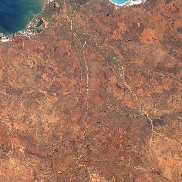
English: This picture is a composite of images acquired by the Landsat-7 satellite on May 19, 2000 (in the north), and June 23, 2001 (in the south). The Shaw River channel runs through the middle of the image. The Strelley Pool Chert rock formation appears near the bottom of the image, on the east side of the river. |
| Date | and 2001 |
| Source | NASA Earth Observatory |
| Author | NASA |
Licensing
[edit]
| This file is in the public domain in the United States because it was solely created by NASA. NASA copyright policy states that "NASA material is not protected by copyright unless noted". (See Template:PD-USGov, NASA copyright policy page or JPL Image Use Policy.) | ||
 |
Warnings:
|
File history
Click on a date/time to view the file as it appeared at that time.
| Date/Time | Thumbnail | Dimensions | User | Comment | |
|---|---|---|---|---|---|
| current | 12:15, 28 July 2020 | | 5,412 × 5,412 (4.88 MB) | Leptictidium (talk | contribs) | {{Information |description= This picture is a composite of images acquired by the Landsat-7 satellite on May 19, 2000 (in the north), and June 23, 2001 (in the south). The Shaw River channel runs through the middle of the image. The Strelley Pool Chert rock formation appears near the bottom of the image, on the east side of the river. |date= 2000 and 2001 |source= [https://earthobservatory.nasa.gov/images/6664/strelley-pool-chert-and-early-life NASA Earth Observatory] |author= NASA |permissio... |
You cannot overwrite this file.
File usage on Commons
There are no pages that use this file.
File usage on other wikis
The following other wikis use this file:
- Usage on ca.wikipedia.org
- Usage on www.wikidata.org