File:Street Atlas of Birmingham - 1939 - Sheet 11 - Edgbaston (north) area.jpg
Jump to navigation
Jump to search
Size of this preview: 777 × 599 pixels. Other resolutions: 311 × 240 pixels | 623 × 480 pixels | 996 × 768 pixels | 1,280 × 987 pixels | 1,600 × 1,234 pixels.
Original file (1,600 × 1,234 pixels, file size: 827 KB, MIME type: image/jpeg)
Captions
Captions
Street Atlas of Birmingham - 1939 - Edgbaston (north) area (Sheet 11)
Summary
[edit]_area.jpg&action=edit§ion=1)
| Description |
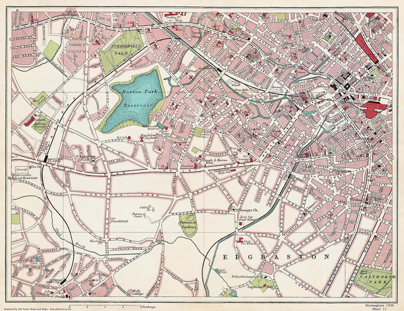
English: Double page spread from a 1939 street atlas of Birmingham, England, showing the north Edgbaston area. |
| Date | |
| Source | https://www.oldtowns.co.uk/Mapshop_Birmingham_1939.htm |
| Author | Anonymous |
Licensing
[edit]_area.jpg&action=edit§ion=2)
This UK artistic or literary work, of which the author is unknown and cannot be ascertained by reasonable enquiry, is in the public domain because it is one of the following:
|
 |
File history
Click on a date/time to view the file as it appeared at that time.
| Date/Time | Thumbnail | Dimensions | User | Comment | |
|---|---|---|---|---|---|
| current | 20:27, 25 April 2023 | | 1,600 × 1,234 (827 KB) | Pigsonthewing (talk | contribs) | Uploaded a work by {{anonymous}} from https://web.archive.org/web/20141113010251/http://www.oldtowns-maps.co.uk/collections/birmingham-1939 with UploadWizard |
You cannot overwrite this file.
File usage on Commons
The following 5 pages use this file:
_area_(Sheet_11).jpg&redirect=no)
_area.jpg&oldid=754443545)