File:Straube-Plan Berlin 1910.jpg
Jump to navigation
Jump to search

Size of this preview: 706 × 600 pixels. Other resolutions: 283 × 240 pixels | 565 × 480 pixels | 904 × 768 pixels | 1,206 × 1,024 pixels | 2,411 × 2,048 pixels | 25,577 × 21,723 pixels.
Original file (25,577 × 21,723 pixels, file size: 73.23 MB, MIME type: image/jpeg)
Captions
Captions
Add a one-line explanation of what this file represents
| Warning | The original file is very high-resolution. It might not load properly or could cause your browser to freeze when opened at full size. |
|---|
Summary
[edit]
| Warning | The original file is very high-resolution. It might not load properly or could cause your browser to freeze when opened at full size. |
|---|
| Title |
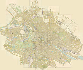
Übersichtsplan von Berlin in 44 Blättern |
|||||||||
| Date | ||||||||||
| Source | HistoMap Berlin (dort "Weitere Layer" anklicken und "Straube-Plan 1910" auswählen) | |||||||||
| Creator | ||||||||||
| Geotemporal data | ||||||||||
| Map location | Berlin | |||||||||
| Map type | City map | |||||||||
| Scale | 1:4,000 | |||||||||
| Heading |
 |
|||||||||
| Bounding box |
|
|||||||||
| Georeferencing | If inappropriate please set warp_status = skip to hide. | |||||||||
| Bibliographic data | ||||||||||
| Language | German | |||||||||
| Publisher |
Geographisches Institut und Landkartenverlag Julius Straube |
|||||||||
| Archival data | ||||||||||
| Medium | chromolithograph | |||||||||
Licensing
[edit]
|
This is a faithful photographic reproduction of a two-dimensional, public domain work of art. The work of art itself is in the public domain for the following reason:
The official position taken by the Wikimedia Foundation is that "faithful reproductions of two-dimensional public domain works of art are public domain".
This photographic reproduction is therefore also considered to be in the public domain in the United States. In other jurisdictions, re-use of this content may be restricted; see Reuse of PD-Art photographs for details. | ||||
File history
Click on a date/time to view the file as it appeared at that time.
| Date/Time | Thumbnail | Dimensions | User | Comment | |
|---|---|---|---|---|---|
| current | 09:02, 27 February 2016 | | 25,577 × 21,723 (73.23 MB) | Chumwa (talk | contribs) | Hintergrundfarbe angepasst |
| 08:29, 27 February 2016 |  | 25,577 × 21,723 (73.62 MB) | Chumwa (talk | contribs) | == {{int:filedesc}} == {{Information |Description = Straubes Übersichtsplan von Berlin in 44 Blättern aus dem Jahr 190 im Maßstab 1:4000 |Source=[http://www.histomapberlin.de/de/index.html?map_x=24490&map_y=21211&map_zoom=6 HistoMap Berlin] (dort... |
You cannot overwrite this file.
File usage on Commons
The following page uses this file:
File usage on other wikis
The following other wikis use this file:
- Usage on de.wikipedia.org
- Usage on www.wikidata.org