File:Straßenbrunnen 142 FalkenhFeld Burbacher Weg (2).jpg
Jump to navigation
Jump to search
Size of this preview: 800 × 600 pixels. Other resolutions: 320 × 240 pixels | 640 × 480 pixels | 1,024 × 768 pixels | 1,280 × 960 pixels | 2,560 × 1,920 pixels | 4,288 × 3,216 pixels.
Original file (4,288 × 3,216 pixels, file size: 2.94 MB, MIME type: image/jpeg)
Captions
Captions
Add a one-line explanation of what this file represents
Summary
[edit].jpg&action=edit§ion=1)
| Description |
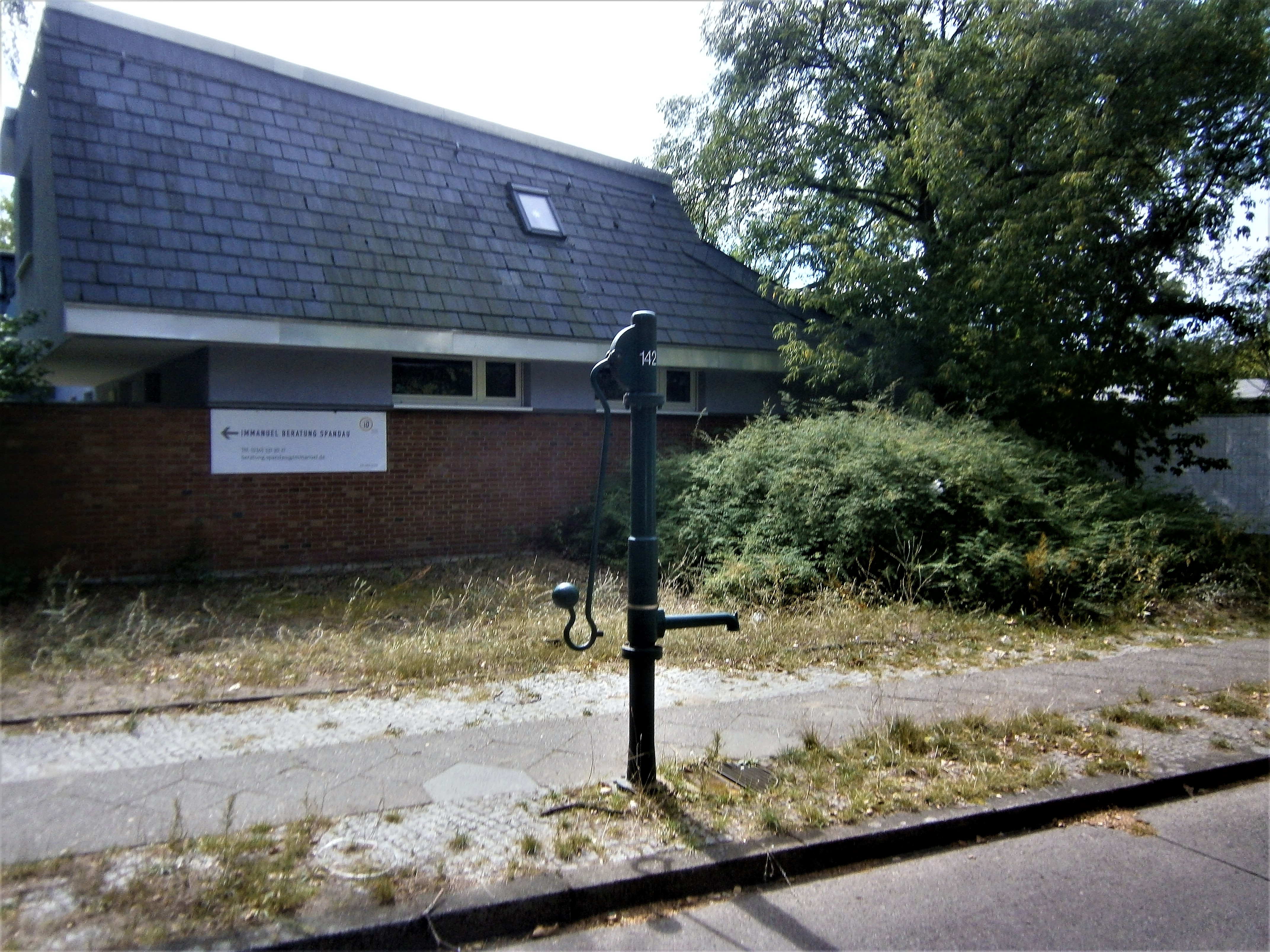
Deutsch: Der gelbe Schliephacke-Brunnen aus dem Jahre 2008 stand am Randstreifen des südlichen Gehwegs vor dem Wendehammer Burbacher Weg, der als Freudenberger Weg weiterführt. Für den Ablauf lag unter dem zum Bordstein gerichteten Austrittsrohr eine Platte, die das Wasser zum Schnittgerinnen leitete. Auf dem angrenzenden südlichen Grundstücken zur Siegener Straße[1] befindet sich die Ev. Zuflucht- und Jeremia-Kirche mit Nebengebäuden (auch Siegener Straße 50 und Henri-Bunant-Platz). Der (Rümmler-)Brunnenkörper der 1960er Jahre wurde 2012 durch die FSH-Säule ausgetauscht, wobei (wohl) gleichzeitig der Straßeneinlass eingebaut wurde, durch den das abfließende (Grund-)Wasser getrennt gesammelt wird. |
| Date | |
| Source | Own work |
| Author | Boonekamp - mithin Günter Haase |
| Camera location | | View this and other nearby images on: OpenStreetMap |
|---|
.jpg¶ms=052.546846_N_0013.178980_E_globe:Earth_type:camera__&language=en)
Licensing
[edit].jpg&action=edit§ion=2)
I, the copyright holder of this work, hereby publish it under the following license:
This file is licensed under the Creative Commons Attribution-Share Alike 4.0 International license.
- You are free:
- to share – to copy, distribute and transmit the work
- to remix – to adapt the work
- Under the following conditions:
- attribution – You must give appropriate credit, provide a link to the license, and indicate if changes were made. You may do so in any reasonable manner, but not in any way that suggests the licensor endorses you or your use.
- share alike – If you remix, transform, or build upon the material, you must distribute your contributions under the same or compatible license as the original.
File history
Click on a date/time to view the file as it appeared at that time.
| Date/Time | Thumbnail | Dimensions | User | Comment | |
|---|---|---|---|---|---|
| current | 09:46, 22 August 2019 | | 4,288 × 3,216 (2.94 MB) | Boonekamp (talk | contribs) | User created page with UploadWizard |
You cannot overwrite this file.
File usage on Commons
There are no pages that use this file.
.jpg&oldid=501564976)