File:Stora Fjäderholmen 1811.png
Jump to navigation
Jump to search
Size of this preview: 800 × 567 pixels. Other resolutions: 320 × 227 pixels | 640 × 454 pixels | 1,024 × 726 pixels | 1,181 × 837 pixels.
Original file (1,181 × 837 pixels, file size: 1.71 MB, MIME type: image/png)
Captions
Captions
Add a one-line explanation of what this file represents
Summary
[edit]
| Description |
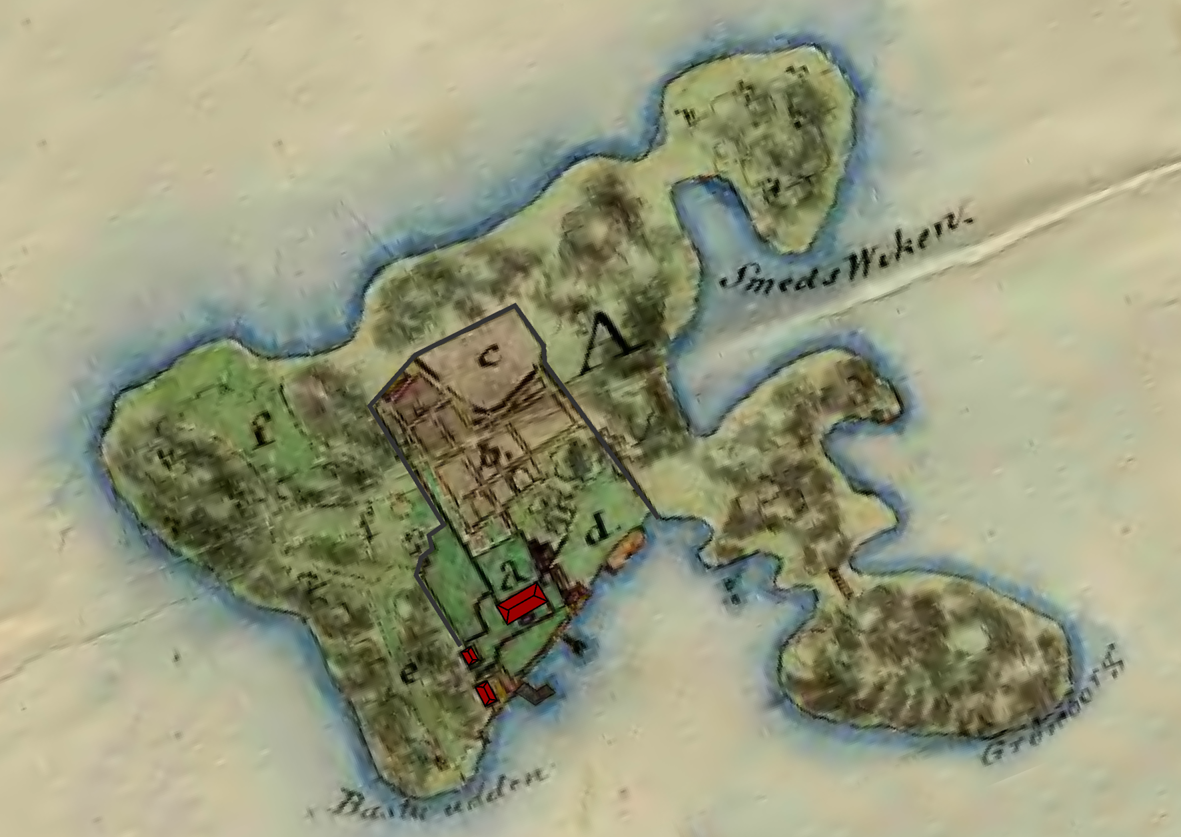
Svenska: Karta över Stora Fjäderholmen, Lidingö socken, 1811. Kartan visar var Fjäderholmens värdshus var beläget på den södra sidan av ön och de trädgårdodlingar som tillhörde värdshuset. Den vik som idag kallas Krogviken benämdes 1811 som Smedsviken och den sydligaste udden, Bastu udden. |
||||
| Date | Modifications, March 2009 | ||||
| Source | Map from Lidingö Municipality, created 1811. | ||||
| Author | Unknown. Cropped and enhanced by Lidingo | ||||
| Permission (Reusing this file) |
|
||||
File history
Click on a date/time to view the file as it appeared at that time.
| Date/Time | Thumbnail | Dimensions | User | Comment | |
|---|---|---|---|---|---|
| current | 23:21, 10 March 2009 | | 1,181 × 837 (1.71 MB) | Lidingo (talk | contribs) | {{Information |Description={{sv|1=Karta över Stora Fjäderholmen, Lidingö socken, 1811. Kartan visar var Fjäderholmens värdshus var beläget på den södra sidan av ön och de trädgårdodlingar som tillhörde värdshuset. Den vik som idag kallas Krog |
You cannot overwrite this file.
File usage on Commons
There are no pages that use this file.
File usage on other wikis
The following other wikis use this file:
- Usage on de.wikipedia.org
- Usage on sv.wikipedia.org