File:Stolperstein Forstweg 25 Jena.jpg
Jump to navigation
Jump to search

Size of this preview: 800 × 600 pixels. Other resolutions: 320 × 240 pixels | 640 × 480 pixels | 1,024 × 768 pixels | 1,280 × 960 pixels | 2,560 × 1,920 pixels | 4,096 × 3,072 pixels.
Original file (4,096 × 3,072 pixels, file size: 9.65 MB, MIME type: image/jpeg)
Captions
Captions
Add a one-line explanation of what this file represents
Summary
[edit]
| Description |
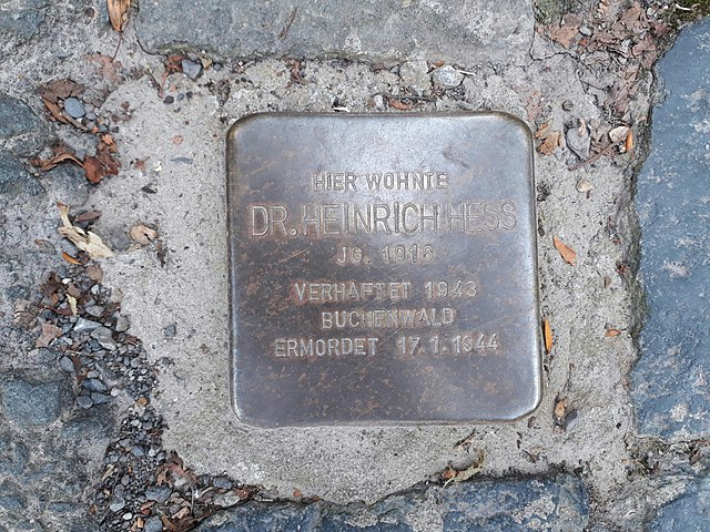
Deutsch: Stolpersteine im Forstweg 25, Jena |
| Inscription | HIER WOHNTE DR. HEINRICH HESS JG. 1916 verhaftet 1943 BUCHENWALD ERMORDET 17.7.1944 |
| Date | 8 September 2017 (according to Exif data) |
| Source | Own work |
| Author | Aschroet |
| Camera location | | View this and other nearby images on: OpenStreetMap |
|---|
Licensing
[edit]
I, the copyright holder of this work, hereby publish it under the following license:
| This file is made available under the Creative Commons CC0 1.0 Universal Public Domain Dedication. | |
| The person who associated a work with this deed has dedicated the work to the public domain by waiving all of their rights to the work worldwide under copyright law, including all related and neighboring rights, to the extent allowed by law. You can copy, modify, distribute and perform the work, even for commercial purposes, all without asking permission.
|
| This file was uploaded via Mobile Android App (Commons mobile app) 2.5.0. |
File history
Click on a date/time to view the file as it appeared at that time.
| Date/Time | Thumbnail | Dimensions | User | Comment | |
|---|---|---|---|---|---|
| current | 11:37, 11 September 2017 | | 4,096 × 3,072 (9.65 MB) | Aschroet (talk | contribs) | Uploaded using Android Commons app |
You cannot overwrite this file.
File usage on Commons
The following 3 pages use this file: