File:Stockerau (2).JPG
Jump to navigation
Jump to search
Size of this preview: 800 × 419 pixels. Other resolutions: 320 × 168 pixels | 640 × 335 pixels | 1,024 × 536 pixels | 1,280 × 670 pixels | 2,560 × 1,340 pixels | 5,174 × 2,709 pixels.
Original file (5,174 × 2,709 pixels, file size: 14.15 MB, MIME type: image/jpeg)
Captions
Captions
Add a one-line explanation of what this file represents
Summary
[edit].JPG&action=edit§ion=1)
| Description |
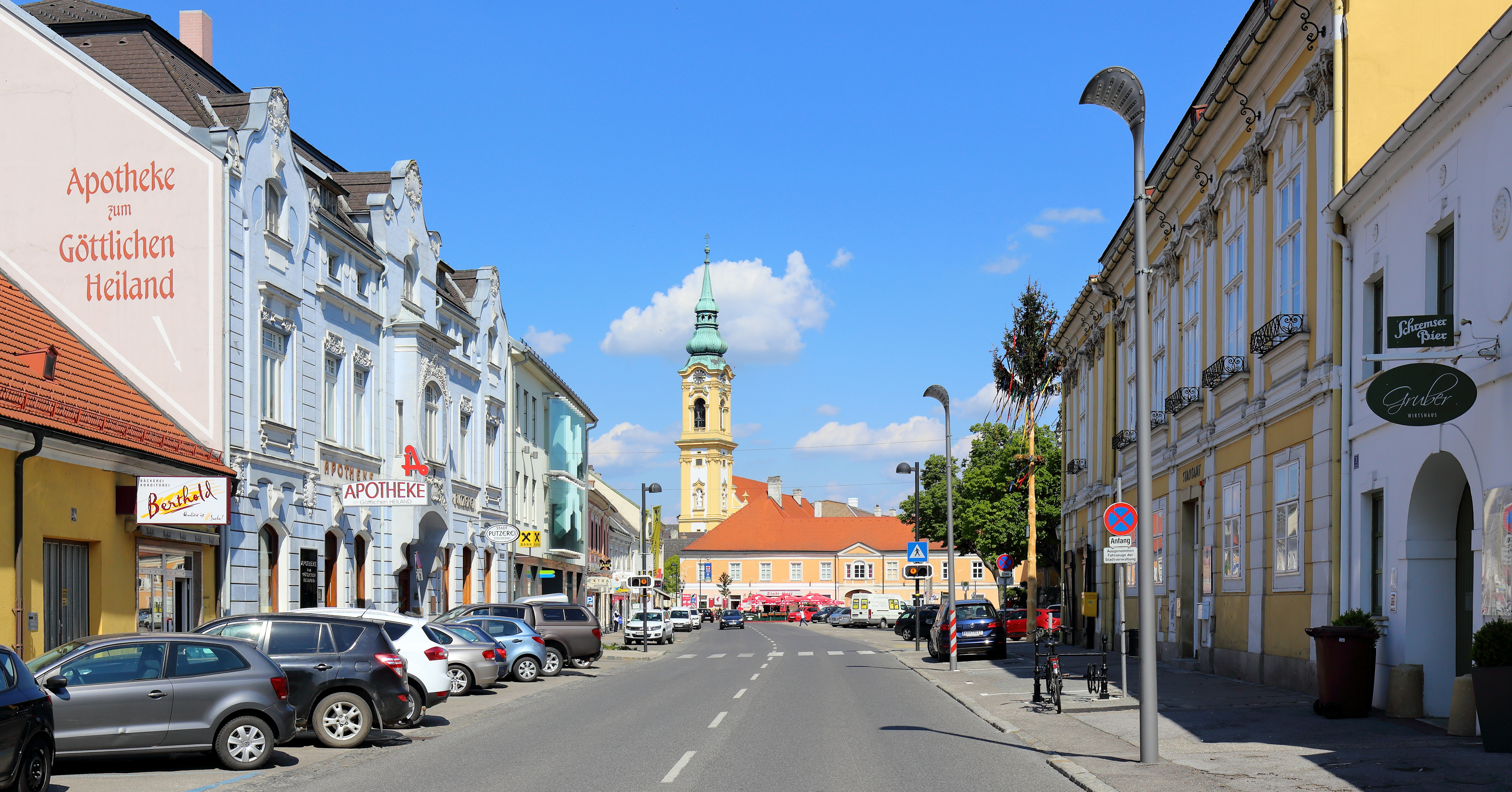
Deutsch: Blick von der Josef-Wolfik-Straße Richtung Rathausplatz in der niederösterreichischen Stadt Stockerau. Im Hintergrund die Stadtpfarrkirche hl. Stephan mit dem 88 m hohen stadtbildbeherrschenden Kirchturm. Links im Vordergrund ein dreigeschoßiges Geschäftshaus, welches nach 1900 durch Friedrich Kleibl im Jugendstil errichtet wurde und rechts auf gleicher Höhe der Nordflügel des Rathauses.
|
| Date | |
| Source | Own work |
| Author | C.Stadler/Bwag |
| Permission (Reusing this file) |
Deutsch: Hallo, du darfst mein Foto kostenlos nutzen, aber nenne mich bitte als Fotograf, beispielsweise „Foto: C.Stadler/Bwag“ oder © C.Stadler/Bwag; CC-BY-SA-4.0. Auf mehr Angaben bestehe ich nicht - im Gegensatz zu manch anderen, die die Vorgaben der unten angeführten Lizenzierung auf Punkt und Beistrich einfordern. English: Feel free to use my photos, but please mention me as the author like © C.Stadler/Bwag or © C.Stadler/Bwag; CC-BY-SA-4.0 (that's good enough) and if you want send me a message: bwag@gmx.net. |
| Camera location | | View this and other nearby images on: OpenStreetMap |
|---|
.JPG¶ms=048.384558_N_0016.206168_E_globe:Earth_type:camera_alt:184.7_source:exif_&language=en)
Licensing
[edit].JPG&action=edit§ion=2)
I, the copyright holder of this work, hereby publish it under the following license:
This file is licensed under the Creative Commons Attribution-Share Alike 4.0 International license.
- You are free:
- to share – to copy, distribute and transmit the work
- to remix – to adapt the work
- Under the following conditions:
- attribution – You must give appropriate credit, provide a link to the license, and indicate if changes were made. You may do so in any reasonable manner, but not in any way that suggests the licensor endorses you or your use.
- share alike – If you remix, transform, or build upon the material, you must distribute your contributions under the same or compatible license as the original.
| Annotations | This image is annotated: View the annotations at Commons |
.JPG)
File history
Click on a date/time to view the file as it appeared at that time.
| Date/Time | Thumbnail | Dimensions | User | Comment | |
|---|---|---|---|---|---|
| current | 20:39, 9 May 2016 | | 5,174 × 2,709 (14.15 MB) | Bwag (talk | contribs) | {{Information |Description= {{de|1=Blick von der Josef-Wolfik-Straße Richtung Rathausplatz in der niederösterreichischen Stadt Stockerau. Im Hintergrund die Stadtpfarrkirche hl. Stephan mit dem stadtbi... |
You cannot overwrite this file.
File usage on Commons
The following 2 pages use this file:
File usage on other wikis
The following other wikis use this file:
- Usage on ar.wikipedia.org
- Usage on be.wikipedia.org
- Usage on bg.wikipedia.org
- Usage on ceb.wikipedia.org
- Usage on ce.wikipedia.org
- Usage on cs.wikipedia.org
- Usage on de.wikipedia.org
- Usage on en.wikipedia.org
- Usage on eo.wikipedia.org
- Usage on hr.wikipedia.org
- Usage on hy.wikipedia.org
- Usage on ka.wikipedia.org
- Usage on lld.wikipedia.org
- Usage on lmo.wikipedia.org
- Usage on lt.wikipedia.org
- Usage on nl.wikipedia.org
- Usage on ro.wikipedia.org
- Usage on ru.wikipedia.org
- Usage on simple.wikipedia.org
- Usage on sk.wikipedia.org
- Usage on sr.wikipedia.org
- Usage on tt.wikipedia.org
- Usage on uk.wikipedia.org
- Usage on uz.wikipedia.org
- Usage on vec.wikipedia.org
- Usage on www.wikidata.org
.JPG&oldid=706229481)